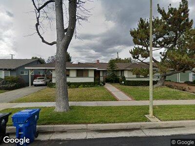
13911 Cumpston St Sherman Oaks, CA 91401
Estimated Value: $1,606,000 - $2,093,000
3
Beds
3
Baths
2,634
Sq Ft
$710/Sq Ft
Est. Value
About This Home
This home is located at 13911 Cumpston St, Sherman Oaks, CA 91401 and is currently estimated at $1,868,901, approximately $709 per square foot. 13911 Cumpston St is a home located in Los Angeles County with nearby schools including Chandler Elementary, Ulysses S. Grant Senior High School, and Louis D. Armstrong Middle School.
Ownership History
Date
Name
Owned For
Owner Type
Purchase Details
Closed on
Nov 1, 2011
Sold by
Mitsuyasu Ronald T and Mitsuyasu Sharon R
Bought by
Mitsuyasu Ronald T and Mitsuyasu Sharon R
Current Estimated Value
Home Financials for this Owner
Home Financials are based on the most recent Mortgage that was taken out on this home.
Original Mortgage
$300,000
Interest Rate
3.87%
Mortgage Type
New Conventional
Purchase Details
Closed on
Nov 5, 2001
Sold by
Mitsuyasu Ronald T and Mitsuyasu Sharon R
Bought by
Mitsuyasu Ronald T
Home Financials for this Owner
Home Financials are based on the most recent Mortgage that was taken out on this home.
Original Mortgage
$275,000
Interest Rate
6.62%
Create a Home Valuation Report for This Property
The Home Valuation Report is an in-depth analysis detailing your home's value as well as a comparison with similar homes in the area
Home Values in the Area
Average Home Value in this Area
Purchase History
| Date | Buyer | Sale Price | Title Company |
|---|---|---|---|
| Mitsuyasu Ronald T | -- | Cctn | |
| Mitsuyasu Ronald T | -- | Fidelity Title |
Source: Public Records
Mortgage History
| Date | Status | Borrower | Loan Amount |
|---|---|---|---|
| Closed | Mitsuyasu Ronald T | $300,000 | |
| Closed | Mitsuyasu Ronald T | $260,000 | |
| Closed | Mitsuyasu Ronald T | $275,000 |
Source: Public Records
Tax History Compared to Growth
Tax History
| Year | Tax Paid | Tax Assessment Tax Assessment Total Assessment is a certain percentage of the fair market value that is determined by local assessors to be the total taxable value of land and additions on the property. | Land | Improvement |
|---|---|---|---|---|
| 2024 | $5,485 | $427,947 | $128,352 | $299,595 |
| 2023 | $5,383 | $419,557 | $125,836 | $293,721 |
| 2022 | $5,140 | $411,331 | $123,369 | $287,962 |
| 2021 | $5,064 | $403,266 | $120,950 | $282,316 |
| 2019 | $4,916 | $391,307 | $117,363 | $273,944 |
| 2018 | $4,768 | $383,635 | $115,062 | $268,573 |
| 2016 | $4,532 | $368,740 | $110,595 | $258,145 |
| 2015 | $4,466 | $363,202 | $108,934 | $254,268 |
| 2014 | $4,487 | $356,089 | $106,801 | $249,288 |
Source: Public Records
Map
Nearby Homes
- 14060 Chandler Blvd
- 5625 Matilija Ave
- 5662 Hazeltine Ave
- 5454 Buffalo Ave
- 5522 Buffalo Ave
- 5653 Hazeltine Ave
- 13624 Burbank Blvd
- 13925 Branton Place
- 5655 Hazeltine Ave
- 5646 Woodman Ave
- 5515 Calhoun Ave
- 5527 Calhoun Ave
- 14050 Magnolia Blvd Unit 315
- 14050 Magnolia Blvd Unit 107
- 13559 Burbank Blvd
- 13541 Chandler Blvd
- 5348 Allott Ave
- 5446 Tyrone Ave
- 5328 Allott Ave
- 14242 Burbank Blvd Unit 103
- 13911 Cumpston St
- 13905 Cumpston St
- 13917 Cumpston St
- 13865 Cumpston St
- 13908 Albers St
- 13923 Cumpston St
- 13916 Albers St
- 13900 Albers St
- 13910 Cumpston St
- 13929 Cumpston St
- 13922 Albers St
- 13855 Cumpston St
- 13916 Cumpston St
- 13906 Cumpston St
- 13864 Cumpston St
- 13922 Cumpston St
- 13928 Albers St
- 13854 Albers St
- 13933 Cumpston St
- 13858 Cumpston St