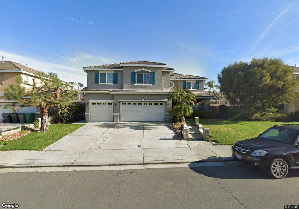
13922 Camp Rock St Corona, CA 92880
Estimated Value: $1,003,479 - $1,089,000
5
Beds
4
Baths
3,849
Sq Ft
$275/Sq Ft
Est. Value
About This Home
This home is located at 13922 Camp Rock St, Corona, CA 92880 and is currently estimated at $1,058,370, approximately $274 per square foot. 13922 Camp Rock St is a home located in Riverside County with nearby schools including Rosa Parks Elementary School, Dr. Augustine Ramirez Intermediate School, and Eleanor Roosevelt High School.
Ownership History
Date
Name
Owned For
Owner Type
Purchase Details
Closed on
Aug 17, 2016
Sold by
Solomon Hilary C and Solomon Gloria E
Bought by
Solomon Hilary C and Solomon Gloria E
Current Estimated Value
Purchase Details
Closed on
May 10, 2004
Sold by
Wl Homes Llc
Bought by
Solomon Hilary Cecil and Solomon Gloria Eleanor
Home Financials for this Owner
Home Financials are based on the most recent Mortgage that was taken out on this home.
Original Mortgage
$426,137
Interest Rate
5.5%
Mortgage Type
New Conventional
Create a Home Valuation Report for This Property
The Home Valuation Report is an in-depth analysis detailing your home's value as well as a comparison with similar homes in the area
Home Values in the Area
Average Home Value in this Area
Purchase History
| Date | Buyer | Sale Price | Title Company |
|---|---|---|---|
| Solomon Hilary C | -- | None Available | |
| Solomon Hilary Cecil | $533,000 | Fidelity National Title Comp |
Source: Public Records
Mortgage History
| Date | Status | Borrower | Loan Amount |
|---|---|---|---|
| Previous Owner | Solomon Hilary Cecil | $426,137 | |
| Closed | Solomon Hilary Cecil | $79,900 |
Source: Public Records
Tax History Compared to Growth
Tax History
| Year | Tax Paid | Tax Assessment Tax Assessment Total Assessment is a certain percentage of the fair market value that is determined by local assessors to be the total taxable value of land and additions on the property. | Land | Improvement |
|---|---|---|---|---|
| 2025 | $10,267 | $742,935 | $153,319 | $589,616 |
| 2023 | $10,267 | $714,087 | $147,366 | $566,721 |
| 2022 | $10,292 | $700,086 | $144,477 | $555,609 |
| 2021 | $10,142 | $686,360 | $141,645 | $544,715 |
| 2020 | $10,004 | $675,927 | $139,256 | $536,671 |
| 2019 | $9,724 | $656,240 | $135,200 | $521,040 |
| 2018 | $9,415 | $631,000 | $130,000 | $501,000 |
| 2017 | $8,514 | $554,000 | $114,000 | $440,000 |
| 2016 | $8,476 | $544,000 | $112,000 | $432,000 |
| 2015 | $8,302 | $530,000 | $109,000 | $421,000 |
| 2014 | $8,161 | $524,000 | $108,000 | $416,000 |
Source: Public Records
Map
Nearby Homes
- 6536 Pimlico Place
- 13933 Ellis Park Tr
- 6522 Gold Dust St
- 13726 Kiwi Ave
- 13894 Blue Ribbon Ln
- 6552 Gold Dust St
- 13893 La Pradera Way
- 13647 Woodlands St
- 6073 Sendero Ave
- 6512 Cedar Creek Rd
- 5873 Oatfield Ave
- 13925 Barnett Ln
- 5869 Oatfield Ave
- 14010 Barnett Ln
- 5857 Oatfield Ave
- 6174 Risingstar Dr
- 6851 Tourmaline Dr
- 2772 Crown Ct
- 6514 Crescendo Ct
- 6562 Crescendo Ct
- 13932 Camp Rock St
- 13912 Camp Rock St
- 13902 Camp Rock St
- 13925 Camp Rock St
- 13935 Camp Rock St
- 13915 Camp Rock St
- 13901 Burrage St
- 13891 Burrage St
- 13905 Camp Rock St
- 13911 Burrage St
- 13882 Camp Rock St
- 13952 Camp Rock St
- 13881 Burrage St
- 13944 Oak Tree Ln
- 13895 Camp Rock St
- 13921 Burrage St
- 13934 Oak Tree Ln
- 13955 Camp Rock St
- 13871 Burrage St
- 13962 Camp Rock St