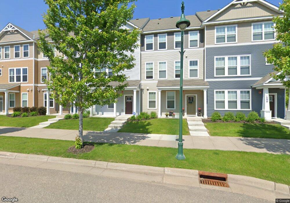
1394 Old Highway 8 NW Unit 8 Saint Paul, MN 55112
Estimated Value: $404,818 - $431,000
3
Beds
3
Baths
1,760
Sq Ft
$235/Sq Ft
Est. Value
About This Home
This home is located at 1394 Old Highway 8 NW Unit 8, Saint Paul, MN 55112 and is currently estimated at $412,955, approximately $234 per square foot. 1394 Old Highway 8 NW Unit 8 is a home located in Ramsey County with nearby schools including Bel Air Elementary School, Highview Middle School, and Irondale Senior High School.
Ownership History
Date
Name
Owned For
Owner Type
Purchase Details
Closed on
May 15, 2019
Sold by
Cox Abbie Christina
Bought by
Sabotta Christopher and Hu Marie
Current Estimated Value
Home Financials for this Owner
Home Financials are based on the most recent Mortgage that was taken out on this home.
Original Mortgage
$260,910
Outstanding Balance
$229,393
Interest Rate
4.2%
Mortgage Type
New Conventional
Estimated Equity
$183,562
Purchase Details
Closed on
Feb 26, 2016
Sold by
Pulte Homes Of Minnesota Llc
Bought by
Cox Abbie Christina
Home Financials for this Owner
Home Financials are based on the most recent Mortgage that was taken out on this home.
Original Mortgage
$231,233
Interest Rate
3.92%
Mortgage Type
FHA
Create a Home Valuation Report for This Property
The Home Valuation Report is an in-depth analysis detailing your home's value as well as a comparison with similar homes in the area
Home Values in the Area
Average Home Value in this Area
Purchase History
| Date | Buyer | Sale Price | Title Company |
|---|---|---|---|
| Sabotta Christopher | $289,900 | Executive Title | |
| Cox Abbie Christina | $235,500 | All American Title Company |
Source: Public Records
Mortgage History
| Date | Status | Borrower | Loan Amount |
|---|---|---|---|
| Open | Sabotta Christopher | $260,910 | |
| Previous Owner | Cox Abbie Christina | $231,233 |
Source: Public Records
Tax History Compared to Growth
Tax History
| Year | Tax Paid | Tax Assessment Tax Assessment Total Assessment is a certain percentage of the fair market value that is determined by local assessors to be the total taxable value of land and additions on the property. | Land | Improvement |
|---|---|---|---|---|
| 2025 | $4,666 | $393,300 | $70,200 | $323,100 |
| 2023 | $4,666 | $355,300 | $70,200 | $285,100 |
| 2022 | $4,432 | $344,700 | $70,200 | $274,500 |
| 2021 | $3,972 | $314,300 | $70,200 | $244,100 |
| 2020 | $4,352 | $294,000 | $70,000 | $224,000 |
| 2019 | $3,828 | $294,800 | $50,000 | $244,800 |
| 2018 | $3,272 | $275,500 | $50,000 | $225,500 |
| 2017 | $3,052 | $233,500 | $20,000 | $213,500 |
| 2016 | $194 | $0 | $0 | $0 |
Source: Public Records
Map
Nearby Homes
- 560 Devine Dr
- 536 Old Steine Cir Unit 12
- 1900 Rush Lake Trail Unit 416
- 1900 Rush Lake Trail Unit 315
- 1900 Rush Lake Trail Unit 110
- 1900 Rush Lake Trail Unit 112
- 1181 12th Ave NW
- 1427 Rosewood Ct
- 833 7th Ave NW
- 724 1st Ave NW
- 644 Village Dr
- 1451 18th St NW
- 649 Old Highway 8 NW Unit 238
- 649 Old Highway 8 NW Unit 227
- 4644 Prior Cir
- 624 1st Ave NW
- 1424 18th Ave NW
- 545 4th Ave NW
- 1703 18th Ave NW
- 1484 19th Ave NW
- 1394 Old Highway 8 NW
- 1392 Old Highway 8 NW Unit 8
- 1396 Old Highway 8 NW
- 1388 Old Highway 8 NW
- 1398 Old Highway 8 NW
- 1398 Old Highway 8 NW Unit 8
- 1384 Old Highway 8 NW
- 1384 Old Highway 8 NW Unit 8
- 1376 Old Highway 8 NW Unit 8
- 1372 Old Highway 8 NW Unit 8
- 0 Unassigned
- 1397 Northwest Pkwy
- 1385 Northwest Pkwy
- 1397 Northwest Pkwy
- 1385 Northwest Pkwy
- 1368 Old Highway 8 NW Unit 8
- 1368 Old Highway 8 NW
- 1381 Northwest Pkwy
- 1400 Old Highway 8 NW Unit 8
- 1400 Old Highway 8 NW