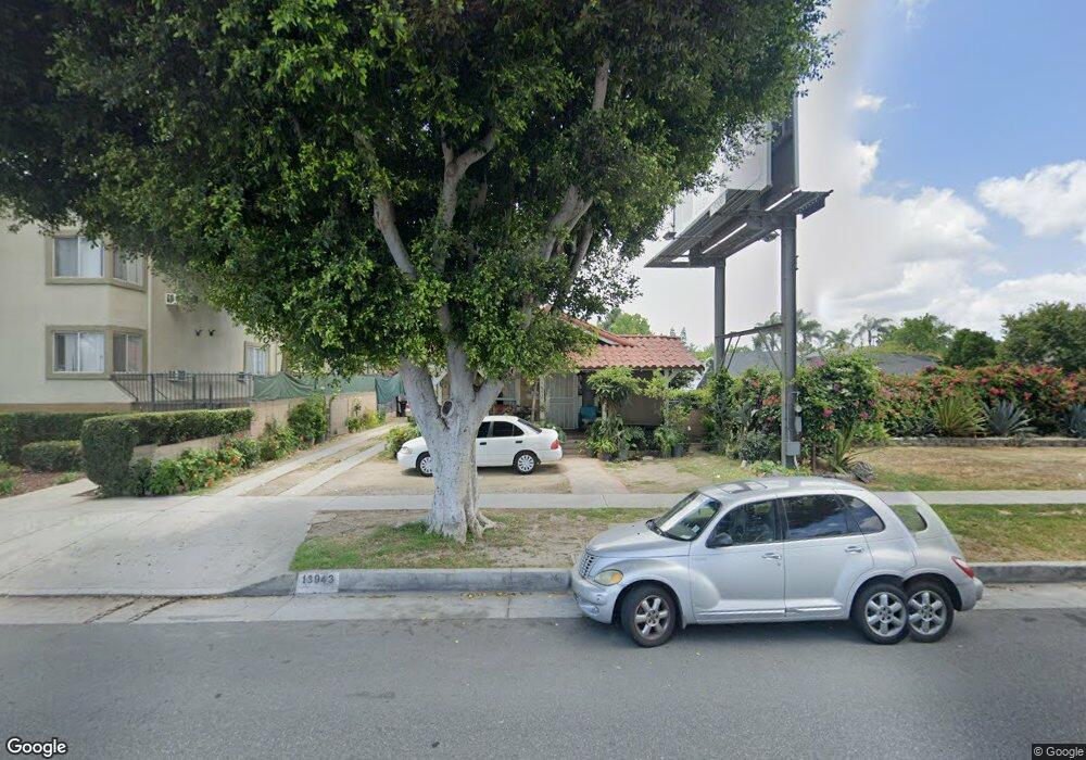
13943 Paramount Blvd Paramount, CA 90723
Estimated Value: $642,000 - $892,000
3
Beds
1
Bath
1,268
Sq Ft
$571/Sq Ft
Est. Value
About This Home
This home is located at 13943 Paramount Blvd, Paramount, CA 90723 and is currently estimated at $724,614, approximately $571 per square foot. 13943 Paramount Blvd is a home located in Los Angeles County with nearby schools including Theodore Roosevelt, Paramount Park Middle School, and Paramount High School.
Ownership History
Date
Name
Owned For
Owner Type
Purchase Details
Closed on
Jul 10, 2003
Sold by
Delgado Alberto H
Bought by
Delgado Beatris
Current Estimated Value
Purchase Details
Closed on
Jul 8, 2003
Sold by
Casillas Antonio
Bought by
Siddique Yolanda Casillas and Casillas Jesus
Purchase Details
Closed on
Dec 2, 1999
Sold by
Casillas Antonio
Bought by
Casillas Antonio P and Casillas Agustina E
Purchase Details
Closed on
Sep 11, 1997
Sold by
Casillas Antonio
Bought by
Casillas Antonio and Casillas Agustina
Home Financials for this Owner
Home Financials are based on the most recent Mortgage that was taken out on this home.
Original Mortgage
$70,000
Interest Rate
7.36%
Create a Home Valuation Report for This Property
The Home Valuation Report is an in-depth analysis detailing your home's value as well as a comparison with similar homes in the area
Home Values in the Area
Average Home Value in this Area
Purchase History
| Date | Buyer | Sale Price | Title Company |
|---|---|---|---|
| Delgado Beatris | -- | -- | |
| Siddique Yolanda Casillas | -- | -- | |
| Casillas Antonio P | -- | -- | |
| Casillas Antonio | -- | -- | |
| Casillas Antonio | $100,000 | North American Title Co |
Source: Public Records
Mortgage History
| Date | Status | Borrower | Loan Amount |
|---|---|---|---|
| Previous Owner | Casillas Antonio | $70,000 |
Source: Public Records
Tax History
| Year | Tax Paid | Tax Assessment Tax Assessment Total Assessment is a certain percentage of the fair market value that is determined by local assessors to be the total taxable value of land and additions on the property. | Land | Improvement |
|---|---|---|---|---|
| 2025 | $2,945 | $196,138 | $140,982 | $55,156 |
| 2024 | $2,945 | $192,293 | $138,218 | $54,075 |
| 2023 | $2,894 | $188,523 | $135,508 | $53,015 |
| 2022 | $2,821 | $184,827 | $132,851 | $51,976 |
| 2021 | $2,756 | $181,204 | $130,247 | $50,957 |
| 2020 | $2,700 | $179,347 | $128,912 | $50,435 |
| 2019 | $2,812 | $175,832 | $126,385 | $49,447 |
| 2018 | $2,570 | $172,385 | $123,907 | $48,478 |
| 2016 | $2,315 | $165,694 | $119,097 | $46,597 |
| 2015 | $2,194 | $163,207 | $117,309 | $45,898 |
| 2014 | $2,248 | $160,011 | $115,012 | $44,999 |
Source: Public Records
Map
Nearby Homes
- 13959 Arthur Ave Unit 1
- 14045 Anderson St Unit 1/2
- 13942 Anderson St
- 14134 Orizaba Ave
- 8217 Howe St
- 13944 Brightwell Ave
- 13450 Merkel Ave
- 8211 Wilbarn St
- 13438 Obispo Ave
- 13623 Fanshaw Ave
- 3 Rosecrans Ave
- 13827 Fairlock Ave
- 0 Nevada Ave
- 8330 Elburg St
- 8052 Alhambra Ave Unit 36
- 13947 Downey Ave
- 13636 Garfield Ave
- 13108 Brock Ave
- 13317 Bixler Ave
- 6100 Mckinley Ave
- 13933 Paramount Blvd
- 13947 Paramount Blvd
- 13940 Paramount Blvd
- 7950 Howe St
- 7922 Howe St
- 13918 Mcclure Ave
- 13918 Mcclure Ave Unit 8
- 13918 Mcclure Ave Unit 7
- 13918 Mcclure Ave Unit 6
- 13918 Mcclure Ave Unit 5
- 13918 Mcclure Ave Unit 4
- 13918 Mcclure Ave Unit 3
- 13918 Mcclure Ave Unit 2
- 13918 Mcclure Ave Unit 1
- 7910 Howe St
- 13914 Paramount Blvd
- 7924 Pearle St
- 13912 Mcclure Ave
- 13912 Mcclure Ave Unit 7
- 13912 Mcclure Ave Unit 6
Your Personal Tour Guide
Ask me questions while you tour the home.