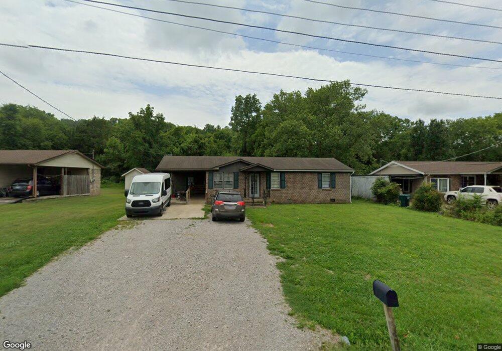
1395 Meadowbrook Dr Pulaski, TN 38478
Estimated Value: $146,860 - $195,000
3
Beds
1
Bath
1,032
Sq Ft
$177/Sq Ft
Est. Value
About This Home
This home is located at 1395 Meadowbrook Dr, Pulaski, TN 38478 and is currently estimated at $182,715, approximately $177 per square foot. 1395 Meadowbrook Dr is a home located in Giles County with nearby schools including Pulaski Elementary School, Southside Elementary School, and Bridgeforth Middle School.
Ownership History
Date
Name
Owned For
Owner Type
Purchase Details
Closed on
Jul 26, 2012
Sold by
Jim Bonner Development Llc
Bought by
Morrow Lonnie Jay
Current Estimated Value
Purchase Details
Closed on
Aug 31, 2010
Bought by
Jim Bonner Development Llc
Purchase Details
Closed on
Oct 5, 2001
Sold by
Rodgers Faye C
Bought by
Dale David W
Purchase Details
Closed on
Jun 30, 1995
Sold by
Ferguson Tammy
Bought by
Reynolds Anissa Y
Purchase Details
Closed on
Jun 18, 1992
Bought by
Ferguson Tammy
Purchase Details
Closed on
Aug 29, 1986
Bought by
Nelson John R and Nelson Sharen
Create a Home Valuation Report for This Property
The Home Valuation Report is an in-depth analysis detailing your home's value as well as a comparison with similar homes in the area
Home Values in the Area
Average Home Value in this Area
Purchase History
| Date | Buyer | Sale Price | Title Company |
|---|---|---|---|
| Morrow Lonnie Jay | $457,800 | -- | |
| Jim Bonner Development Llc | $99,500 | -- | |
| Dale David W | $36,500 | -- | |
| Reynolds Anissa Y | $47,000 | -- | |
| Ferguson Tammy | -- | -- | |
| Nelson John R | -- | -- |
Source: Public Records
Tax History Compared to Growth
Tax History
| Year | Tax Paid | Tax Assessment Tax Assessment Total Assessment is a certain percentage of the fair market value that is determined by local assessors to be the total taxable value of land and additions on the property. | Land | Improvement |
|---|---|---|---|---|
| 2024 | $677 | $28,100 | $5,600 | $22,500 |
| 2023 | $677 | $28,100 | $5,600 | $22,500 |
| 2022 | $677 | $28,100 | $5,600 | $22,500 |
| 2021 | $494 | $14,600 | $1,500 | $13,100 |
| 2020 | $494 | $14,600 | $1,500 | $13,100 |
| 2019 | $412 | $14,600 | $1,500 | $13,100 |
| 2018 | $494 | $14,600 | $1,500 | $13,100 |
| 2017 | $494 | $14,600 | $1,500 | $13,100 |
| 2016 | $511 | $14,425 | $1,500 | $12,925 |
| 2015 | $482 | $14,425 | $1,500 | $12,925 |
| 2014 | $482 | $14,418 | $0 | $0 |
Source: Public Records
Map
Nearby Homes
- 1361 Riley Hill Rd
- 1244 E Jefferson St
- 1340 Magazine Rd
- 300 Longview Dr
- 308 Longview Dr
- 0 Ables Ln
- 310 Glendale Dr
- 115 Horseshoe St
- 442 Longmeadow Cir
- 635 Cleveland St Unit 637
- 207 N Cedar Ln
- 515 S Cedar Ln
- 534 E College St
- 527 E Madison St
- 0 Marietta St
- 0 Maple St
- 525 Culpepper St Extended
- 528 Maple St
- 326 Ballentine St
- 403 Victoria St
- 1391 Meadowbrook Dr
- 1399 Meadowbrook Dr
- 1389 Meadowbrook Dr
- 1411 Meadowbrook Dr
- 1360 Meadowbrook Dr
- 1317 Walnut St
- 1387 Meadowbrook Dr
- 1354 Meadowbrook Dr
- 1313 Walnut St
- 1413 Meadowbrook Dr
- 1350 Meadowbrook Dr
- 1385 Meadowbrook Dr
- 1340 Walnut St
- 1348 Meadowbrook Dr
- 1415 Meadowbrook Dr
- 1410 Meadowbrook Dr
- 1328 Walnut St
- 1383 Meadowbrook Dr
- 1332 Meadowbrook Dr
- 1420 Meadowbrook Dr