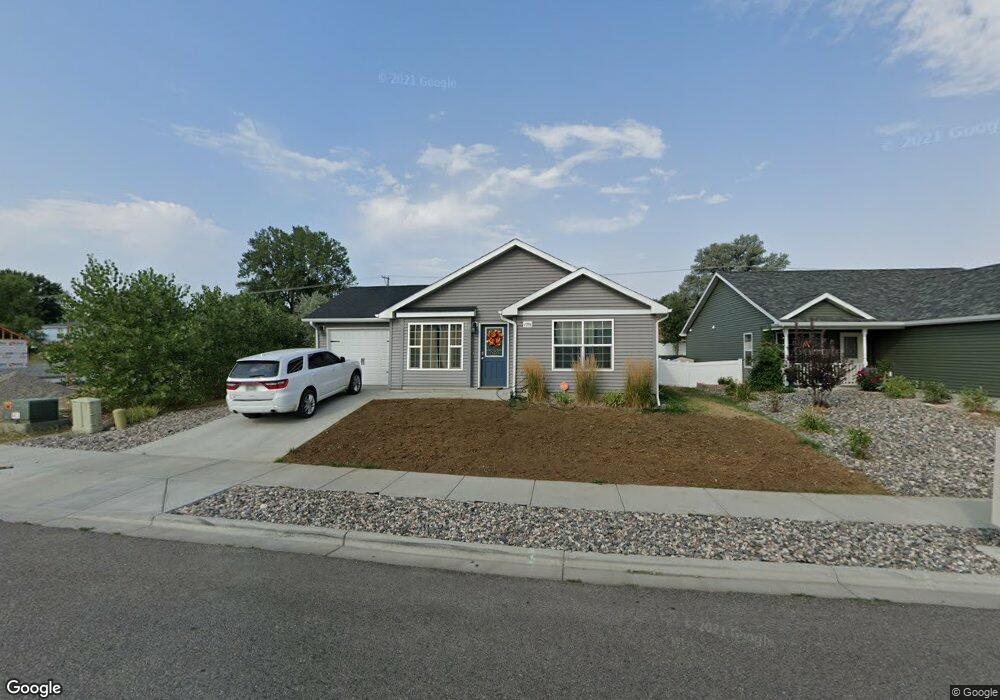
1396 Watson Peak Rd Billings, MT 59105
Billings Heights NeighborhoodEstimated Value: $313,000 - $366,000
3
Beds
2
Baths
1,351
Sq Ft
$249/Sq Ft
Est. Value
About This Home
This home is located at 1396 Watson Peak Rd, Billings, MT 59105 and is currently estimated at $336,316, approximately $248 per square foot. 1396 Watson Peak Rd is a home with nearby schools including Bench School, Medicine Crow Middle School, and Skyview High School.
Ownership History
Date
Name
Owned For
Owner Type
Purchase Details
Closed on
Oct 4, 2024
Sold by
Red Tomahawk Jr James Kenneth and Red Tomahawk Jacey Paula-Marie
Bought by
Lamoure Emmaline
Current Estimated Value
Purchase Details
Closed on
Jun 25, 2019
Sold by
Peterson Daniel
Bought by
Red-Tomahawk James K and Marie-Red Jacey P
Home Financials for this Owner
Home Financials are based on the most recent Mortgage that was taken out on this home.
Original Mortgage
$213,314
Interest Rate
3.9%
Mortgage Type
FHA
Create a Home Valuation Report for This Property
The Home Valuation Report is an in-depth analysis detailing your home's value as well as a comparison with similar homes in the area
Home Values in the Area
Average Home Value in this Area
Purchase History
| Date | Buyer | Sale Price | Title Company |
|---|---|---|---|
| Lamoure Emmaline | -- | Stewart Title | |
| Red-Tomahawk James K | -- | -- |
Source: Public Records
Mortgage History
| Date | Status | Borrower | Loan Amount |
|---|---|---|---|
| Previous Owner | Red-Tomahawk James K | $213,314 |
Source: Public Records
Tax History Compared to Growth
Tax History
| Year | Tax Paid | Tax Assessment Tax Assessment Total Assessment is a certain percentage of the fair market value that is determined by local assessors to be the total taxable value of land and additions on the property. | Land | Improvement |
|---|---|---|---|---|
| 2025 | $2,749 | $303,900 | $56,270 | $247,630 |
| 2024 | $2,749 | $286,400 | $54,004 | $232,396 |
| 2023 | $2,747 | $286,400 | $54,004 | $232,396 |
| 2022 | $2,347 | $213,600 | $44,966 | $168,634 |
| 2021 | $2,234 | $213,600 | $0 | $0 |
| 2020 | $2,283 | $204,500 | $0 | $0 |
| 2019 | $2,179 | $204,500 | $0 | $0 |
| 2018 | $2,078 | $191,100 | $0 | $0 |
| 2017 | $1,769 | $191,100 | $0 | $0 |
| 2016 | $1,892 | $179,300 | $0 | $0 |
| 2015 | $509 | $44,486 | $0 | $0 |
| 2014 | $498 | $23,288 | $0 | $0 |
Source: Public Records
Map
Nearby Homes
- 10 Miners Place
- 1422 Watson Peak Rd
- 1409 Twin Oaks Dr
- 1485 Westchester Square E
- 1524 Westchester Square E
- TBD Saint Andrews Dr
- 1534 Westchester Square E Unit 6
- 269 Westchester Square S
- 243 Westchester Square N Unit A2
- 237 Prospectors Ln
- 69 Nugget Place
- 218 Reda Ln Unit 3
- 218 Reda Ln Unit 4
- 130 132 Stillwater Ln
- lot 12 Southern Sky Estates
- 1034 Nutter Blvd
- 225 Windsor Cir N
- 104 Stillwater Ln
- 1703 Cody Dr
- 1152 Toole Ct
- 1402 Watson Peak Rd
- 1402 Watson Peak Rd
- 1392 Watson Peak Rd
- 1404 Watson Peak Rd
- 1397 Watson Peak Rd
- 1401 Watson Peak Rd
- 1401 Watson Peak Rd
- 1403 Watson Peak Rd
- 1380 Watson Peak Rd
- 1406 Watson Peak Rd
- 1395 Watson Peak Rd
- 1405 Watson Peak Rd
- 1408 Watson Peak Rd
- 1383 Twin Lakes Dr
- 1407 Watson Peak Rd
- 11 Miners Place
- 11 Miners Place
- 11 Miners Place
- 11 Miners Place
- 11 Miners Place Unit 2