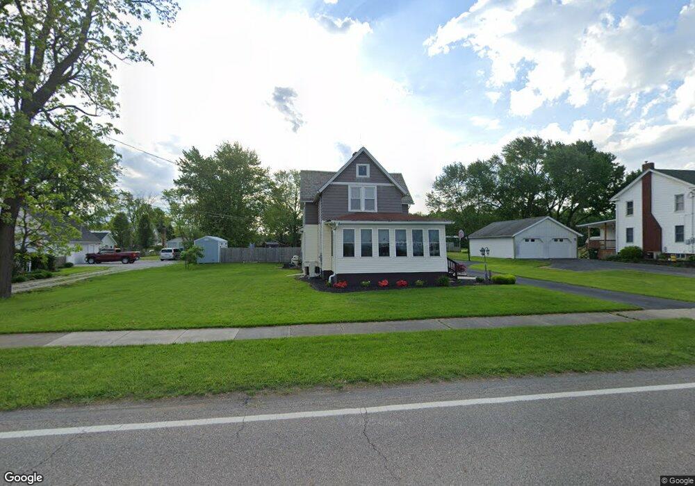
13981 S Main St Beloit, OH 44609
Estimated Value: $227,000 - $288,000
4
Beds
3
Baths
2,124
Sq Ft
$122/Sq Ft
Est. Value
About This Home
This home is located at 13981 S Main St, Beloit, OH 44609 and is currently estimated at $259,825, approximately $122 per square foot. 13981 S Main St is a home located in Mahoning County with nearby schools including West Branch Middle School, West Branch Early Learning Center, and West Branch High School.
Ownership History
Date
Name
Owned For
Owner Type
Purchase Details
Closed on
May 23, 2017
Sold by
Bland Richard W
Bought by
Bland Richard W and Bland Joyce L
Current Estimated Value
Purchase Details
Closed on
Jul 30, 2007
Sold by
Thomas Linda A and Thomas Jerry L
Bought by
Bland Richard W
Home Financials for this Owner
Home Financials are based on the most recent Mortgage that was taken out on this home.
Original Mortgage
$110,000
Outstanding Balance
$68,384
Interest Rate
6.76%
Mortgage Type
Purchase Money Mortgage
Estimated Equity
$191,441
Purchase Details
Closed on
Oct 24, 1997
Sold by
Greenawalt Roger W and Greenawalt Terri L
Bought by
Bryan John A and Bryan Diane M
Home Financials for this Owner
Home Financials are based on the most recent Mortgage that was taken out on this home.
Original Mortgage
$40,000
Interest Rate
7.65%
Mortgage Type
Purchase Money Mortgage
Purchase Details
Closed on
Aug 5, 1976
Bought by
Greenawalt Roger W and T L
Create a Home Valuation Report for This Property
The Home Valuation Report is an in-depth analysis detailing your home's value as well as a comparison with similar homes in the area
Purchase History
| Date | Buyer | Sale Price | Title Company |
|---|---|---|---|
| Bland Richard W | -- | None Available | |
| Bland Richard W | $131,500 | Source One Title | |
| Bryan John A | $50,000 | -- | |
| Greenawalt Roger W | -- | -- |
Source: Public Records
Mortgage History
| Date | Status | Borrower | Loan Amount |
|---|---|---|---|
| Open | Bland Richard W | $110,000 | |
| Previous Owner | Bryan John A | $40,000 |
Source: Public Records
Tax History
| Year | Tax Paid | Tax Assessment Tax Assessment Total Assessment is a certain percentage of the fair market value that is determined by local assessors to be the total taxable value of land and additions on the property. | Land | Improvement |
|---|---|---|---|---|
| 2025 | $2,900 | $72,220 | $4,820 | $67,400 |
| 2024 | $2,900 | $72,220 | $4,820 | $67,400 |
| 2023 | $2,850 | $72,220 | $4,820 | $67,400 |
| 2022 | $2,320 | $49,640 | $4,820 | $44,820 |
| 2021 | $2,536 | $49,640 | $4,820 | $44,820 |
| 2020 | $2,544 | $49,640 | $4,820 | $44,820 |
| 2019 | $2,236 | $39,840 | $4,820 | $35,020 |
| 2018 | $2,260 | $39,840 | $4,820 | $35,020 |
| 2017 | $1,961 | $39,380 | $4,360 | $35,020 |
| 2016 | $1,665 | $29,070 | $3,220 | $25,850 |
| 2015 | $1,629 | $29,070 | $3,220 | $25,850 |
| 2014 | $1,635 | $29,070 | $3,220 | $25,850 |
| 2013 | $1,618 | $29,070 | $3,220 | $25,850 |
Source: Public Records
Map
Nearby Homes
- 18061 Derr Ave
- 18280 5th St
- 57 Redwood St
- 18262 W Pine Lake Rd
- 430 Hillsdale St
- 423 S 14th St
- 345 E Indiana Ave
- 195 E Pennsylvania Ave
- 324 S 15th St
- 208 S 15th St
- 157 E Ohio Ave
- 104 W Carolina Ave
- 27292 Lake Front Dr
- 125 E Indiana Ave
- 945 N 12th St
- 166 E Michigan Ave
- 175 W Ohio Ave
- 1005 N 13th St
- 26223 Wildwood Dr
- 0 W Nevada Ave Unit 5181868
- 13969 S Main St
- 14009 S Main St
- 14023 S Main St
- 13958 Oak Ave
- 13943 S Main St
- 14035 S Main St
- 13931 S Main St
- 14047 S Main St
- 13971 Oak Ave
- 17967 Penn Ave
- 13959 Oak Ave
- 13943 Oak Ave
- 14059 S Main St
- 14064 S Main St
- 13935 Oak Ave
- 13901 S Main St
- 17946 Penn Ave
- 13903 Oak Ave
- 13875 S Main St
- 14091 S Main St
Your Personal Tour Guide
Ask me questions while you tour the home.