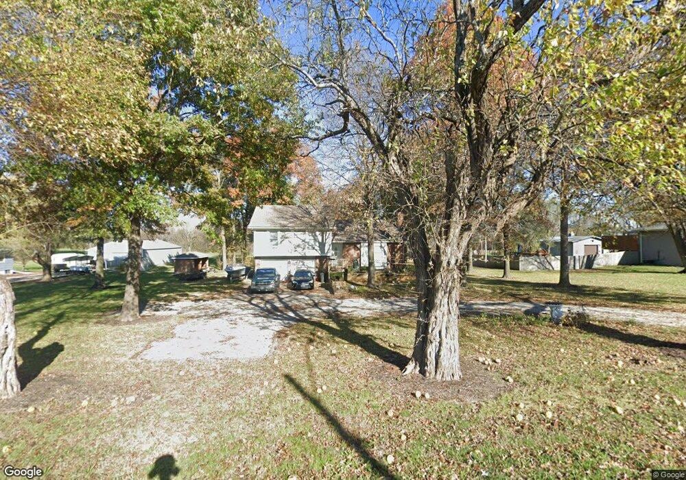
13992 Mcintyre Rd Leavenworth, KS 66048
Estimated Value: $326,848 - $375,000
3
Beds
2
Baths
1,444
Sq Ft
$241/Sq Ft
Est. Value
About This Home
This home is located at 13992 Mcintyre Rd, Leavenworth, KS 66048 and is currently estimated at $348,712, approximately $241 per square foot. 13992 Mcintyre Rd is a home located in Leavenworth County with nearby schools including Lansing Elementary School, Lansing Middle 6-8, and Lansing High 9-12.
Ownership History
Date
Name
Owned For
Owner Type
Purchase Details
Closed on
Dec 1, 1987
Bought by
Cassella Douglas R and Cassella Tina
Current Estimated Value
Home Financials for this Owner
Home Financials are based on the most recent Mortgage that was taken out on this home.
Original Mortgage
$173,829
Outstanding Balance
$139,632
Interest Rate
10.55%
Mortgage Type
FHA
Estimated Equity
$209,080
Create a Home Valuation Report for This Property
The Home Valuation Report is an in-depth analysis detailing your home's value as well as a comparison with similar homes in the area
Home Values in the Area
Average Home Value in this Area
Purchase History
| Date | Buyer | Sale Price | Title Company |
|---|---|---|---|
| Cassella Douglas R | $75,000 | -- |
Source: Public Records
Mortgage History
| Date | Status | Borrower | Loan Amount |
|---|---|---|---|
| Open | Cassella Douglas R | $173,829 | |
| Closed | Cassella Douglas R | $175,493 |
Source: Public Records
Tax History Compared to Growth
Tax History
| Year | Tax Paid | Tax Assessment Tax Assessment Total Assessment is a certain percentage of the fair market value that is determined by local assessors to be the total taxable value of land and additions on the property. | Land | Improvement |
|---|---|---|---|---|
| 2025 | $4,384 | $32,741 | $7,166 | $25,575 |
| 2024 | $3,981 | $32,740 | $8,528 | $24,212 |
| 2023 | $3,981 | $30,764 | $8,528 | $22,236 |
| 2022 | $3,828 | $27,968 | $5,711 | $22,257 |
| 2021 | $3,450 | $24,027 | $4,833 | $19,194 |
| 2020 | $3,192 | $21,892 | $4,648 | $17,244 |
| 2019 | $3,049 | $20,895 | $4,303 | $16,592 |
| 2018 | $3,047 | $20,895 | $4,587 | $16,308 |
| 2017 | $2,965 | $20,293 | $4,587 | $15,706 |
| 2016 | $2,849 | $19,504 | $4,587 | $14,917 |
| 2015 | $2,757 | $18,940 | $4,587 | $14,353 |
| 2014 | $2,620 | $18,388 | $4,587 | $13,801 |
Source: Public Records
Map
Nearby Homes
- 13965 Mc Intyre Rd
- 24431 139th St
- 13788 McIntyre2 Rd
- 13788 McIntyre1 Rd
- 13788 Mcintyre Rd
- Lot 2 139th St
- 23802 140th St
- 131 Rock Creek Loop
- 705 Rock Creek Dr
- 833 Rock Creek Dr
- 875 Clearview Dr
- 115 W Gilman Rd
- 1221 S Desoto Rd
- 922 Southfork St
- 901 S Main St
- 811 4-H Rd
- 722 Bittersweet Rd
- 24131 126th St
- 624 S Bittersweet Ln
- 513 Forestglen Ln
- 14008 Mcintyre Rd
- 13968 Mcintyre Rd
- 14026 Mcintyre Rd
- 24417 139th St
- 13965 Mcintyre Rd
- 24481 139th St
- 14060 Mcintyre Rd
- 14074 Mcintyre Rd
- 24511 139th St
- 14124 Mcintyre Rd
- 13889 Mcintyre Rd
- 13887 Mcintyre Rd
- 13885 Mcintyre Rd
- 14168 Mcintyre Rd
- 13794 Mcintyre Rd
- 14192 Mcintyre Rd
- 13883 Mcintyre Rd
- 24227 139th St
- 23577 139th St
- 14215 Mcintyre Rd