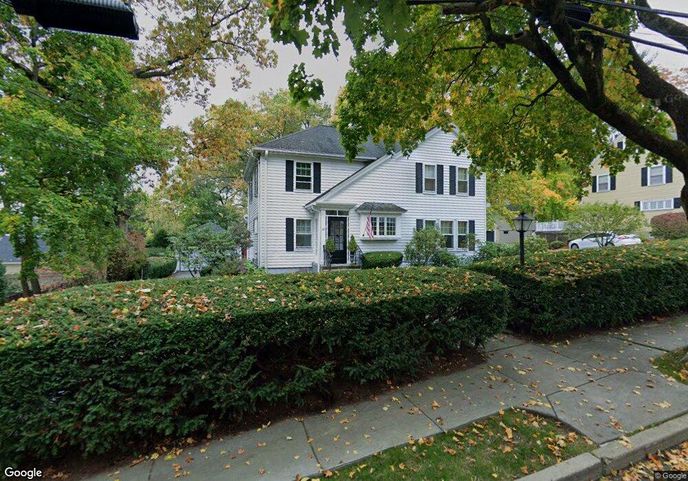
14 Arden Rd Newtonville, MA 02460
Newtonville NeighborhoodEstimated Value: $1,407,000 - $1,647,322
4
Beds
2
Baths
2,271
Sq Ft
$692/Sq Ft
Est. Value
About This Home
This home is located at 14 Arden Rd, Newtonville, MA 02460 and is currently estimated at $1,571,581, approximately $692 per square foot. 14 Arden Rd is a home located in Middlesex County with nearby schools including Cabot Elementary School, F.A. Day Middle School, and Newton North High School.
Ownership History
Date
Name
Owned For
Owner Type
Purchase Details
Closed on
Mar 29, 2012
Sold by
Hatem Charles J
Bought by
Hatem Rt and Hatem Charles J
Current Estimated Value
Purchase Details
Closed on
May 21, 2010
Sold by
Hatem Charles J and Hatem Barbara A
Bought by
Hatem Charles J and Hatem Barbara A
Create a Home Valuation Report for This Property
The Home Valuation Report is an in-depth analysis detailing your home's value as well as a comparison with similar homes in the area
Home Values in the Area
Average Home Value in this Area
Purchase History
| Date | Buyer | Sale Price | Title Company |
|---|---|---|---|
| Hatem Rt | -- | -- | |
| Hatem Charles J | -- | -- |
Source: Public Records
Tax History Compared to Growth
Tax History
| Year | Tax Paid | Tax Assessment Tax Assessment Total Assessment is a certain percentage of the fair market value that is determined by local assessors to be the total taxable value of land and additions on the property. | Land | Improvement |
|---|---|---|---|---|
| 2025 | $13,722 | $1,400,200 | $1,274,500 | $125,700 |
| 2024 | $13,268 | $1,359,400 | $1,237,400 | $122,000 |
| 2023 | $12,641 | $1,241,700 | $951,300 | $290,400 |
| 2022 | $12,095 | $1,149,700 | $880,800 | $268,900 |
| 2021 | $11,670 | $1,084,600 | $830,900 | $253,700 |
| 2020 | $11,323 | $1,084,600 | $830,900 | $253,700 |
| 2019 | $11,004 | $1,053,000 | $806,700 | $246,300 |
| 2018 | $10,513 | $971,600 | $726,100 | $245,500 |
| 2017 | $10,193 | $916,600 | $685,000 | $231,600 |
| 2016 | $9,748 | $856,600 | $640,200 | $216,400 |
| 2015 | $9,295 | $800,600 | $598,300 | $202,300 |
Source: Public Records
Map
Nearby Homes
- 61 Lakeview Ave
- 308 Prince St
- 887 Commonwealth Ave
- 34 Morton Rd
- 39 Valentine Park
- 54 Garland Rd
- 22 Walnut Place Unit 1
- 3 Cedar St
- 123-125 Mount Vernon St
- 123 Mount Vernon St Unit 2
- 1114 Beacon St Unit 106
- 1114 Beacon St Unit 203
- 1114 Beacon St Unit 111
- 1114 Beacon St Unit 206
- 1114 Beacon St Unit 104
- 1114 Beacon St Unit 207
- 26 Wilson Cir Unit 26
- 28 Wilson Cir Unit 28
- 32 Wilson Cir Unit 32
- 300 Cabot St
- 22 Arden Rd
- 6 Arden Rd
- 519 Lowell Ave
- 525 Lowell Ave
- 11 Whittier Rd
- 41 Oak Cliff Rd
- 11 Arden Rd
- 19 Arden Rd
- 5 Whittier Rd
- 19 Whittier Rd
- 507 Lowell Ave Unit 2
- 507 Lowell Ave Unit 1
- 507 Lowell Ave
- 507 Lowell Ave Unit 2,507
- 35 Oak Cliff Rd
- 67 Oak Cliff Rd
- 526 Lowell Ave
- 503 Lowell Ave
- 503 Lowell Ave Unit 1
- 52 Oak Cliff Rd