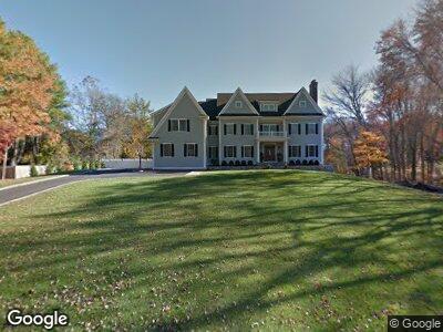
14 Bonnie Brook Rd Westport, CT 06880
Coleytown NeighborhoodEstimated Value: $3,430,000 - $4,343,000
6
Beds
8
Baths
7,039
Sq Ft
$542/Sq Ft
Est. Value
About This Home
This home is located at 14 Bonnie Brook Rd, Westport, CT 06880 and is currently estimated at $3,816,377, approximately $542 per square foot. 14 Bonnie Brook Rd is a home located in Fairfield County with nearby schools including Coleytown Elementary School, Coleytown Middle School, and Staples High School.
Ownership History
Date
Name
Owned For
Owner Type
Purchase Details
Closed on
May 3, 2013
Sold by
Printz Lorelle H
Bought by
Feeney Austin and Gambale Virginia
Current Estimated Value
Purchase Details
Closed on
Feb 1, 1993
Sold by
Bossom Bernard and Bossom Janet
Bought by
Printz Michael and Printz Lorelle
Create a Home Valuation Report for This Property
The Home Valuation Report is an in-depth analysis detailing your home's value as well as a comparison with similar homes in the area
Home Values in the Area
Average Home Value in this Area
Purchase History
| Date | Buyer | Sale Price | Title Company |
|---|---|---|---|
| Feeney Austin | $1,050,000 | -- | |
| Feeney Austin | $1,050,000 | -- | |
| Printz Michael | $470,000 | -- | |
| Printz Michael | $470,000 | -- |
Source: Public Records
Mortgage History
| Date | Status | Borrower | Loan Amount |
|---|---|---|---|
| Previous Owner | Bossom Bernard | $792,000 | |
| Previous Owner | Bossom Bernard | $790,000 |
Source: Public Records
Tax History Compared to Growth
Tax History
| Year | Tax Paid | Tax Assessment Tax Assessment Total Assessment is a certain percentage of the fair market value that is determined by local assessors to be the total taxable value of land and additions on the property. | Land | Improvement |
|---|---|---|---|---|
| 2024 | $32,628 | $1,752,300 | $436,000 | $1,316,300 |
| 2023 | $32,124 | $1,750,600 | $436,000 | $1,314,600 |
| 2022 | $31,633 | $1,750,600 | $436,000 | $1,314,600 |
| 2021 | $27,375 | $1,750,600 | $436,000 | $1,314,600 |
| 2020 | $34,068 | $2,038,760 | $385,400 | $1,653,360 |
| 2019 | $34,373 | $2,038,760 | $385,400 | $1,653,360 |
| 2018 | $34,373 | $2,038,760 | $385,400 | $1,653,360 |
| 2017 | $34,373 | $2,038,760 | $385,400 | $1,653,360 |
| 2016 | $36,972 | $2,192,900 | $455,400 | $1,737,500 |
| 2015 | $39,709 | $2,195,100 | $388,300 | $1,806,800 |
| 2014 | $12,178 | $678,800 | $388,300 | $290,500 |
Source: Public Records
Map
Nearby Homes
- 4 Silver Brook Rd
- 30 Easton Rd
- 83 Red Coat Rd
- 21 Warnock Dr
- 70 Clinton Ave
- 87 Red Coat Rd
- 5 Northside Ln
- 11 Gault Park Dr
- 17 Huckleberry Ln
- 48 Cavalry Rd
- 9 Daybreak Commons Unit 9
- 6 N Ridge Rd
- 15 Arrowhead Way
- 18 Stoneboat Rd
- 7 N Ridge Rd
- 5 Fraser Rd
- 489 Main St
- 30 Coley Dr
- 44 Charcoal Hill Rd
- 157 North Ave
- 14 Bonnie Brook Rd
- 19 Bonnie Brook Rd
- 16 Bonnie Brook Rd
- 17 Bonnie Brook Rd
- 21 Bonnie Brook Rd
- 18 Bonnie Brook Rd
- 25 Bonnie Brook Rd
- 27 Bonnie Brook Rd
- 12 Bonnie Brook Rd
- 5 Bonnie Brook Ln
- 29 Bonnie Brook Rd
- 7 Bonnie Brook Ln
- 7 Elliot Ln
- 15 Bonnie Brook Rd
- 23 Bonnie Brook Rd
- 31 Bonnie Brook Rd
- 11 Bonnie Brook Rd
- 10 Bonnie Brook Ln
- 6 Bonnie Brook Ln
- 6 Elliot Ln