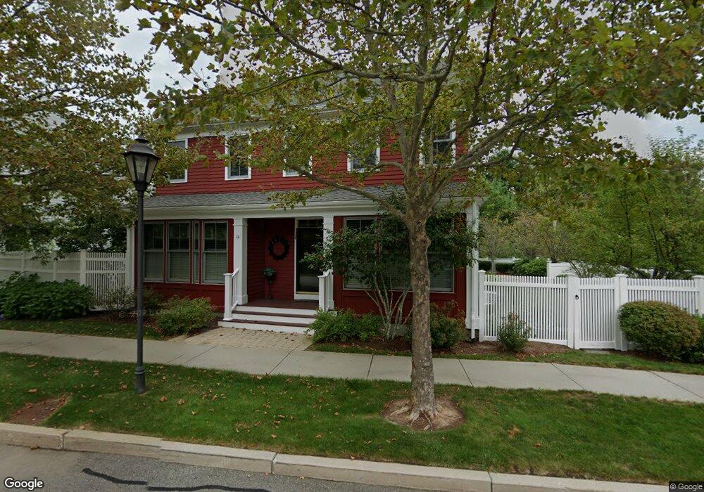
14 Codding Rd Norton, MA 02766
Estimated Value: $775,000 - $829,000
3
Beds
3
Baths
2,240
Sq Ft
$355/Sq Ft
Est. Value
About This Home
This home is located at 14 Codding Rd, Norton, MA 02766 and is currently estimated at $795,468, approximately $355 per square foot. 14 Codding Rd is a home located in Bristol County with nearby schools including L.G. Nourse Elementary School, Henri A. Yelle Elementary School, and Norton Middle School.
Ownership History
Date
Name
Owned For
Owner Type
Purchase Details
Closed on
Aug 14, 2025
Sold by
Wigdor Michael and Wigdor Sheryl
Bought by
Wigdor Ret and Wigdor
Current Estimated Value
Purchase Details
Closed on
May 22, 2025
Sold by
Zamagni William E and Zamagni Arlene J
Bought by
Wigdor Michael and Wigdor Sheryl
Purchase Details
Closed on
Jun 29, 2006
Sold by
Thorndike Prop Of Mass
Bought by
Zamagni Arlene J and Zamagni William E
Create a Home Valuation Report for This Property
The Home Valuation Report is an in-depth analysis detailing your home's value as well as a comparison with similar homes in the area
Home Values in the Area
Average Home Value in this Area
Purchase History
| Date | Buyer | Sale Price | Title Company |
|---|---|---|---|
| Wigdor Ret | -- | -- | |
| Wigdor Ret | -- | -- | |
| Wigdor Michael | $810,000 | None Available | |
| Wigdor Michael | $810,000 | None Available | |
| Zamagni Arlene J | $615,855 | -- | |
| Zamagni Arlene J | $615,855 | -- | |
| Zamagni Arlene J | $615,855 | -- |
Source: Public Records
Tax History Compared to Growth
Tax History
| Year | Tax Paid | Tax Assessment Tax Assessment Total Assessment is a certain percentage of the fair market value that is determined by local assessors to be the total taxable value of land and additions on the property. | Land | Improvement |
|---|---|---|---|---|
| 2025 | $8,154 | $628,700 | $0 | $628,700 |
| 2024 | $8,296 | $640,600 | $0 | $640,600 |
| 2023 | $7,441 | $572,800 | $0 | $572,800 |
| 2022 | $7,662 | $537,300 | $0 | $537,300 |
| 2021 | $7,640 | $511,700 | $0 | $511,700 |
| 2020 | $7,431 | $502,100 | $0 | $502,100 |
| 2019 | $7,566 | $507,800 | $0 | $507,800 |
| 2018 | $7,441 | $490,800 | $0 | $490,800 |
| 2017 | $7,122 | $463,400 | $0 | $463,400 |
| 2016 | $7,170 | $459,300 | $0 | $459,300 |
| 2015 | $7,515 | $488,300 | $0 | $488,300 |
| 2014 | $7,293 | $474,500 | $0 | $474,500 |
Source: Public Records
Map
Nearby Homes
- 48 Codding Rd Unit 48
- 31 Owen Rd
- 6 Horton Dr
- 14 Downing Dr
- 195 E Main St
- 1 Carlton Dr
- O Leonard St
- 0 Knollwood & 0 Rear Kensington
- 12 Kayak Trail
- 0 S Washington St Unit 73437419
- 0 Kensington Rd
- 15 S Washington St
- 8 Johnson Dr
- 38 S Washington St
- 139 Burt St Unit 6
- 145 Burt St Unit 1
- 9 Shagbark Rd
- 23 Indian Rd
- 12 Sylvan Rd
- 10 Ridge Rd
- 12 Codding Rd
- 10 Codding Rd
- 10 Codding Rd Unit lot 27
- 8 Codding Rd
- 8 Codding Rd Unit Lot26/Essex
- 8 Codding Rd Unit lot 26
- 3 Barker Lane Ex Aldrich Unit 16-5
- 73 Codding Rd
- 6 Codding Rd
- 87 Codding Rd Unit 89
- 44 Codding Rd
- 89 Codding Rd Unit 88
- 44 Codding Rd Unit 53
- 87 Codding Rd
- 44 Codding Rd Unit Cohasset
- 72 Codding Rd
- 63 Codding Rd
- 57 Codding Rd
- 61 Codding Rd Unit 43
- 42 Codding Rd Unit 52