Estimated Value: $417,000 - $583,000
4
Beds
2
Baths
2,784
Sq Ft
$186/Sq Ft
Est. Value
About This Home
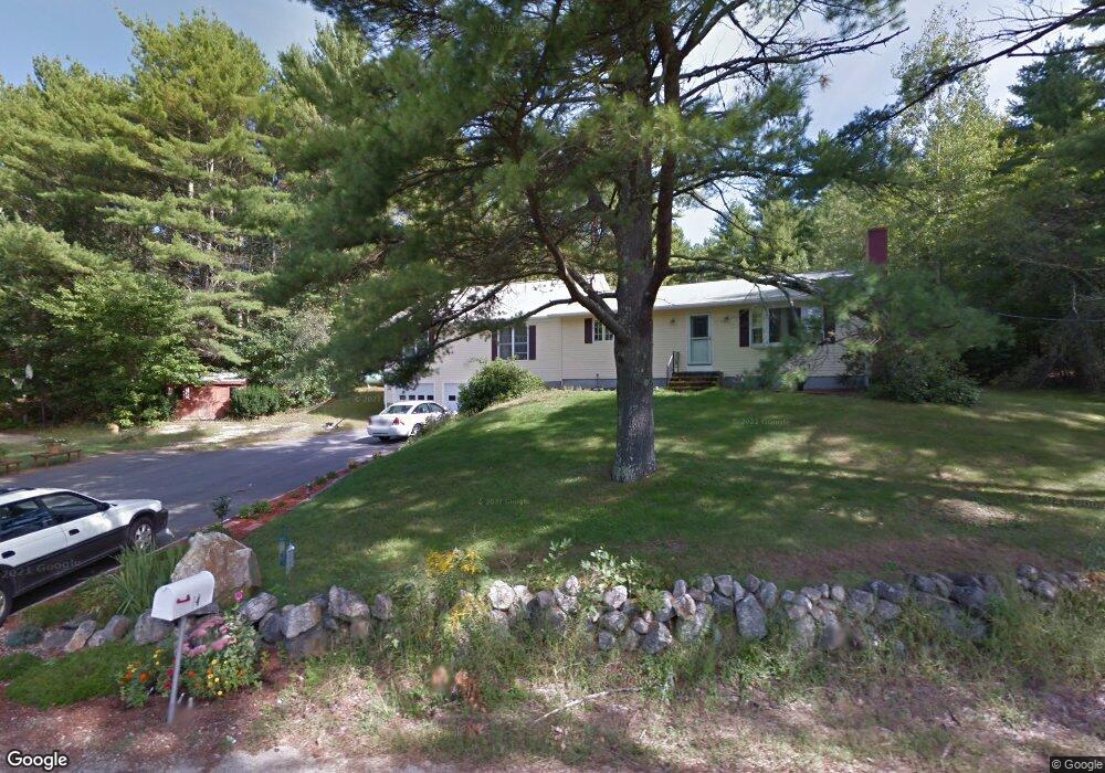
This home is located at 14 Drolet Rd, Epsom, NH 03234 and is currently estimated at $517,495, approximately $185 per square foot. 14 Drolet Rd is a home located in Merrimack County with nearby schools including Epsom Central School, First Choice for Children, and Tender Years Child Care & Learning Center.
Ownership History
Date
Name
Owned For
Owner Type
Purchase Details
Closed on
Apr 30, 1998
Sold by
Polish Karen A
Bought by
Raper Stephen M and Raper Katharyn B
Current Estimated Value
Home Financials for this Owner
Home Financials are based on the most recent Mortgage that was taken out on this home.
Original Mortgage
$98,900
Interest Rate
7.04%
Create a Home Valuation Report for This Property
The Home Valuation Report is an in-depth analysis detailing your home's value as well as a comparison with similar homes in the area
Home Values in the Area
Average Home Value in this Area
Purchase History
| Date | Buyer | Sale Price | Title Company |
|---|---|---|---|
| Raper Stephen M | $109,900 | -- |
Source: Public Records
Mortgage History
| Date | Status | Borrower | Loan Amount |
|---|---|---|---|
| Open | Raper Stephen M | $195,975 | |
| Closed | Raper Stephen M | $200,000 | |
| Closed | Raper Stephen M | $200,970 | |
| Closed | Raper Stephen M | $98,900 |
Source: Public Records
Tax History
| Year | Tax Paid | Tax Assessment Tax Assessment Total Assessment is a certain percentage of the fair market value that is determined by local assessors to be the total taxable value of land and additions on the property. | Land | Improvement |
|---|---|---|---|---|
| 2025 | $9,886 | $563,600 | $171,500 | $392,100 |
| 2024 | $8,048 | $302,100 | $92,100 | $210,000 |
| 2023 | $7,441 | $302,100 | $92,100 | $210,000 |
| 2022 | $7,202 | $302,100 | $92,100 | $210,000 |
| 2021 | $7,142 | $302,100 | $92,100 | $210,000 |
| 2020 | $6,595 | $302,100 | $92,100 | $210,000 |
| 2019 | $7,005 | $258,600 | $83,700 | $174,900 |
| 2018 | $6,716 | $258,600 | $83,700 | $174,900 |
| 2017 | $6,638 | $258,600 | $83,700 | $174,900 |
| 2016 | $6,473 | $258,600 | $83,700 | $174,900 |
| 2015 | $6,160 | $258,600 | $83,700 | $174,900 |
| 2014 | $5,489 | $246,600 | $71,400 | $175,200 |
| 2013 | $5,566 | $246,600 | $71,400 | $175,200 |
Source: Public Records
Map
Nearby Homes
- 6 Lincoln St
- 0 Poor Town Rd Unit 4
- 9 Princess Ln
- 2 Archer Cir
- 357 New Rye Rd
- 8 Bush Ave
- 1 Jefferson Ave
- 7 Pinecrest Cir
- 5 Catamount Hill Dr
- 647 Cross Country Rd
- 821 Cross Country Rd
- 428 Dawn Ct Unit 21
- 426 Dawn Ct Unit 22
- 431 Dawn Ct Unit 17
- 427 Grady Ln Unit 29
- 441 Blane Cir Unit 12
- 474 Blane Cir Unit 40
- 325 Pembroke Hill Rd
- 506 4th Range Rd Unit 4
- 88 Old Town Road Extension
- 26 Drolet Rd
- 5 Drolet Rd
- 23 Drolet Rd
- 112 Suncook Valley Hwy S
- 20 Drolet Rd
- 36 Drolet Rd
- Lot 82-D Off Route 28
- 125 Suncook Valley Hwy
- 90 Suncook Valley Hwy
- 71 Suncook Valley Hwy
- 41 Drolet Rd
- 126 Suncook Valley Hwy
- 2 Fowler Rd
- 133 Suncook Valley Hwy
- 134 Suncook Valley Hwy
- 15 Martin Hill Rd
- 18 Martin Hill Rd
- 16 Fowler Rd
- 19 Ash St
- 31 L and S Ln
Your Personal Tour Guide
Ask me questions while you tour the home.