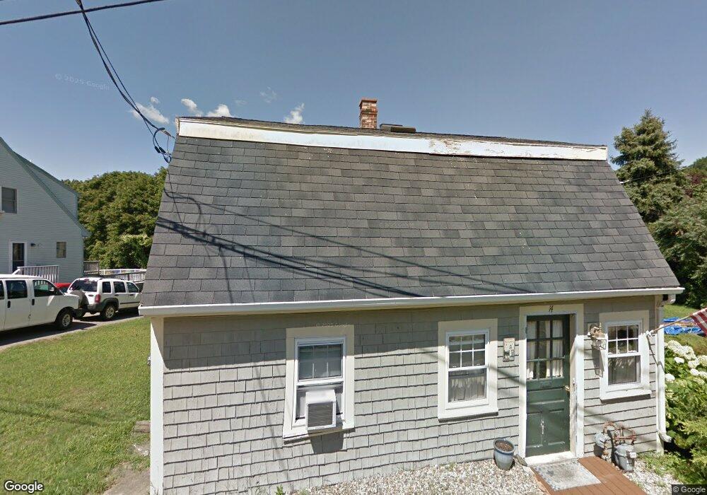
14 Gee Ave Gloucester, MA 01930
Estimated Value: $628,000 - $769,000
3
Beds
2
Baths
1,638
Sq Ft
$420/Sq Ft
Est. Value
About This Home
This home is located at 14 Gee Ave, Gloucester, MA 01930 and is currently estimated at $688,141, approximately $420 per square foot. 14 Gee Ave is a home located in Essex County with nearby schools including Beeman Memorial, Ralph B O'maley Middle School, and Gloucester High School.
Ownership History
Date
Name
Owned For
Owner Type
Purchase Details
Closed on
Jul 30, 1992
Sold by
Russell Eric G and Russell Dianne R
Bought by
Thibodeau Charles and Thibodeau Stavey
Current Estimated Value
Purchase Details
Closed on
Oct 2, 1990
Sold by
Aiello Joseph L
Bought by
Russell Eric G
Create a Home Valuation Report for This Property
The Home Valuation Report is an in-depth analysis detailing your home's value as well as a comparison with similar homes in the area
Purchase History
| Date | Buyer | Sale Price | Title Company |
|---|---|---|---|
| Thibodeau Charles | $110,000 | -- | |
| Russell Eric G | $115,000 | -- |
Source: Public Records
Mortgage History
| Date | Status | Borrower | Loan Amount |
|---|---|---|---|
| Open | Russell Eric G | $111,000 | |
| Closed | Russell Eric G | $145,000 | |
| Closed | Russell Eric G | $142,000 |
Source: Public Records
Tax History
| Year | Tax Paid | Tax Assessment Tax Assessment Total Assessment is a certain percentage of the fair market value that is determined by local assessors to be the total taxable value of land and additions on the property. | Land | Improvement |
|---|---|---|---|---|
| 2025 | $5,801 | $596,800 | $185,800 | $411,000 |
| 2024 | $5,720 | $587,900 | $176,900 | $411,000 |
| 2023 | $5,472 | $516,700 | $158,000 | $358,700 |
| 2022 | $5,294 | $451,300 | $137,400 | $313,900 |
| 2021 | $5,107 | $410,500 | $124,900 | $285,600 |
| 2020 | $5,047 | $409,300 | $124,900 | $284,400 |
| 2019 | $4,807 | $378,800 | $124,900 | $253,900 |
| 2018 | $4,621 | $357,400 | $124,900 | $232,500 |
| 2017 | $4,477 | $339,400 | $119,000 | $220,400 |
| 2016 | $4,372 | $321,200 | $124,100 | $197,100 |
| 2015 | $4,177 | $306,000 | $124,100 | $181,900 |
Source: Public Records
Map
Nearby Homes
- 27 Gee Ave
- 498 Washington St
- 457 Washington St Unit 2
- 31 Echo Ave
- 672 Washington St
- 35 Reservoir Rd
- 6-8 Joppa Way
- 3 Rockland St
- 3 Acacia St
- 167 Atlantic St
- 178 Atlantic St
- 226 Atlantic St
- 220 Atlantic St
- 6 Arthur St
- 136 Leonard St
- 7 Dodge St Unit 2
- 105 Centennial Ave
- 113 Pleasant St
- 33 Maplewood Ave Unit 310
- 4 Alpine Ct
Your Personal Tour Guide
Ask me questions while you tour the home.