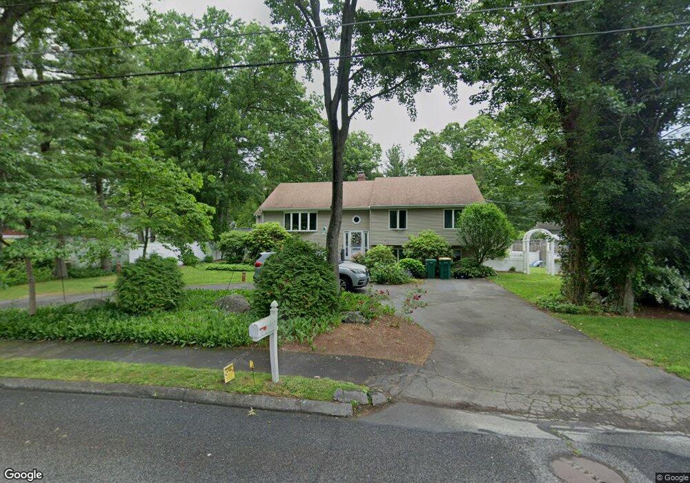
14 Hemlock Ln Mansfield, MA 02048
Estimated Value: $771,692 - $928,000
4
Beds
2
Baths
2,700
Sq Ft
$309/Sq Ft
Est. Value
About This Home
This home is located at 14 Hemlock Ln, Mansfield, MA 02048 and is currently estimated at $833,173, approximately $308 per square foot. 14 Hemlock Ln is a home located in Bristol County with nearby schools including Everett W. Robinson Elementary School, Jordan/Jackson Elementary School, and Harold L. Qualters Middle School.
Ownership History
Date
Name
Owned For
Owner Type
Purchase Details
Closed on
Dec 5, 2018
Sold by
Flynn Joseph E and Flynn Nancy S
Bought by
Flynn Joseph E
Current Estimated Value
Purchase Details
Closed on
Sep 30, 1992
Sold by
Tarinella Charles C and Tarinella Rose C
Bought by
Flynn Joseph E and Flynn Nancy S
Home Financials for this Owner
Home Financials are based on the most recent Mortgage that was taken out on this home.
Original Mortgage
$137,020
Interest Rate
7.83%
Mortgage Type
Purchase Money Mortgage
Create a Home Valuation Report for This Property
The Home Valuation Report is an in-depth analysis detailing your home's value as well as a comparison with similar homes in the area
Home Values in the Area
Average Home Value in this Area
Purchase History
| Date | Buyer | Sale Price | Title Company |
|---|---|---|---|
| Flynn Joseph E | -- | -- | |
| Flynn Joseph E | $161,200 | -- |
Source: Public Records
Mortgage History
| Date | Status | Borrower | Loan Amount |
|---|---|---|---|
| Previous Owner | Flynn Joseph E | $137,020 |
Source: Public Records
Tax History Compared to Growth
Tax History
| Year | Tax Paid | Tax Assessment Tax Assessment Total Assessment is a certain percentage of the fair market value that is determined by local assessors to be the total taxable value of land and additions on the property. | Land | Improvement |
|---|---|---|---|---|
| 2025 | $9,227 | $700,600 | $264,600 | $436,000 |
| 2024 | $8,871 | $657,100 | $276,100 | $381,000 |
| 2023 | $8,572 | $608,400 | $276,100 | $332,300 |
| 2022 | $8,272 | $545,300 | $255,600 | $289,700 |
| 2021 | $7,669 | $499,300 | $213,000 | $286,300 |
| 2020 | $7,784 | $506,800 | $213,000 | $293,800 |
| 2019 | $7,173 | $471,300 | $177,500 | $293,800 |
| 2018 | $6,860 | $440,600 | $169,200 | $271,400 |
| 2017 | $6,618 | $440,600 | $164,200 | $276,400 |
| 2016 | $6,554 | $425,300 | $156,400 | $268,900 |
| 2015 | $6,012 | $387,900 | $156,400 | $231,500 |
Source: Public Records
Map
Nearby Homes
- 414 Branch St
- 460 Ware St
- 442 Ware St
- 18 Columbine Rd
- 15 Reservoir St Unit 44
- 15 Rock Ln
- Lot 3 Birch Ln
- 28 Court St
- 21 Juniper Rd
- 150 Rumford Ave Unit 110
- 22 Pleasant St Unit C
- 12 Sylvan Rd
- 212 Mill St
- 82 Brook St
- 0 Brook Pkwy
- 15 Patten Rd
- 631 East St Unit E203
- 166 Chauncy St
- 157 Mansfield Ave Unit 14
- 0 Kensington Rd