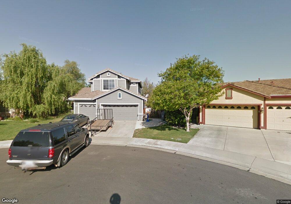
14 Hildebrand Ct Woodland, CA 95776
Estimated Value: $619,000 - $722,000
3
Beds
3
Baths
2,544
Sq Ft
$267/Sq Ft
Est. Value
About This Home
This home is located at 14 Hildebrand Ct, Woodland, CA 95776 and is currently estimated at $680,111, approximately $267 per square foot. 14 Hildebrand Ct is a home located in Yolo County with nearby schools including Ramon S. Tafoya Elementary School, Douglass Middle School, and Pioneer High School.
Ownership History
Date
Name
Owned For
Owner Type
Purchase Details
Closed on
Sep 23, 2014
Sold by
Curtis Darrin M and Curtis Marilyn D
Bought by
Garvey Mark
Current Estimated Value
Home Financials for this Owner
Home Financials are based on the most recent Mortgage that was taken out on this home.
Original Mortgage
$368,000
Outstanding Balance
$281,207
Interest Rate
4.09%
Mortgage Type
New Conventional
Estimated Equity
$398,904
Purchase Details
Closed on
Apr 16, 2003
Sold by
Va
Bought by
Curtis Darrin M and Curtis Marilyn D
Home Financials for this Owner
Home Financials are based on the most recent Mortgage that was taken out on this home.
Original Mortgage
$263,000
Interest Rate
5.71%
Purchase Details
Closed on
Nov 1, 1999
Sold by
Morrison Homes Div Geo Wimpey
Bought by
Va
Create a Home Valuation Report for This Property
The Home Valuation Report is an in-depth analysis detailing your home's value as well as a comparison with similar homes in the area
Home Values in the Area
Average Home Value in this Area
Purchase History
| Date | Buyer | Sale Price | Title Company |
|---|---|---|---|
| Garvey Mark | $423,000 | Old Republic Title Company | |
| Curtis Darrin M | -- | First American Title | |
| Va | $112,750 | First American Title Ins Co |
Source: Public Records
Mortgage History
| Date | Status | Borrower | Loan Amount |
|---|---|---|---|
| Open | Garvey Mark | $368,000 | |
| Previous Owner | Curtis Darrin M | $263,000 |
Source: Public Records
Tax History Compared to Growth
Tax History
| Year | Tax Paid | Tax Assessment Tax Assessment Total Assessment is a certain percentage of the fair market value that is determined by local assessors to be the total taxable value of land and additions on the property. | Land | Improvement |
|---|---|---|---|---|
| 2025 | $5,887 | $508,371 | $114,168 | $394,203 |
| 2023 | $5,887 | $488,633 | $109,736 | $378,897 |
| 2022 | $6,084 | $479,053 | $107,585 | $371,468 |
| 2021 | $6,004 | $469,661 | $105,476 | $364,185 |
| 2020 | $5,932 | $464,846 | $104,395 | $360,451 |
| 2019 | $5,829 | $455,733 | $102,349 | $353,384 |
| 2018 | $5,773 | $446,798 | $100,343 | $346,455 |
| 2017 | $5,661 | $438,038 | $98,376 | $339,662 |
| 2016 | $5,570 | $429,450 | $96,448 | $333,002 |
| 2015 | $5,500 | $423,000 | $95,000 | $328,000 |
| 2014 | $4,286 | $308,895 | $81,492 | $227,403 |
Source: Public Records
Map
Nearby Homes
- 1840 E Gum Ave
- 737 Farnham Ave
- 976 Huston Cir
- 1808 Farnham Ave
- 1967 Hawkins Ct
- 1095 Powers Cir
- 1060 Powers Cir
- 1729 Lee Dr
- Residence 1943 Plan at Ruby Cottages
- Residence 2117 Plan at Ruby Cottages
- Residence 1709 Plan at Ruby Cottages
- 2001 Baker Place
- 2120 Freeway Dr
- 2021 Santos St
- 1414 St Louis Way
- 1607 Motta St
- 1446 Peterson Dr
- 2712 Farmers Central Rd
- 1429 Patriot Way
- 2205 Armus St
- 10 Hildebrand Ct
- 18 Hildebrand Ct
- 10 Reiff Place
- 1848 Olvera Dr
- 1844 Olvera Dr
- 16 Olvera Ct
- 1852 Olvera Dr
- 6 Hildebrand Ct
- 22 Hildebrand Ct
- 1840 Olvera Dr
- 1856 Olvera Dr
- 14 Reiff Place
- 26 Hildebrand Ct
- 6 Reiff Place
- 932 Cranston Dr
- 928 Cranston Dr
- 924 Cranston Dr
- 940 Cranston Dr
- 1860 Olvera Dr
- 12 Olvera Ct