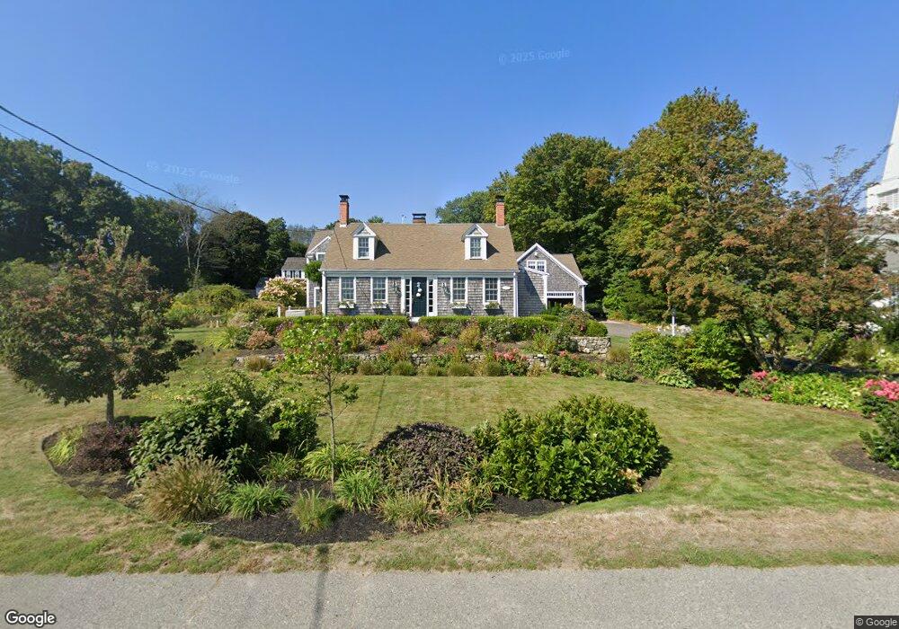
14 Kent St Scituate, MA 02066
Estimated Value: $1,348,000 - $1,730,000
4
Beds
3
Baths
2,984
Sq Ft
$499/Sq Ft
Est. Value
About This Home
This home is located at 14 Kent St, Scituate, MA 02066 and is currently estimated at $1,489,223, approximately $499 per square foot. 14 Kent St is a home located in Plymouth County with nearby schools including Jenkins Elementary School, Lester J. Gates Middle School, and Scituate High School.
Ownership History
Date
Name
Owned For
Owner Type
Purchase Details
Closed on
Mar 15, 2021
Sold by
14 Kent Street Rt
Bought by
Blake Mary R and Blake George Christopher
Current Estimated Value
Home Financials for this Owner
Home Financials are based on the most recent Mortgage that was taken out on this home.
Original Mortgage
$280,000
Outstanding Balance
$251,000
Interest Rate
2.7%
Mortgage Type
Purchase Money Mortgage
Estimated Equity
$1,238,223
Purchase Details
Closed on
May 6, 2019
Sold by
Kathleen S Blake T
Bought by
14 Kent Street Rt
Purchase Details
Closed on
Dec 16, 2010
Sold by
Blake Kathleen S and Blake Richard H
Bought by
Kathleen S Blake T
Create a Home Valuation Report for This Property
The Home Valuation Report is an in-depth analysis detailing your home's value as well as a comparison with similar homes in the area
Home Values in the Area
Average Home Value in this Area
Purchase History
| Date | Buyer | Sale Price | Title Company |
|---|---|---|---|
| Blake Mary R | $400,000 | None Available | |
| 14 Kent Street Rt | -- | -- | |
| Kathleen S Blake T | -- | -- |
Source: Public Records
Mortgage History
| Date | Status | Borrower | Loan Amount |
|---|---|---|---|
| Open | Blake Mary R | $280,000 |
Source: Public Records
Tax History Compared to Growth
Tax History
| Year | Tax Paid | Tax Assessment Tax Assessment Total Assessment is a certain percentage of the fair market value that is determined by local assessors to be the total taxable value of land and additions on the property. | Land | Improvement |
|---|---|---|---|---|
| 2025 | $12,217 | $1,222,900 | $604,700 | $618,200 |
| 2024 | $11,976 | $1,156,000 | $549,700 | $606,300 |
| 2023 | $11,125 | $1,026,200 | $464,100 | $562,100 |
| 2022 | $11,125 | $881,500 | $404,100 | $477,400 |
| 2021 | $10,764 | $807,500 | $384,800 | $422,700 |
| 2020 | $10,433 | $772,800 | $370,000 | $402,800 |
| 2019 | $10,273 | $747,700 | $362,700 | $385,000 |
| 2018 | $9,942 | $712,700 | $358,200 | $354,500 |
| 2017 | $9,683 | $687,200 | $346,600 | $340,600 |
| 2016 | $9,228 | $652,600 | $312,000 | $340,600 |
| 2015 | $8,397 | $641,000 | $300,400 | $340,600 |
Source: Public Records
Map
Nearby Homes
- 12 Meeting House Ln Unit 308
- 50 First Parish Rd
- 91 Front St Unit 106
- 76 A Brook St
- 76 A Brook St Unit 1
- 67 Greenfield Ln
- 59 Greenfield Ln
- 74 Tilden Rd
- 23 Sunset Rd
- 12 Richfield Rd
- 32 Barker Rd Unit 3
- 148 Tilden Rd
- 2 Collier Rd
- 29 Ladds Way Unit 29
- 111 Elm St
- 115 Elm St
- 37 Moorland Rd
- 105 Turner Rd
- 18 James Way
- 48 Moorland Rd
- 16 Kent St
- 12 Kent St
- 12 Kent St Unit 12
- 1 First Parish Rd
- 20 Kent St
- 14 Vinal Ave
- 8 Vinal Ave
- 16 Vinal Ave
- 20 Vinal Ave
- 17 First Parish Rd
- 3 First Parish Rd
- 0 Front St Unit 202 70225460
- 0 Front St Unit 210 70225327
- 0 Front St Unit 203 70225417
- 0 Front St Unit 206 70225455
- 0 Front St Unit 204 70225340
- 0 Front St Unit 308 70225294
- 0 Front St Unit 112 70225603
- 0 Front St Unit 104 70225429
- 0 Front St Unit 201