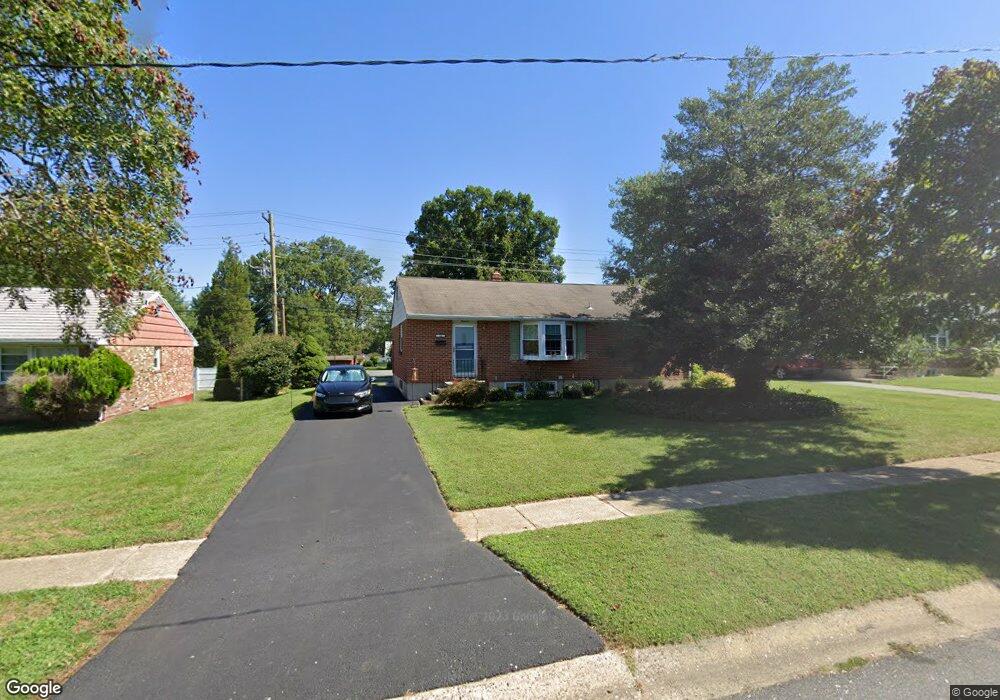
14 Mattei Ln Newark, DE 19713
Estimated Value: $285,000 - $335,000
3
Beds
2
Baths
1,344
Sq Ft
$229/Sq Ft
Est. Value
About This Home
This home is located at 14 Mattei Ln, Newark, DE 19713 and is currently estimated at $307,831, approximately $229 per square foot. 14 Mattei Ln is a home located in New Castle County with nearby schools including Brookside Elementary School, Kirk (George V.) Middle School, and Newark High School.
Ownership History
Date
Name
Owned For
Owner Type
Purchase Details
Closed on
Feb 8, 2008
Sold by
Jjw Properties Llc
Bought by
Walters Joseph J
Current Estimated Value
Purchase Details
Closed on
Nov 29, 2007
Sold by
Walters Joseph J and Walters Pamela
Bought by
Jjw Properties Llc
Purchase Details
Closed on
Aug 5, 2005
Sold by
Mulhern Neil J and Mulhern Lucy A
Bought by
Walters Joseph J and Walters Pamela J
Home Financials for this Owner
Home Financials are based on the most recent Mortgage that was taken out on this home.
Original Mortgage
$144,000
Interest Rate
5.54%
Mortgage Type
Fannie Mae Freddie Mac
Create a Home Valuation Report for This Property
The Home Valuation Report is an in-depth analysis detailing your home's value as well as a comparison with similar homes in the area
Home Values in the Area
Average Home Value in this Area
Purchase History
| Date | Buyer | Sale Price | Title Company |
|---|---|---|---|
| Walters Joseph J | -- | None Available | |
| Jjw Properties Llc | -- | None Available | |
| Walters Joseph J | $180,000 | -- |
Source: Public Records
Mortgage History
| Date | Status | Borrower | Loan Amount |
|---|---|---|---|
| Previous Owner | Walters Joseph J | $144,000 |
Source: Public Records
Tax History Compared to Growth
Tax History
| Year | Tax Paid | Tax Assessment Tax Assessment Total Assessment is a certain percentage of the fair market value that is determined by local assessors to be the total taxable value of land and additions on the property. | Land | Improvement |
|---|---|---|---|---|
| 2024 | $2,071 | $48,500 | $6,000 | $42,500 |
| 2023 | $2,013 | $48,500 | $6,000 | $42,500 |
| 2022 | $2,009 | $48,500 | $6,000 | $42,500 |
| 2021 | $1,967 | $48,500 | $6,000 | $42,500 |
| 2020 | $1,916 | $48,500 | $6,000 | $42,500 |
| 2019 | $1,768 | $48,500 | $6,000 | $42,500 |
| 2018 | $1,650 | $48,500 | $6,000 | $42,500 |
| 2017 | $1,592 | $48,500 | $6,000 | $42,500 |
| 2016 | $1,587 | $48,500 | $6,000 | $42,500 |
| 2015 | $1,447 | $48,500 | $6,000 | $42,500 |
| 2014 | $1,446 | $48,500 | $6,000 | $42,500 |
Source: Public Records
Map
Nearby Homes
- 42 Lynch Farm Dr
- 183 Brookside Blvd
- 4 Martell Rd
- 107 Anderson Rd
- 3 Matthews Rd
- 620 Ilse Dr
- 13 Erskine Ct
- 21 Merion Rd
- 40 E Shady Dr
- 1401 Chelmsford Cir Unit 1401
- 120 Hopkins Ct
- 28 W Stephen Dr
- 886 Broadfield Dr
- 1200 Chelmsford Cir
- 59 E Shady Dr
- 18 Malvina Ln
- 11 Palmer Place
- 2 Augusta Dr
- 48 Chippendale Cir
- 135 Salem Church Rd