Estimated Value: $643,000 - $771,000
2
Beds
3
Baths
2,598
Sq Ft
$278/Sq Ft
Est. Value
About This Home
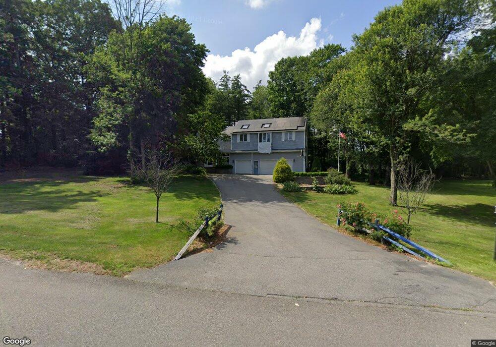
This home is located at 14 Oxbow Ln, Derry, NH 03038 and is currently estimated at $723,359, approximately $278 per square foot. 14 Oxbow Ln is a home located in Rockingham County with nearby schools including East Derry Memorial Elementary School, West Running Brook Middle School, and Pinkerton Academy.
Ownership History
Date
Name
Owned For
Owner Type
Purchase Details
Closed on
Jun 2, 2021
Sold by
Sapareto Farnk V
Bought by
Sapareto Farnk V and Sapareto Stephen
Current Estimated Value
Home Financials for this Owner
Home Financials are based on the most recent Mortgage that was taken out on this home.
Original Mortgage
$403,957
Outstanding Balance
$365,733
Interest Rate
2.9%
Mortgage Type
FHA
Estimated Equity
$357,626
Create a Home Valuation Report for This Property
The Home Valuation Report is an in-depth analysis detailing your home's value as well as a comparison with similar homes in the area
Home Values in the Area
Average Home Value in this Area
Purchase History
| Date | Buyer | Sale Price | Title Company |
|---|---|---|---|
| Sapareto Farnk V | -- | Misc Company | |
| Sapareto Farnk V | -- | None Available |
Source: Public Records
Mortgage History
| Date | Status | Borrower | Loan Amount |
|---|---|---|---|
| Open | Sapareto Farnk V | $403,957 | |
| Closed | Sapareto Farnk V | $403,957 |
Source: Public Records
Tax History Compared to Growth
Tax History
| Year | Tax Paid | Tax Assessment Tax Assessment Total Assessment is a certain percentage of the fair market value that is determined by local assessors to be the total taxable value of land and additions on the property. | Land | Improvement |
|---|---|---|---|---|
| 2024 | $12,287 | $657,400 | $200,000 | $457,400 |
| 2023 | $12,625 | $610,500 | $170,000 | $440,500 |
| 2022 | $11,624 | $610,500 | $170,000 | $440,500 |
| 2021 | $10,149 | $409,900 | $129,900 | $280,000 |
| 2020 | $9,977 | $409,900 | $129,900 | $280,000 |
| 2019 | $9,910 | $379,400 | $100,300 | $279,100 |
| 2018 | $9,871 | $379,200 | $100,300 | $278,900 |
| 2017 | $10,110 | $350,300 | $95,300 | $255,000 |
| 2016 | $9,479 | $350,300 | $95,300 | $255,000 |
| 2015 | $9,433 | $322,700 | $95,300 | $227,400 |
| 2014 | $9,494 | $322,700 | $95,300 | $227,400 |
| 2013 | $9,595 | $304,700 | $87,300 | $217,400 |
Source: Public Records
Map
Nearby Homes
- 29 Hawk Dr
- 16 Autumn Woods Rd
- 114 Chases Grove Rd
- 116 Chases Grove Rd
- 120 Chases Grove Rd
- 35 Steele Rd
- 117C Chases Grove Rd
- 21 Teague Dr
- 69 Caddy Dr
- 84 Caddy Dr
- 67 & 69 Conleys Grove Rd
- 34 Shore Dr
- 6 Weston St
- 26 King St
- 60 Shore Dr
- 10 Independence Dr
- 27 Norwood Rd
- 3 Evergreen Way
- 7 Evergreen Way
- 242 Rockingham Rd