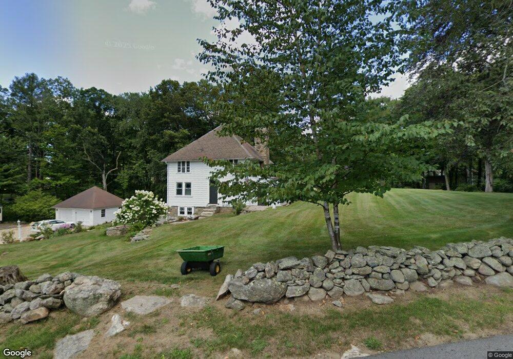
14 Partrick Ln Wilton, CT 06897
Estimated Value: $1,084,000 - $1,441,000
3
Beds
3
Baths
2,160
Sq Ft
$550/Sq Ft
Est. Value
About This Home
This home is located at 14 Partrick Ln, Wilton, CT 06897 and is currently estimated at $1,188,692, approximately $550 per square foot. 14 Partrick Ln is a home located in Fairfield County with nearby schools including Miller-Driscoll School, Cider Mill School, and Middlebrook School.
Ownership History
Date
Name
Owned For
Owner Type
Purchase Details
Closed on
Jul 26, 2007
Sold by
Walsh Timothy F and Walsh Patricia M
Bought by
Mcfarland Alan Scott
Current Estimated Value
Home Financials for this Owner
Home Financials are based on the most recent Mortgage that was taken out on this home.
Original Mortgage
$620,000
Outstanding Balance
$394,954
Interest Rate
6.78%
Estimated Equity
$793,738
Purchase Details
Closed on
Apr 30, 2001
Sold by
Mayle Donald and Mayle Betty
Bought by
Walsh Tim and Walsh Patricia
Purchase Details
Closed on
Jul 27, 1989
Sold by
Vartabedian Richard
Bought by
Buchanan William
Create a Home Valuation Report for This Property
The Home Valuation Report is an in-depth analysis detailing your home's value as well as a comparison with similar homes in the area
Home Values in the Area
Average Home Value in this Area
Purchase History
| Date | Buyer | Sale Price | Title Company |
|---|---|---|---|
| Mcfarland Alan Scott | $775,000 | -- | |
| Walsh Tim | $775,900 | -- | |
| Buchanan William | $532,500 | -- |
Source: Public Records
Mortgage History
| Date | Status | Borrower | Loan Amount |
|---|---|---|---|
| Open | Buchanan William | $620,000 | |
| Closed | Buchanan William | $116,250 | |
| Previous Owner | Buchanan William | $44,000 |
Source: Public Records
Tax History Compared to Growth
Tax History
| Year | Tax Paid | Tax Assessment Tax Assessment Total Assessment is a certain percentage of the fair market value that is determined by local assessors to be the total taxable value of land and additions on the property. | Land | Improvement |
|---|---|---|---|---|
| 2025 | $14,210 | $582,120 | $306,110 | $276,010 |
| 2024 | $13,936 | $582,120 | $306,110 | $276,010 |
| 2023 | $16,283 | $444,710 | $292,740 | $151,970 |
| 2022 | $12,554 | $444,710 | $292,740 | $151,970 |
| 2021 | $11,421 | $444,710 | $292,740 | $151,970 |
| 2020 | $12,212 | $444,710 | $292,740 | $151,970 |
| 2019 | $10,823 | $444,710 | $292,740 | $151,970 |
| 2018 | $12,410 | $440,230 | $308,000 | $132,230 |
| 2017 | $10,878 | $440,230 | $308,000 | $132,230 |
| 2016 | $12,036 | $440,230 | $308,000 | $132,230 |
| 2015 | $11,811 | $440,230 | $308,000 | $132,230 |
| 2014 | $11,670 | $440,230 | $308,000 | $132,230 |
Source: Public Records
Map
Nearby Homes
- 175 Mountain Rd
- 54 Mountain Rd
- Lot 6 Cattle Pen Ln
- 35 Branch Brook Rd
- 9 Read Place
- 00 Old Mill Rd
- 0 Mountain Rd
- 269 Thunder Lake Rd
- 0 Old Mill Rd
- 10 Mallory Hill Rd
- 134 Nod Rd
- 26 Wilridge Rd
- 66 Portland Ave
- 311 Old Branchville Rd
- 55 Tanners Dr
- 20 Georgetown Rd
- 87 Silver Hill Rd
- 23 Silver Hill Rd
- 38 Honey Hill Rd
- 274 Nod Rd
- 15 Partrick Ln
- 558 Nod Hill Rd
- 544 Nod Hill Rd
- 545 Nod Hill Rd
- 561 Nod Hill Rd
- 26 Partrick Ln
- 567 Nod Hill Rd
- 25 Partrick Ln
- 11 Partrick Ln
- 573 Nod Hill Rd
- 34 Partrick Ln
- 575 Nod Hill Rd
- 525 Nod Hill Rd
- 529 Nod Hill Rd
- 51 Partrick Ln
- 582 Nod Hill Rd
- 523 Nod Hill Rd
- 9 Partrick Ln
- 133 Indian Hill Rd
- 20 Boas Ln