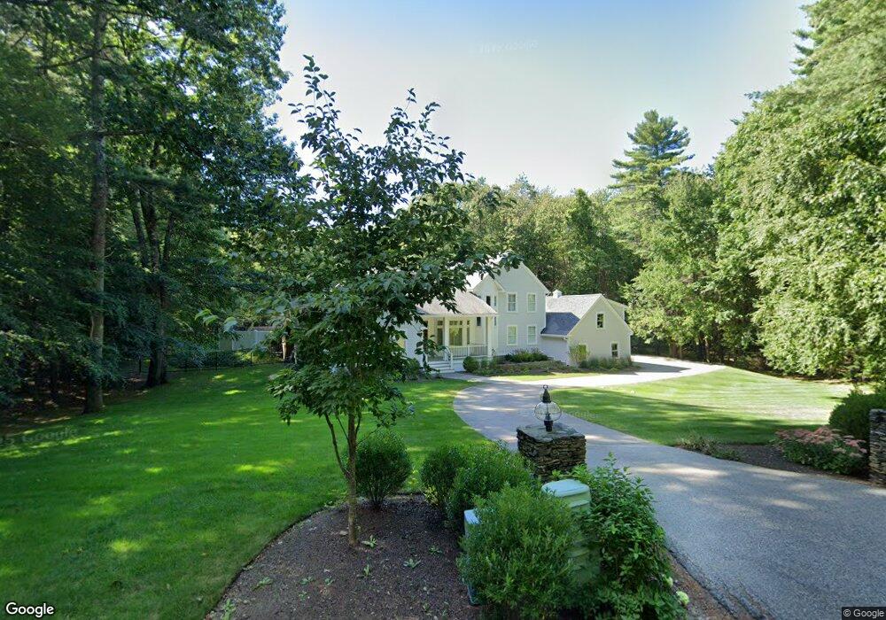
14 Shiprock Estate North Hampton, NH 03862
Estimated Value: $1,901,000 - $2,333,000
4
Beds
6
Baths
4,688
Sq Ft
$453/Sq Ft
Est. Value
About This Home
This home is located at 14 Shiprock Estate, North Hampton, NH 03862 and is currently estimated at $2,125,248, approximately $453 per square foot. 14 Shiprock Estate is a home located in Rockingham County with nearby schools including North Hampton School, Winnacunnet High School, and Sacred Heart School.
Ownership History
Date
Name
Owned For
Owner Type
Purchase Details
Closed on
Mar 25, 2004
Sold by
Purcell Gloria J
Bought by
Smith Stanley F and Smith Sandra
Current Estimated Value
Home Financials for this Owner
Home Financials are based on the most recent Mortgage that was taken out on this home.
Original Mortgage
$125,000
Outstanding Balance
$58,338
Interest Rate
5.65%
Mortgage Type
Purchase Money Mortgage
Estimated Equity
$2,066,910
Purchase Details
Closed on
Jan 9, 2001
Sold by
Est Helen M Stulgis
Bought by
Purcell Gloria J
Home Financials for this Owner
Home Financials are based on the most recent Mortgage that was taken out on this home.
Original Mortgage
$275,000
Interest Rate
7.69%
Create a Home Valuation Report for This Property
The Home Valuation Report is an in-depth analysis detailing your home's value as well as a comparison with similar homes in the area
Home Values in the Area
Average Home Value in this Area
Purchase History
| Date | Buyer | Sale Price | Title Company |
|---|---|---|---|
| Smith Stanley F | $775,000 | -- | |
| Purcell Gloria J | $754,900 | -- |
Source: Public Records
Mortgage History
| Date | Status | Borrower | Loan Amount |
|---|---|---|---|
| Open | Purcell Gloria J | $125,000 | |
| Previous Owner | Purcell Gloria J | $275,000 |
Source: Public Records
Tax History Compared to Growth
Tax History
| Year | Tax Paid | Tax Assessment Tax Assessment Total Assessment is a certain percentage of the fair market value that is determined by local assessors to be the total taxable value of land and additions on the property. | Land | Improvement |
|---|---|---|---|---|
| 2024 | $20,362 | $1,590,800 | $457,700 | $1,133,100 |
| 2023 | $19,805 | $1,590,800 | $457,700 | $1,133,100 |
| 2022 | $18,135 | $1,056,200 | $305,000 | $751,200 |
| 2021 | $17,501 | $1,056,200 | $305,000 | $751,200 |
| 2020 | $17,860 | $1,056,200 | $305,000 | $751,200 |
| 2019 | $17,639 | $1,056,200 | $305,000 | $751,200 |
| 2018 | $16,642 | $1,056,200 | $305,000 | $751,200 |
| 2017 | $18,850 | $1,018,900 | $314,400 | $704,500 |
| 2016 | $18,123 | $1,018,700 | $314,400 | $704,300 |
| 2015 | $17,807 | $1,018,700 | $314,400 | $704,300 |
| 2014 | $17,369 | $1,018,700 | $314,400 | $704,300 |
| 2013 | $17,063 | $1,018,700 | $314,400 | $704,300 |
Source: Public Records
Map
Nearby Homes
- 139 Atlantic Ave
- 19 Rockrimmon Rd
- 23 Rockrimmon Rd
- 12 Runnymede Dr
- 19 Juniper Ln
- 16 Briar Rd
- 00 Ocean Blvd
- 30 Squier Dr
- 7 Hunter Dr
- 221 Atlantic Ave
- 15 Atlantic Ave
- 223 Atlantic Ave
- 223 Mill Rd
- 61 Acorn Rd
- 24 Milbern Ave
- 951 Ocean Blvd Unit 7
- 17 Pond Path
- 1 Beach Plum Way
- 467 High St Unit 22
- 190 Kings Hwy Unit A1
- 12 Shiprock Estate
- 12 Shiprock Rd
- 13 Shiprock Estate
- 11 Shiprock Rd
- 10 Shiprock Estate
- 18 Shiprock Estate
- 108 Atlantic Ave
- 15 Shiprock Estate
- 15 Shiprock Estate
- 8 Shiprock Estate
- 22 Shiprock Estate
- 22 Shiprock Estate
- 106 Atlantic Ave
- 17 Shiprock Estate
- 102 Atlantic Ave
- 24 Shiprock Rd
- 118 Atlantic Ave
- 110 Atlantic Ave
- 24 Shiprock Estate
- 112 Atlantic Ave