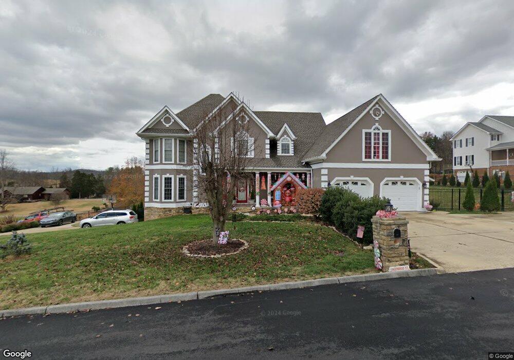
140 Barefoot Landing Dr Blountville, TN 37617
Estimated Value: $909,433 - $1,131,000
5
Beds
5
Baths
7,293
Sq Ft
$138/Sq Ft
Est. Value
About This Home
This home is located at 140 Barefoot Landing Dr, Blountville, TN 37617 and is currently estimated at $1,004,108, approximately $137 per square foot. 140 Barefoot Landing Dr is a home located in Sullivan County with nearby schools including Holston Elementary School, Sullivan Central Middle School, and Tri-Cities Christian Academy.
Ownership History
Date
Name
Owned For
Owner Type
Purchase Details
Closed on
Jun 5, 2019
Sold by
Patel Nick R and Patel Nehal N
Bought by
Packer Clarence W and Packer Charity A
Current Estimated Value
Home Financials for this Owner
Home Financials are based on the most recent Mortgage that was taken out on this home.
Original Mortgage
$482,229
Outstanding Balance
$424,848
Interest Rate
4.2%
Mortgage Type
New Conventional
Estimated Equity
$579,260
Purchase Details
Closed on
Sep 2, 2014
Sold by
Ferrell Randy R
Bought by
Patel Nick R and Patel Nehal N
Home Financials for this Owner
Home Financials are based on the most recent Mortgage that was taken out on this home.
Original Mortgage
$500,000
Interest Rate
4.2%
Mortgage Type
New Conventional
Purchase Details
Closed on
Jul 25, 2003
Sold by
Gregory Darnell
Bought by
Ferrell Randy R
Home Financials for this Owner
Home Financials are based on the most recent Mortgage that was taken out on this home.
Original Mortgage
$322,700
Interest Rate
5.24%
Create a Home Valuation Report for This Property
The Home Valuation Report is an in-depth analysis detailing your home's value as well as a comparison with similar homes in the area
Home Values in the Area
Average Home Value in this Area
Purchase History
| Date | Buyer | Sale Price | Title Company |
|---|---|---|---|
| Packer Clarence W | $568,150 | Fc Title Llc | |
| Patel Nick R | $500,000 | -- | |
| Ferrell Randy R | $419,000 | -- |
Source: Public Records
Mortgage History
| Date | Status | Borrower | Loan Amount |
|---|---|---|---|
| Open | Packer Clarence W | $482,229 | |
| Previous Owner | Patel Nick R | $500,000 | |
| Previous Owner | Ferrell Randy R | $322,700 | |
| Previous Owner | Ferrell Randy R | $96,300 |
Source: Public Records
Tax History Compared to Growth
Tax History
| Year | Tax Paid | Tax Assessment Tax Assessment Total Assessment is a certain percentage of the fair market value that is determined by local assessors to be the total taxable value of land and additions on the property. | Land | Improvement |
|---|---|---|---|---|
| 2024 | $4,030 | $161,450 | $6,700 | $154,750 |
| 2023 | $3,885 | $161,450 | $6,700 | $154,750 |
| 2022 | $3,885 | $161,450 | $6,700 | $154,750 |
| 2021 | $3,885 | $161,450 | $6,700 | $154,750 |
| 2020 | $3,737 | $161,450 | $6,700 | $154,750 |
| 2019 | $3,737 | $145,425 | $6,700 | $138,725 |
| 2018 | $3,708 | $145,425 | $6,700 | $138,725 |
| 2017 | $3,708 | $145,425 | $6,700 | $138,725 |
| 2016 | $3,660 | $142,125 | $6,700 | $135,425 |
| 2014 | -- | $142,136 | $0 | $0 |
Source: Public Records
Map
Nearby Homes
- 295 Brown Cir
- 239 Brown Cir
- Tbd Yoakley Rd
- 129 Forest Ln N
- 290 Candy Creek Private Dr
- 156 Forest Ln N
- 164 Forest Ln N
- 148 Forest Ln S
- 205 Grande Harbor Way
- 191 Grande Harbor Way
- 304 Rutledge Ln
- 112 Cardinal Point
- 205 Forest Ct
- 145 Grande Harbor Way
- 225 Forest Ln N
- Tbd Old Muddy Creek Rd
- 780 Hamilton Rd Unit 6
- 780 Hamilton Rd Unit I-4
- 999 Muddy Creek Rd
- 308 Sugar Hollow Trail
- 140 Barefoot Landings Dr
- LOT 26 Sandy Pointe St
- LOT 43 Sandy Pointe St
- Lot43 Sandy Pointe St
- 30 Sandy Pointe St
- 0 Sandy Pointe St
- 242 Sandy Pointe St
- 136 Barefoot Landing Dr
- 136 Barefoot Landings Dr
- 141 Barefoot Landing Dr
- 137 Barefoot Landings Dr
- 132 Barefoot Landing Dr
- 137 Barefoot Landing Dr
- 132 Barefoot Landings Dr
- 133 Barefoot Landing Dr
- 229 Sandy Pointe St
- 212 Sandy Pointe St
- 212 Sandy Point
- 212 Sandy Point Dr
- 233 Sandy Pointe St