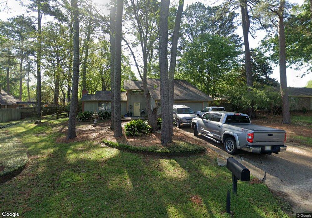
140 Stonegate Dr Madison, MS 39110
Estimated Value: $233,000 - $320,670
3
Beds
2
Baths
1,845
Sq Ft
$144/Sq Ft
Est. Value
About This Home
This home is located at 140 Stonegate Dr, Madison, MS 39110 and is currently estimated at $265,418, approximately $143 per square foot. 140 Stonegate Dr is a home located in Madison County with nearby schools including Madison Avenue Elementary, Madison Avenue Upper Elementary School, and Madison Middle School.
Ownership History
Date
Name
Owned For
Owner Type
Purchase Details
Closed on
Jun 17, 2016
Bought by
Loyd Sara
Current Estimated Value
Home Financials for this Owner
Home Financials are based on the most recent Mortgage that was taken out on this home.
Original Mortgage
$38,000
Interest Rate
3.54%
Purchase Details
Closed on
Feb 24, 2006
Sold by
Regions Bank
Bought by
Secretary Of The Department Of Housing &
Create a Home Valuation Report for This Property
The Home Valuation Report is an in-depth analysis detailing your home's value as well as a comparison with similar homes in the area
Home Values in the Area
Average Home Value in this Area
Purchase History
| Date | Buyer | Sale Price | Title Company |
|---|---|---|---|
| Loyd Sara | -- | -- | |
| Secretary Of The Department Of Housing & | -- | None Available |
Source: Public Records
Mortgage History
| Date | Status | Borrower | Loan Amount |
|---|---|---|---|
| Open | Loyd Sara | $39,406 | |
| Closed | Loyd Sara | $38,000 | |
| Closed | Loyd Sara | -- |
Source: Public Records
Tax History
| Year | Tax Paid | Tax Assessment Tax Assessment Total Assessment is a certain percentage of the fair market value that is determined by local assessors to be the total taxable value of land and additions on the property. | Land | Improvement |
|---|---|---|---|---|
| 2025 | $1,005 | $11,203 | $0 | $0 |
| 2024 | $1,005 | $11,203 | $0 | $0 |
| 2023 | $1,005 | $11,203 | $0 | $0 |
| 2022 | $1,005 | $11,203 | $0 | $0 |
| 2021 | $966 | $10,861 | $0 | $0 |
| 2020 | $966 | $10,861 | $0 | $0 |
| 2019 | $966 | $10,861 | $0 | $0 |
| 2018 | $907 | $10,361 | $0 | $0 |
| 2017 | $891 | $10,224 | $0 | $0 |
| 2016 | $891 | $10,224 | $0 | $0 |
| 2015 | $891 | $10,224 | $0 | $0 |
| 2014 | $1,007 | $11,216 | $0 | $0 |
Source: Public Records
Map
Nearby Homes
- 105 Victoria Place
- 169 Saint Ives Dr
- 422 Summerville Dr
- 290 Geneva Blvd
- 161 Victoria Place
- 1205 Woodberry Dr
- 1241 Woodberry Dr
- 204 Belle Rose Cir
- 1141 Highway 51
- 865 Wellington Way
- 112 Woodsong Way
- 345 Avonlea Ln
- 220 Vintage Dr
- 209 Pine Place
- 245 Mackey Dr
- 000 Mississippi 463
- 212 N Ridge Dr
- 717 Wildberry Pointe
- 104 Willow Ct
- 636 Live Oak Dr
- 262 Oak Bend
- 262 Oakbend Dr
- 206 Timberline Dr
- 136 Stonegate Dr
- 268 Oak Bend
- 268 Oakbend Dr
- 210 Timberline Dr
- 153 Stonegate Dr
- 157 Stonegate Dr
- 214 Timberline Dr
- 148 Stonegate Dr
- 254 Oakbend Dr
- 233 Oak Bend
- 145 Stonegate Dr
- 233 Oakbend Dr
- 161 Stonegate Dr
- 205 Timberline Dr
- 201 Timberline Dr
- 209 Timberline Dr
- 218 Timberline Dr
Your Personal Tour Guide
Ask me questions while you tour the home.