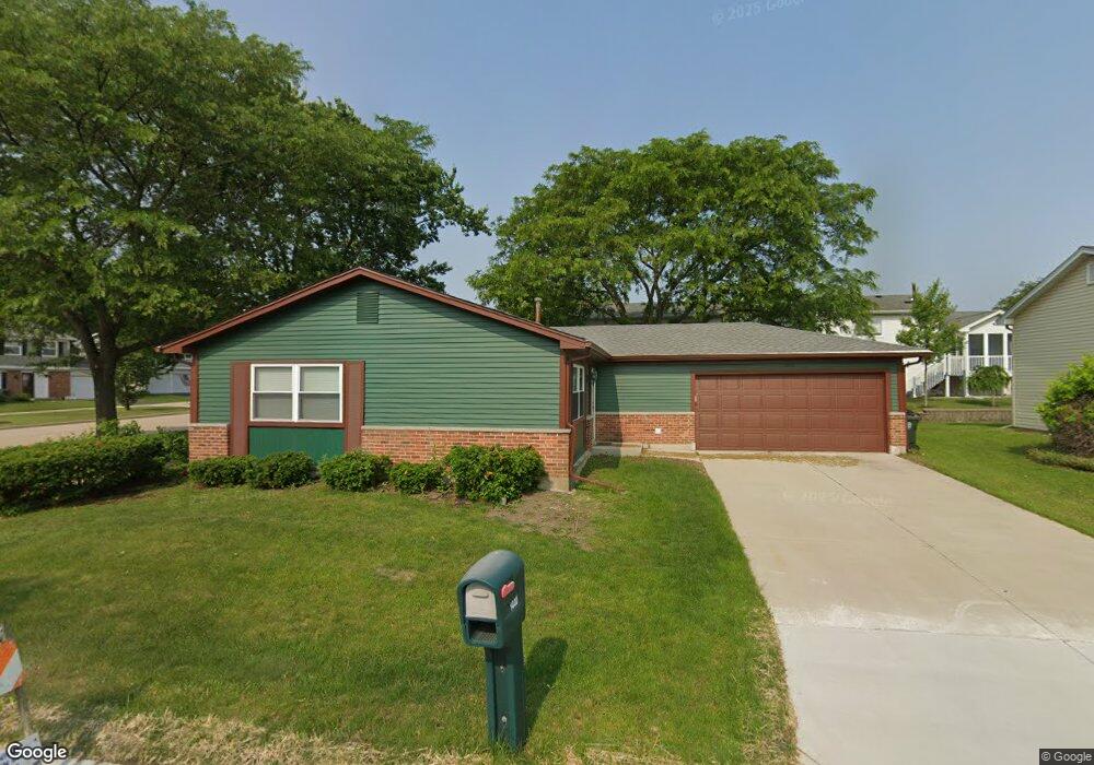
1400 Westbury Dr Unit 2 Hoffman Estates, IL 60192
South Ridge NeighborhoodEstimated Value: $340,000 - $388,926
2
Beds
2
Baths
1,300
Sq Ft
$279/Sq Ft
Est. Value
About This Home
This home is located at 1400 Westbury Dr Unit 2, Hoffman Estates, IL 60192 and is currently estimated at $362,732, approximately $279 per square foot. 1400 Westbury Dr Unit 2 is a home located in Cook County with nearby schools including Frank C. Whiteley Elementary School, Plum Grove Jr High School, and William Fremd High School.
Ownership History
Date
Name
Owned For
Owner Type
Purchase Details
Closed on
Oct 7, 2011
Sold by
Right Residential Llc
Bought by
Arneberg Jim
Current Estimated Value
Home Financials for this Owner
Home Financials are based on the most recent Mortgage that was taken out on this home.
Original Mortgage
$152,950
Outstanding Balance
$14,450
Interest Rate
4.09%
Mortgage Type
New Conventional
Estimated Equity
$348,282
Purchase Details
Closed on
Jun 10, 2011
Sold by
Platts Kimberly A
Bought by
Right Residential Llc
Purchase Details
Closed on
Mar 17, 1999
Sold by
Platts Hoyt V
Bought by
Platts Kimberly A
Create a Home Valuation Report for This Property
The Home Valuation Report is an in-depth analysis detailing your home's value as well as a comparison with similar homes in the area
Home Values in the Area
Average Home Value in this Area
Purchase History
| Date | Buyer | Sale Price | Title Company |
|---|---|---|---|
| Arneberg Jim | $161,000 | Cti | |
| Right Residential Llc | $97,500 | None Available | |
| Platts Kimberly A | -- | -- | |
| Platts Hoyt V | -- | -- |
Source: Public Records
Mortgage History
| Date | Status | Borrower | Loan Amount |
|---|---|---|---|
| Open | Arneberg Jim | $152,950 |
Source: Public Records
Tax History Compared to Growth
Tax History
| Year | Tax Paid | Tax Assessment Tax Assessment Total Assessment is a certain percentage of the fair market value that is determined by local assessors to be the total taxable value of land and additions on the property. | Land | Improvement |
|---|---|---|---|---|
| 2024 | $7,838 | $23,902 | $4,775 | $19,127 |
| 2023 | $8,297 | $28,000 | $4,775 | $23,225 |
| 2022 | $8,297 | $28,000 | $4,775 | $23,225 |
| 2021 | $6,605 | $19,724 | $3,316 | $16,408 |
| 2020 | $6,460 | $19,724 | $3,316 | $16,408 |
| 2019 | $7,842 | $26,832 | $3,316 | $23,516 |
| 2018 | $7,731 | $24,402 | $3,050 | $21,352 |
| 2017 | $7,587 | $24,402 | $3,050 | $21,352 |
| 2016 | $7,042 | $24,402 | $3,050 | $21,352 |
| 2015 | $6,559 | $21,102 | $2,785 | $18,317 |
| 2014 | $6,435 | $21,102 | $2,785 | $18,317 |
| 2013 | $6,272 | $21,102 | $2,785 | $18,317 |
Source: Public Records
Map
Nearby Homes
- 4320 Lombardy Ln
- 1404 W Sapphire Dr
- 4658 Burnham Dr
- 4797 Amber Cir
- 1195 Old Timber Ct
- 4760 Amber Cir
- 4827 Turnberry Dr
- 1208 Old Timber Ln
- 13 Chipping Campden Dr
- 4850 Prestwick Place
- 4890 Prestwick Place
- 3925 Charlemagne Dr
- 4944 Somerton Dr
- 4090 N Parkside Dr
- 3991 Whispering Trails Dr
- 26 Forest Ln
- 330 Poteet Ave
- 3960 Colony Ct
- 39 Forest Ln
- 16 Forest Ln
- 1398 Westbury Dr
- 1410 Westbury Dr
- 1390 Westbury Dr
- 1412 Westbury Dr
- 1392 Westbury Dr
- 1396 Westbury Dr
- 1414 Westbury Dr
- 1394 Westbury Dr
- 4390 N Stone Harbor Dr
- 1420 Westbury Dr
- 4402 Trailside Ct
- 1425 Westbury Dr
- 1418 Westbury Dr
- 4412 Trailside Ct
- 4395 N Stone Harbor Dr
- 4440 Trailside Ct
- 1435 Westbury Dr
- 1416 Westbury Dr
- 4444 Trailside Ct
- 4422 Trailside Ct