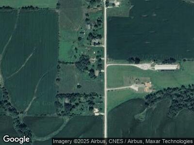
14005 Apache Way Greentop, MO 63546
Estimated Value: $296,008 - $301,000
4
Beds
2
Baths
1,380
Sq Ft
$216/Sq Ft
Est. Value
About This Home
This home is located at 14005 Apache Way, Greentop, MO 63546 and is currently estimated at $298,504, approximately $216 per square foot. 14005 Apache Way is a home with nearby schools including Adair County R-II School.
Ownership History
Date
Name
Owned For
Owner Type
Purchase Details
Closed on
Feb 23, 2021
Sold by
Blodgett Courtney Nicole
Bought by
Meredith Coty J
Current Estimated Value
Home Financials for this Owner
Home Financials are based on the most recent Mortgage that was taken out on this home.
Original Mortgage
$145,706
Outstanding Balance
$133,252
Interest Rate
3%
Mortgage Type
FHA
Purchase Details
Closed on
Apr 29, 2019
Sold by
Est Jeffries Randy C
Bought by
Meredith Coty J and Meredith Courtney N
Home Financials for this Owner
Home Financials are based on the most recent Mortgage that was taken out on this home.
Original Mortgage
$96,000
Interest Rate
4.3%
Mortgage Type
New Conventional
Create a Home Valuation Report for This Property
The Home Valuation Report is an in-depth analysis detailing your home's value as well as a comparison with similar homes in the area
Home Values in the Area
Average Home Value in this Area
Purchase History
| Date | Buyer | Sale Price | Title Company |
|---|---|---|---|
| Meredith Coty J | -- | None Available | |
| Meredith Coty J | -- | None Available |
Source: Public Records
Mortgage History
| Date | Status | Borrower | Loan Amount |
|---|---|---|---|
| Open | Meredith Coty J | $145,706 | |
| Previous Owner | Meredith Coty J | $96,000 |
Source: Public Records
Tax History Compared to Growth
Tax History
| Year | Tax Paid | Tax Assessment Tax Assessment Total Assessment is a certain percentage of the fair market value that is determined by local assessors to be the total taxable value of land and additions on the property. | Land | Improvement |
|---|---|---|---|---|
| 2024 | $1,553 | $30,420 | $4,280 | $26,140 |
| 2023 | $1,543 | $30,420 | $4,280 | $26,140 |
| 2022 | $1,544 | $30,420 | $4,280 | $26,140 |
| 2021 | $1,543 | $30,420 | $4,280 | $26,140 |
| 2020 | $1,136 | $28,210 | $1,690 | $26,520 |
| 2019 | $1,127 | $21,320 | $1,080 | $20,240 |
| 2018 | $1,124 | $21,320 | $1,080 | $20,240 |
| 2017 | $1,105 | $21,320 | $1,080 | $20,240 |
| 2016 | $1,105 | $21,320 | $1,080 | $20,240 |
| 2015 | -- | $21,320 | $1,080 | $20,240 |
| 2011 | -- | $0 | $0 | $0 |
Source: Public Records
Map
Nearby Homes
- 16063 Hazel Green Way
- X Hamilton Way
- 18179 Dairy Way
- 25119 Benton Way
- 14159 Hungry Hollow Rd
- 15789 U S 63
- 905 E Brewington Ave
- 27155 State Highway 11
- 26831 State Highway 11
- 1109 Greystone St
- 2715 N Lincoln St
- 2605 Woodwind Ct
- 21465 Lost Branch Way
- 302 Park Plaza
- 28065 County Road 355
- 28065 Cr 355
- 1905 Teal Dr
- 2304 N New St
