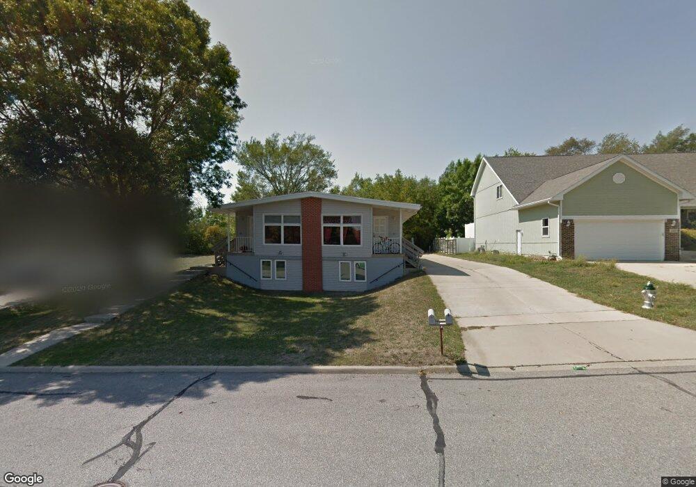
1401 Brenton Dr Unit 1403 Cedar Falls, IA 50613
Estimated Value: $231,003 - $318,000
6
Beds
4
Baths
1,776
Sq Ft
$148/Sq Ft
Est. Value
About This Home
This home is located at 1401 Brenton Dr Unit 1403, Cedar Falls, IA 50613 and is currently estimated at $263,001, approximately $148 per square foot. 1401 Brenton Dr Unit 1403 is a home located in Black Hawk County with nearby schools including Lincoln Elementary School, Holmes Junior High School, and Cedar Falls High School.
Ownership History
Date
Name
Owned For
Owner Type
Purchase Details
Closed on
Jan 14, 2015
Sold by
Padavich Properties Llc
Bought by
Larsen Rentals Llc
Current Estimated Value
Home Financials for this Owner
Home Financials are based on the most recent Mortgage that was taken out on this home.
Original Mortgage
$159,200
Outstanding Balance
$121,630
Interest Rate
3.85%
Mortgage Type
Commercial
Estimated Equity
$141,371
Purchase Details
Closed on
Jun 20, 2008
Sold by
Co Fossil Properties Llc
Bought by
Co Padavich Properties Llc
Create a Home Valuation Report for This Property
The Home Valuation Report is an in-depth analysis detailing your home's value as well as a comparison with similar homes in the area
Home Values in the Area
Average Home Value in this Area
Purchase History
| Date | Buyer | Sale Price | Title Company |
|---|---|---|---|
| Larsen Rentals Llc | $199,000 | None Available | |
| Co Padavich Properties Llc | -- | None Available |
Source: Public Records
Mortgage History
| Date | Status | Borrower | Loan Amount |
|---|---|---|---|
| Open | Larsen Rentals Llc | $159,200 |
Source: Public Records
Tax History Compared to Growth
Tax History
| Year | Tax Paid | Tax Assessment Tax Assessment Total Assessment is a certain percentage of the fair market value that is determined by local assessors to be the total taxable value of land and additions on the property. | Land | Improvement |
|---|---|---|---|---|
| 2025 | $3,728 | $260,160 | $36,600 | $223,560 |
| 2024 | $3,728 | $231,690 | $36,600 | $195,090 |
| 2023 | $3,966 | $231,690 | $36,600 | $195,090 |
| 2022 | $4,014 | $214,790 | $36,600 | $178,190 |
| 2021 | $3,810 | $214,790 | $36,600 | $178,190 |
| 2020 | $3,734 | $204,630 | $26,440 | $178,190 |
| 2019 | $3,734 | $204,630 | $26,440 | $178,190 |
| 2018 | $3,452 | $186,810 | $26,440 | $160,370 |
| 2017 | $3,526 | $186,810 | $26,440 | $160,370 |
| 2016 | $3,302 | $186,810 | $26,440 | $160,370 |
| 2015 | $3,302 | $186,810 | $26,440 | $160,370 |
| 2014 | $3,202 | $179,170 | $26,440 | $152,730 |
Source: Public Records
Map
Nearby Homes
- 1916 Shelden Ave
- 1104 Warwick Dr
- 2126 Coventry Ln
- 2126 Oxford Ln
- 1223 W 19th St
- 1221 Catherine St
- 1125 W 12th St
- 2201 W 8th St
- 1618 Quail Ridge Rd
- 927 W 14th St
- 1212 W 7th St
- 1710 College St
- 423 Chateau Ct
- 1014 W 8th St
- 1025 W 8th St
- 3726 Broomfield Dr
- 538 Fireside Dr
- 915 W 9th St
- 803 College St
- 816 College St
- 1335 Brenton Dr
- 1407 Brenton Dr Unit 1409
- 1333 Brenton Dr Unit 1335
- 1329 Brenton Dr Unit 1331
- 1334 Brenton Dr
- 1415 Brenton Dr
- 1406 Brenton Dr Unit 1408
- 1812 Linden Ave
- 1321 Brenton Dr
- 1324 Brenton Dr Unit 1326
- 1424 Brenton Dr
- 1905 Sheldon Ave Unit 1907
- 1806 Linden Ave
- 1813 Sheldon Ave
- 1316 Brenton Dr Unit 1318
- 1912 Shelden Ave
- 1807 Sheldon Ave
- 1902 Sheldon Ave Unit 1904
- 1333 Delta Dr Unit 1335
- 1325 Delta Dr