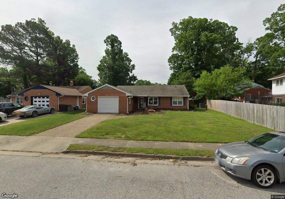
1402 Adams Cir Hampton, VA 23663
Buckroe Beach NeighborhoodEstimated Value: $267,000 - $329,000
3
Beds
2
Baths
1,400
Sq Ft
$210/Sq Ft
Est. Value
About This Home
This home is located at 1402 Adams Cir, Hampton, VA 23663 and is currently estimated at $293,546, approximately $209 per square foot. 1402 Adams Cir is a home located in Hampton City with nearby schools including Capt. John Smith Elementary School, Benjamin Syms Middle School, and Phoebus High School.
Ownership History
Date
Name
Owned For
Owner Type
Purchase Details
Closed on
Sep 25, 2015
Sold by
Fortune Joel R
Bought by
Clark Amecia D
Current Estimated Value
Home Financials for this Owner
Home Financials are based on the most recent Mortgage that was taken out on this home.
Original Mortgage
$153,805
Outstanding Balance
$121,381
Interest Rate
3.97%
Mortgage Type
New Conventional
Estimated Equity
$172,165
Purchase Details
Closed on
Jun 9, 2015
Sold by
Edwards Exr Linda P and The Estate Of Aurelia D Parker
Bought by
Fortune Joel R
Create a Home Valuation Report for This Property
The Home Valuation Report is an in-depth analysis detailing your home's value as well as a comparison with similar homes in the area
Home Values in the Area
Average Home Value in this Area
Purchase History
| Date | Buyer | Sale Price | Title Company |
|---|---|---|---|
| Clark Amecia D | $161,900 | None Available | |
| Fortune Joel R | $80,000 | -- |
Source: Public Records
Mortgage History
| Date | Status | Borrower | Loan Amount |
|---|---|---|---|
| Open | Clark Amecia D | $153,805 |
Source: Public Records
Tax History
| Year | Tax Paid | Tax Assessment Tax Assessment Total Assessment is a certain percentage of the fair market value that is determined by local assessors to be the total taxable value of land and additions on the property. | Land | Improvement |
|---|---|---|---|---|
| 2025 | $3,266 | $283,300 | $57,000 | $226,300 |
| 2024 | $3,006 | $261,400 | $57,000 | $204,400 |
| 2023 | $2,779 | $239,600 | $50,000 | $189,600 |
| 2022 | $2,772 | $234,900 | $50,000 | $184,900 |
| 2021 | $2,312 | $176,000 | $40,000 | $136,000 |
| 2020 | $2,013 | $162,300 | $35,900 | $126,400 |
| 2019 | $2,013 | $162,300 | $35,900 | $126,400 |
| 2018 | $1,946 | $158,600 | $35,900 | $122,700 |
| 2017 | $2,061 | $0 | $0 | $0 |
| 2016 | $2,061 | $158,600 | $0 | $0 |
| 2015 | $1,785 | $0 | $0 | $0 |
| 2014 | $1,827 | $140,600 | $35,900 | $104,700 |
Source: Public Records
Map
Nearby Homes
- 304 Woodland Rd
- 54 George Ct
- 1445 Oakcrest Dr
- 1314 Saxton Dr
- 1307 Colebrook Dr
- 1841 Kensington Dr
- 1504 E Pembroke Ave
- 1530 Morgan Dr
- 1814 Somerville Dr
- 208 Woodland Rd
- 15 Gayle St
- 11 Sherazi Dr
- 1810 Beall Dr
- 124 Southerland Dr
- 55 Calhoun St
- 51 Calhoun St
- 64 Ireland St
- 816 Old Point Ave
- 168 Woodland Rd
- 1909 Long Green Ln
- 1404 Adams Cir
- 306 Woodland Rd
- 302 Woodland Rd
- 303 Jerome Cir
- 305 Jerome Cir
- 1403 Adams Cir
- 1401 Adams Cir
- 1405 Adams Cir
- 301 Jerome Cir
- 1407 Adams Cir
- 1475 Morgan Dr
- 1477 Morgan Dr
- 300 Woodland Rd
- 1479 Morgan Dr
- 1409 Adams Cir
- 312 Woodland Rd
- 1481 Morgan Dr
- 300 Jerome Cir
- 304 Jerome Cir
- 1411 Adams Cir
Your Personal Tour Guide
Ask me questions while you tour the home.