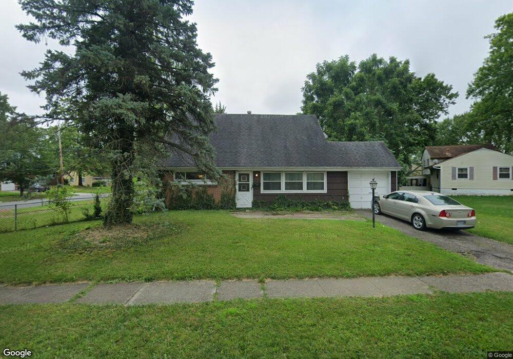
1402 Benson Dr Columbus, OH 43227
Shady Lane NeighborhoodEstimated Value: $207,000 - $232,000
4
Beds
2
Baths
1,269
Sq Ft
$170/Sq Ft
Est. Value
About This Home
This home is located at 1402 Benson Dr, Columbus, OH 43227 and is currently estimated at $216,254, approximately $170 per square foot. 1402 Benson Dr is a home located in Franklin County with nearby schools including Shady Lane Elementary School, Sherwood Middle School, and Walnut Ridge High School.
Ownership History
Date
Name
Owned For
Owner Type
Purchase Details
Closed on
Apr 11, 2005
Sold by
Diehl Lindsay and Diehl Olga
Bought by
Knese Kathleen R
Current Estimated Value
Home Financials for this Owner
Home Financials are based on the most recent Mortgage that was taken out on this home.
Original Mortgage
$68,400
Outstanding Balance
$34,596
Interest Rate
5.88%
Mortgage Type
Purchase Money Mortgage
Estimated Equity
$181,658
Purchase Details
Closed on
Sep 29, 2004
Sold by
Diehl Lindsay
Bought by
Diehl Lindsay and Diehl Olga
Home Financials for this Owner
Home Financials are based on the most recent Mortgage that was taken out on this home.
Original Mortgage
$75,650
Interest Rate
5.93%
Mortgage Type
New Conventional
Purchase Details
Closed on
Jul 30, 2004
Sold by
Estate Of Juanita Diehl
Bought by
Diehl Lindsay
Purchase Details
Closed on
Nov 26, 1986
Bought by
Diehl Juanita L
Create a Home Valuation Report for This Property
The Home Valuation Report is an in-depth analysis detailing your home's value as well as a comparison with similar homes in the area
Home Values in the Area
Average Home Value in this Area
Purchase History
| Date | Buyer | Sale Price | Title Company |
|---|---|---|---|
| Knese Kathleen R | $85,500 | Title Quest | |
| Diehl Lindsay | -- | -- | |
| Diehl Lindsay | -- | -- | |
| Diehl Juanita L | -- | -- |
Source: Public Records
Mortgage History
| Date | Status | Borrower | Loan Amount |
|---|---|---|---|
| Open | Knese Kathleen R | $68,400 | |
| Previous Owner | Diehl Lindsay | $75,650 | |
| Closed | Knese Kathleen R | $17,100 |
Source: Public Records
Tax History
| Year | Tax Paid | Tax Assessment Tax Assessment Total Assessment is a certain percentage of the fair market value that is determined by local assessors to be the total taxable value of land and additions on the property. | Land | Improvement |
|---|---|---|---|---|
| 2025 | $2,707 | $60,310 | $17,570 | $42,740 |
| 2024 | $2,707 | $60,310 | $17,570 | $42,740 |
| 2023 | $2,672 | $60,305 | $17,570 | $42,735 |
| 2022 | $1,523 | $29,370 | $8,370 | $21,000 |
| 2021 | $1,526 | $29,370 | $8,370 | $21,000 |
| 2020 | $1,528 | $29,370 | $8,370 | $21,000 |
| 2019 | $1,401 | $23,100 | $6,720 | $16,380 |
| 2018 | $1,344 | $23,100 | $6,720 | $16,380 |
| 2017 | $1,400 | $23,100 | $6,720 | $16,380 |
| 2016 | $1,422 | $21,460 | $6,550 | $14,910 |
| 2015 | $1,290 | $21,460 | $6,550 | $14,910 |
| 2014 | $1,203 | $19,960 | $6,550 | $13,410 |
| 2013 | $750 | $25,235 | $7,700 | $17,535 |
Source: Public Records
Map
Nearby Homes
- 4859 Folger Dr
- 4819 Calvin Dr
- 1310 Manfeld Dr
- 1260 Country Club Rd
- 1472 Blaine Dr
- 4677 E Livingston Ave
- 1211 Shady Lane Rd
- 1470 Efner Dr
- 1193 Marble Dr
- 4701 Janis Dr
- 4530 Amesbury Rd
- 1243 Simpson Dr
- 1639 Shady Lane Rd
- 1284 Thurston Dr
- 4649 Dundee Ave
- 4467 Grimsby Rd
- 4472 Aragon Ave
- 4991 Justin Rd
- 1281 Maetzel Dr
- 1607 Baxter Dr
- 1406 Benson Dr
- 1423 Country Club Rd
- 1414 Country Club Rd
- 1395 Benson Dr
- 1433 Country Club Rd
- 1397 Benson Dr
- 1424 Country Club Rd
- 4826 Folger Dr
- 1422 Benson Dr
- 4833 Folger Dr
- 1432 Country Club Rd
- 1401 Benson Dr
- 1441 Country Club Rd
- 1399 Benson Dr
- 1405 Benson Dr
- 1375 Country Club Rd
- 1440 Country Club Rd
- 4836 Folger Dr
- 1411 Benson Dr
- 1428 Benson Dr
Your Personal Tour Guide
Ask me questions while you tour the home.