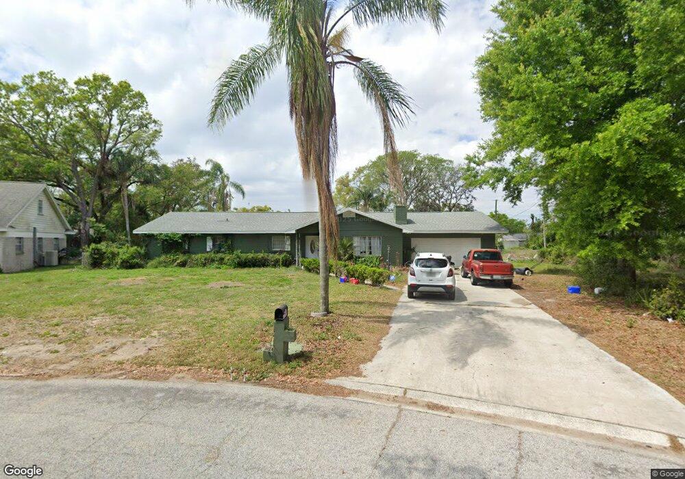
1402 Gertrude Dr Brandon, FL 33511
Estimated Value: $367,000 - $415,000
3
Beds
3
Baths
1,871
Sq Ft
$212/Sq Ft
Est. Value
About This Home
This home is located at 1402 Gertrude Dr, Brandon, FL 33511 and is currently estimated at $397,279, approximately $212 per square foot. 1402 Gertrude Dr is a home located in Hillsborough County with nearby schools including Brooker Elementary School, Burns Middle School, and Bloomingdale High School.
Ownership History
Date
Name
Owned For
Owner Type
Purchase Details
Closed on
Oct 27, 2017
Sold by
Bianchi Cathrerine and Jakubas Loretta
Bought by
Blanchl Timothy Thomas
Current Estimated Value
Home Financials for this Owner
Home Financials are based on the most recent Mortgage that was taken out on this home.
Original Mortgage
$132,000
Outstanding Balance
$109,488
Interest Rate
3.83%
Mortgage Type
New Conventional
Estimated Equity
$287,791
Purchase Details
Closed on
Oct 24, 2017
Sold by
Markley Brandy and Stacy Helen Lorin
Bought by
Markley Brandy
Home Financials for this Owner
Home Financials are based on the most recent Mortgage that was taken out on this home.
Original Mortgage
$132,000
Outstanding Balance
$109,488
Interest Rate
3.83%
Mortgage Type
New Conventional
Estimated Equity
$287,791
Create a Home Valuation Report for This Property
The Home Valuation Report is an in-depth analysis detailing your home's value as well as a comparison with similar homes in the area
Home Values in the Area
Average Home Value in this Area
Purchase History
| Date | Buyer | Sale Price | Title Company |
|---|---|---|---|
| Blanchl Timothy Thomas | $140,000 | Bay National Title Co | |
| Markley Brandy | -- | Bay National Title Co | |
| Markley Brandy | -- | Bay National Title Co |
Source: Public Records
Mortgage History
| Date | Status | Borrower | Loan Amount |
|---|---|---|---|
| Open | Blanchl Timothy Thomas | $132,000 |
Source: Public Records
Tax History
| Year | Tax Paid | Tax Assessment Tax Assessment Total Assessment is a certain percentage of the fair market value that is determined by local assessors to be the total taxable value of land and additions on the property. | Land | Improvement |
|---|---|---|---|---|
| 2025 | $3,881 | $238,855 | -- | -- |
| 2024 | $3,881 | $232,123 | -- | -- |
| 2023 | $3,749 | $225,362 | $0 | $0 |
| 2022 | $3,570 | $218,798 | $0 | $0 |
| 2021 | $3,513 | $212,425 | $0 | $0 |
| 2020 | $3,427 | $209,492 | $0 | $0 |
| 2019 | $3,319 | $204,782 | $0 | $0 |
| 2018 | $3,265 | $200,964 | $0 | $0 |
| 2017 | $3,620 | $186,577 | $0 | $0 |
| 2016 | $3,265 | $156,245 | $0 | $0 |
| 2015 | $3,062 | $145,568 | $0 | $0 |
| 2014 | $2,780 | $128,429 | $0 | $0 |
| 2013 | -- | $111,994 | $0 | $0 |
Source: Public Records
Map
Nearby Homes
- 124 Barrington Dr
- 133 Barrington Dr
- 1409 Bryan Rd
- 1111 Bryan Rd
- 1909 Lido Dr
- 1726 Loriana St
- 101 Kiana Dr
- 1038 Emerald Dr
- 1609 Oakmont Dr
- 703 E Lumsden Rd
- 1001 Edgemont Place
- 2303 Green Lawn St
- 502 Oakhurst St
- 2518 Knight Island Dr
- 832 S Parsons Ave
- 215 Lake Brook Cir Unit 204
- 2310 Medford Ln
- 209 Lake Brook Cir Unit 102
- 928 Valmar St
- 905 Stanberry Dr
Your Personal Tour Guide
Ask me questions while you tour the home.