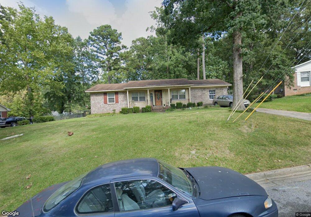
1402 Springfield Cir Augusta, GA 30909
Lake Aumond NeighborhoodEstimated Value: $190,000 - $217,000
3
Beds
2
Baths
1,300
Sq Ft
$153/Sq Ft
Est. Value
About This Home
This home is located at 1402 Springfield Cir, Augusta, GA 30909 and is currently estimated at $198,806, approximately $152 per square foot. 1402 Springfield Cir is a home located in Richmond County with nearby schools including Copeland Elementary School, Langford Middle School, and Johnson Magnet.
Ownership History
Date
Name
Owned For
Owner Type
Purchase Details
Closed on
Jun 28, 2002
Sold by
Dunn Kathleen J
Bought by
Garnett Reginald and Garnett Willie L
Current Estimated Value
Home Financials for this Owner
Home Financials are based on the most recent Mortgage that was taken out on this home.
Original Mortgage
$79,807
Outstanding Balance
$33,928
Interest Rate
6.75%
Estimated Equity
$164,878
Purchase Details
Closed on
Jul 21, 1998
Sold by
Shepherd Reaby H L Est
Bought by
Dunn Kathleen J
Home Financials for this Owner
Home Financials are based on the most recent Mortgage that was taken out on this home.
Original Mortgage
$68,450
Interest Rate
6.96%
Purchase Details
Closed on
Sep 21, 1989
Sold by
Shepherd Reaby H
Bought by
Shepherd Reaby H and Life Est
Create a Home Valuation Report for This Property
The Home Valuation Report is an in-depth analysis detailing your home's value as well as a comparison with similar homes in the area
Home Values in the Area
Average Home Value in this Area
Purchase History
| Date | Buyer | Sale Price | Title Company |
|---|---|---|---|
| Garnett Reginald | $81,100 | -- | |
| Dunn Kathleen J | $71,000 | -- | |
| Shepherd Reaby H | -- | -- |
Source: Public Records
Mortgage History
| Date | Status | Borrower | Loan Amount |
|---|---|---|---|
| Open | Garnett Reginald | $79,807 | |
| Previous Owner | Dunn Kathleen J | $68,450 |
Source: Public Records
Tax History Compared to Growth
Tax History
| Year | Tax Paid | Tax Assessment Tax Assessment Total Assessment is a certain percentage of the fair market value that is determined by local assessors to be the total taxable value of land and additions on the property. | Land | Improvement |
|---|---|---|---|---|
| 2024 | $1,976 | $72,552 | $12,000 | $60,552 |
| 2023 | $2,343 | $56,068 | $12,000 | $44,068 |
| 2022 | $1,244 | $30,310 | $12,000 | $18,310 |
| 2021 | $1,395 | $32,508 | $12,000 | $20,508 |
| 2020 | $1,402 | $33,365 | $8,200 | $25,165 |
| 2019 | $1,475 | $33,365 | $8,200 | $25,165 |
| 2018 | $1,484 | $33,365 | $8,200 | $25,165 |
| 2017 | $1,433 | $33,365 | $8,200 | $25,165 |
| 2016 | $1,434 | $33,365 | $8,200 | $25,165 |
| 2015 | $1,442 | $33,365 | $8,200 | $25,165 |
| 2014 | $1,444 | $33,365 | $8,200 | $25,165 |
Source: Public Records
Map
Nearby Homes
- 3367 Braeswood Ct
- 1404 Springfield Ct
- 3379 Wedgewood Dr
- 3347 Tanglewood Dr
- 3620 Jamaica Dr
- 1402 Marks Church Rd
- 1264 Marks Church Rd
- 3509 Nassau Dr
- 3602 Nassau Dr
- 3322 Ridgeway Ct
- 1404 Feldspar Ct
- 3736 Wrightsboro Rd
- 1439 Ridgewood Dr
- 3517 Jamaica Dr
- 3052 Brems Dr
- 1125 Brookstone Way
- 1413 Ranch Dr
- 1133 Brookstone Way
- 1415 Springview Dr
- 1426 Springview Dr
- 3374 Tanglewood Dr
- 1404 Springfield Cir
- 1400 Springfield Cir
- 3372 Tanglewood Dr
- 1406 Springfield Cir
- 3370 Tanglewood Dr
- 1403 Springfield Cir
- 1401 Springfield Cir
- 3363 Braeswood Ct
- 3371 Tanglewood Dr
- 3365 Braeswood Ct
- 3368 Tanglewood Dr
- 1405 Springfield Cir
- 1408 Springfield Cir
- 3365 Tanglewood Dr
- 3367 Tanglewood Dr
- 3380 Tanglewood Dr
- 3366 Tanglewood Dr
- 3361 Tanglewood Dr
- 1410 Springfield Cir