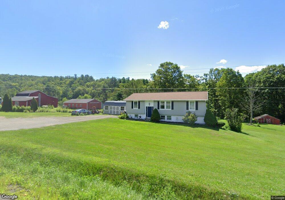
1402 State Route 7 Port Crane, NY 13833
Estimated Value: $177,000 - $214,000
3
Beds
2
Baths
1,248
Sq Ft
$151/Sq Ft
Est. Value
About This Home
This home is located at 1402 State Route 7, Port Crane, NY 13833 and is currently estimated at $188,862, approximately $151 per square foot. 1402 State Route 7 is a home located in Broome County with nearby schools including W.A. Olmsted Elementary School and Harpursville Junior/Senior High School.
Ownership History
Date
Name
Owned For
Owner Type
Purchase Details
Closed on
Aug 21, 2021
Sold by
Huizinga Henry C and Huizinga Lynda M
Bought by
Labore Frank O and Labore Jeannette
Current Estimated Value
Home Financials for this Owner
Home Financials are based on the most recent Mortgage that was taken out on this home.
Original Mortgage
$132,554
Interest Rate
3.01%
Mortgage Type
FHA
Purchase Details
Closed on
Aug 26, 2006
Sold by
Guy Shirley
Bought by
Huizinga Henry
Create a Home Valuation Report for This Property
The Home Valuation Report is an in-depth analysis detailing your home's value as well as a comparison with similar homes in the area
Home Values in the Area
Average Home Value in this Area
Purchase History
| Date | Buyer | Sale Price | Title Company |
|---|---|---|---|
| Labore Frank O | $135,000 | None Listed On Document | |
| Huizinga Henry | $125,000 | Lachman & Gorton |
Source: Public Records
Mortgage History
| Date | Status | Borrower | Loan Amount |
|---|---|---|---|
| Previous Owner | Labore Frank O | $132,554 |
Source: Public Records
Tax History Compared to Growth
Tax History
| Year | Tax Paid | Tax Assessment Tax Assessment Total Assessment is a certain percentage of the fair market value that is determined by local assessors to be the total taxable value of land and additions on the property. | Land | Improvement |
|---|---|---|---|---|
| 2024 | $3,687 | $9,900 | $1,020 | $8,880 |
| 2023 | $3,638 | $9,900 | $1,020 | $8,880 |
| 2022 | $3,502 | $9,900 | $1,020 | $8,880 |
| 2021 | $3,463 | $9,900 | $1,020 | $8,880 |
| 2020 | $3,043 | $9,900 | $1,020 | $8,880 |
| 2019 | -- | $9,900 | $1,020 | $8,880 |
| 2018 | $2,869 | $9,900 | $1,020 | $8,880 |
| 2017 | $2,798 | $9,900 | $1,020 | $8,880 |
| 2016 | $2,792 | $9,900 | $1,020 | $8,880 |
| 2015 | -- | $9,900 | $1,020 | $8,880 |
| 2014 | -- | $9,900 | $1,020 | $8,880 |
Source: Public Records
Map
Nearby Homes
- 878 Cafferty Rd
- 572 Martin Hill Rd
- 150 Cafferty Rd
- 938 State Route 7
- 58 Ridge Rd
- 714 Pleasant Hill Rd
- 219 Martin Hill Rd
- 660 North Rd
- 270 Ouaquaga Rd
- 304 Monkey Run Rd
- 4915 New York 79
- 848 Ouaquaga Rd
- 19 Holcomb Rd
- 358 Pleasant Hill Rd
- 404 Ballyhack Rd
- 504 New York 7b
- 297 Springer Rd
- 10 Pratt Rd
- 433 North Rd
- 330 Palmer Hill Rd