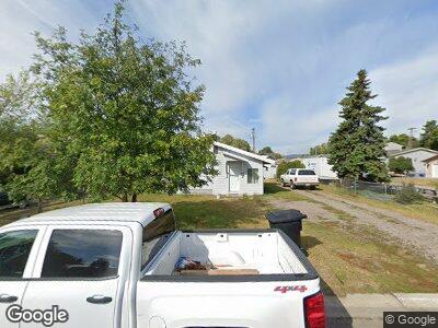
1404 6th Ave W Kalispell, MT 59901
Estimated Value: $272,000 - $338,000
1
Bed
1
Bath
672
Sq Ft
$437/Sq Ft
Est. Value
About This Home
This home is located at 1404 6th Ave W, Kalispell, MT 59901 and is currently estimated at $293,700, approximately $437 per square foot. 1404 6th Ave W is a home located in Flathead County with nearby schools including Lillian Peterson School, Kalispell Middle School, and Flathead High School.
Ownership History
Date
Name
Owned For
Owner Type
Purchase Details
Closed on
Jul 31, 2023
Sold by
Raan James R
Bought by
Mcmillan Barbara
Current Estimated Value
Purchase Details
Closed on
Jul 3, 2023
Sold by
Mcmillan Max
Bought by
Raan James R
Purchase Details
Closed on
Jun 16, 2005
Sold by
Dern Patricia A and Morgan Patricia A
Bought by
Raan James R
Home Financials for this Owner
Home Financials are based on the most recent Mortgage that was taken out on this home.
Original Mortgage
$55,500
Interest Rate
5.5%
Mortgage Type
Future Advance Clause Open End Mortgage
Create a Home Valuation Report for This Property
The Home Valuation Report is an in-depth analysis detailing your home's value as well as a comparison with similar homes in the area
Home Values in the Area
Average Home Value in this Area
Purchase History
| Date | Buyer | Sale Price | Title Company |
|---|---|---|---|
| Mcmillan Barbara | -- | None Listed On Document | |
| Raan James R | $70,000 | None Listed On Document | |
| Raan James R | -- | Citizens Title & Escrow Co I |
Source: Public Records
Mortgage History
| Date | Status | Borrower | Loan Amount |
|---|---|---|---|
| Previous Owner | Raan James R | $55,500 | |
| Previous Owner | Boe Beverly K | $89,000 |
Source: Public Records
Tax History Compared to Growth
Tax History
| Year | Tax Paid | Tax Assessment Tax Assessment Total Assessment is a certain percentage of the fair market value that is determined by local assessors to be the total taxable value of land and additions on the property. | Land | Improvement |
|---|---|---|---|---|
| 2024 | $1,691 | $217,100 | $0 | $0 |
| 2023 | $2,253 | $217,100 | $0 | $0 |
| 2022 | $1,578 | $157,000 | $0 | $0 |
| 2021 | $1,690 | $157,000 | $0 | $0 |
| 2020 | $1,955 | $129,500 | $0 | $0 |
| 2019 | $1,953 | $129,500 | $0 | $0 |
| 2018 | $1,687 | $101,100 | $0 | $0 |
| 2017 | $1,686 | $101,100 | $0 | $0 |
| 2016 | $14 | $92,700 | $0 | $0 |
| 2015 | $1,430 | $92,700 | $0 | $0 |
| 2014 | $1,405 | $55,579 | $0 | $0 |
Source: Public Records
Map
Nearby Homes
- 1401 6th Ave W
- 1302 5th Ave W
- 1202 6th Ave W
- 1543 7th Ave W
- 1129 6th Ave W
- 861 9th St W
- 945 3rd Ave W
- 804 5th Ave W
- 824 8th St W
- 1888 N Belmar Dr
- 1030 1st Ave W
- 819 3rd Ave W
- 1922 Bluestone Dr
- 1215 Sunnyside Dr
- 1735 Bluestone Dr
- 7 and 9 Stratford Dr
- 1905 Darlington Dr
- 648 7th Ave W
- 1814 Bluestone Dr
- 706 Ashley Dr
- 1404 6th Ave W
- 1310 6th Ave W
- 1314 6th Ave W
- 1314 6th Ave W
- 1412 6th Ave W
- 1405 6th Ave W
- 1318 6th Ave W
- 1403 6th Ave W
- 1322 6th Ave W
- 1425 6th Ave W
- 1306 6th Ave W
- 1399 6th Ave W
- 1433 6th Ave W
- 1422 6th Ave W
- 1305 6th Ave W
- 1304 6th Ave W
- 1313 7th Ave W
- 1405 7th Ave W
- 1311 7th Ave W
- 1311 A/B 7th Ave W
