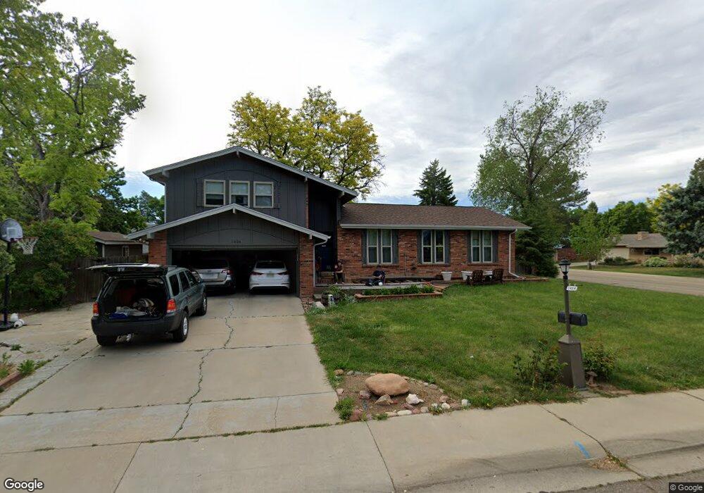
1404 Drake St Longmont, CO 80503
Longmont Estates NeighborhoodEstimated Value: $567,483 - $633,000
3
Beds
3
Baths
2,820
Sq Ft
$214/Sq Ft
Est. Value
About This Home
This home is located at 1404 Drake St, Longmont, CO 80503 and is currently estimated at $602,121, approximately $213 per square foot. 1404 Drake St is a home located in Boulder County with nearby schools including Longmont Estates Elementary School, Westview Middle School, and Silver Creek High School.
Ownership History
Date
Name
Owned For
Owner Type
Purchase Details
Closed on
May 11, 2007
Sold by
Edelen Sheila L
Bought by
Cain Matthew P and Cain Michelle W
Current Estimated Value
Home Financials for this Owner
Home Financials are based on the most recent Mortgage that was taken out on this home.
Original Mortgage
$228,800
Outstanding Balance
$138,868
Interest Rate
6.13%
Mortgage Type
Purchase Money Mortgage
Estimated Equity
$463,253
Purchase Details
Closed on
Sep 9, 2003
Sold by
Edelen Sheila L and Edelen Martin G
Bought by
Edelen Sheila L
Home Financials for this Owner
Home Financials are based on the most recent Mortgage that was taken out on this home.
Original Mortgage
$184,500
Interest Rate
4.87%
Mortgage Type
Purchase Money Mortgage
Purchase Details
Closed on
Sep 8, 2003
Sold by
Edelen Shelia L
Bought by
Edelen Sheila L
Home Financials for this Owner
Home Financials are based on the most recent Mortgage that was taken out on this home.
Original Mortgage
$184,500
Interest Rate
4.87%
Mortgage Type
Purchase Money Mortgage
Purchase Details
Closed on
Dec 9, 2002
Sold by
Land Sheila L
Bought by
Edelen Shelia L
Home Financials for this Owner
Home Financials are based on the most recent Mortgage that was taken out on this home.
Original Mortgage
$180,000
Interest Rate
6.05%
Purchase Details
Closed on
Jun 25, 1999
Sold by
Land Thomas A and Land Sheila L
Bought by
Land Sheila L
Home Financials for this Owner
Home Financials are based on the most recent Mortgage that was taken out on this home.
Original Mortgage
$163,200
Interest Rate
7.21%
Purchase Details
Closed on
Aug 26, 1994
Sold by
Conzemius Mark C and Conzemius Jean E
Bought by
Land Thomas A
Home Financials for this Owner
Home Financials are based on the most recent Mortgage that was taken out on this home.
Original Mortgage
$163,850
Interest Rate
8.52%
Purchase Details
Closed on
Jul 23, 1992
Bought by
Cain Matthew P and Cain Michelle W
Purchase Details
Closed on
Nov 26, 1973
Bought by
Cain Matthew P and Cain Michelle W
Create a Home Valuation Report for This Property
The Home Valuation Report is an in-depth analysis detailing your home's value as well as a comparison with similar homes in the area
Home Values in the Area
Average Home Value in this Area
Purchase History
We collect this data history from publicly available records. To have your information removed, we recommend requesting removal directly through your county’s website.
| Date | Buyer | Sale Price | Title Company |
|---|---|---|---|
| Cain Matthew P | $286,000 | Land Title Guarantee Company | |
| Edelen Sheila L | -- | None Available | |
| Edelen Sheila L | -- | First American Heritage Titl | |
| Edelen Shelia L | -- | Land Title | |
| Land Sheila L | -- | -- | |
| Land Thomas A | $17,250 | Stewart Title | |
| Cain Matthew P | $130,300 | -- | |
| Cain Matthew P | $37,500 | -- |
Source: Public Records
Mortgage History
We collect this data history from publicly available records. To have your information removed, we recommend requesting removal directly through your county’s website.
| Date | Status | Borrower | Loan Amount |
|---|---|---|---|
| Open | Cain Matthew P | $228,800 | |
| Previous Owner | Edelen Sheila L | $184,500 | |
| Previous Owner | Edelen Shelia L | $180,000 | |
| Previous Owner | Land Sheila L | $163,200 | |
| Previous Owner | Land Thomas A | $163,850 |
Source: Public Records
Tax History
| Year | Tax Paid | Tax Assessment Tax Assessment Total Assessment is a certain percentage of the fair market value that is determined by local assessors to be the total taxable value of land and additions on the property. | Land | Improvement |
|---|---|---|---|---|
| 2025 | $3,558 | $37,619 | $9,819 | $27,800 |
| 2024 | $3,558 | $37,619 | $9,819 | $27,800 |
| 2023 | $3,510 | $37,198 | $10,961 | $29,922 |
| 2022 | $3,081 | $31,136 | $8,444 | $22,692 |
| 2021 | $3,121 | $32,032 | $8,687 | $23,345 |
| 2020 | $2,774 | $28,557 | $7,007 | $21,550 |
| 2019 | $2,730 | $28,557 | $7,007 | $21,550 |
| 2018 | $2,367 | $24,919 | $7,056 | $17,863 |
| 2017 | $2,335 | $27,550 | $7,801 | $19,749 |
| 2016 | $2,164 | $22,638 | $9,472 | $13,166 |
| 2015 | $2,062 | $19,287 | $5,333 | $13,954 |
| 2014 | $1,801 | $19,287 | $5,333 | $13,954 |
Source: Public Records
Map
Nearby Homes
- 1600 Northwestern Rd
- 1440 Northwestern Rd
- 12 Baylor Dr
- 1617 Albion Ln
- 24 University Cir
- 46 Princeton Cir
- 28 University Dr
- 1232 Cornell Dr
- 1617 Ithaca Ct
- 1463 Harvard St
- 1224 Cornell Dr
- 3331 Lakeview Cir
- 1689 Geneva Cir
- 2803 Denver Ave
- 1437 Elmhurst Ln
- 1379 Charles Dr Unit 5
- 1379 Charles Dr Unit 4
- 1379 Charles Dr Unit A5
- 1379 Charles Dr Unit 6
- 2652 Mountain View Ave
- 44 Cornell Dr
- 46 Cornell Dr
- 42 Cornell Dr
- 1549 Northwestern Rd
- 1541 Northwestern Rd
- 1557 Northwestern Rd
- 48 Cornell Dr
- 45 Cornell Dr
- 43 Cornell Dr
- 1533 Northwestern Rd
- 1565 Northwestern Rd
- 47 Cornell Dr
- 50 Cornell Dr
- 39 Cornell Dr
- 49 Cornell Dr
- 1525 Northwestern Rd
- 1573 Northwestern Rd
- 1548 Northwestern Rd
- 34 Cornell Dr
- 26 Cornell Dr
Your Personal Tour Guide
Ask me questions while you tour the home.