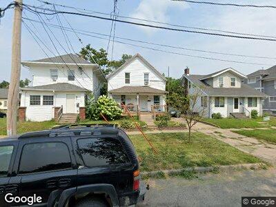
1405 1st St SW Cedar Rapids, IA 52404
Taylor NeighborhoodEstimated Value: $96,000 - $119,000
4
Beds
2
Baths
1,091
Sq Ft
$101/Sq Ft
Est. Value
About This Home
This home is located at 1405 1st St SW, Cedar Rapids, IA 52404 and is currently estimated at $110,124, approximately $100 per square foot. 1405 1st St SW is a home located in Linn County with nearby schools including Cedar River Academy at Taylor Elementary School, Wilson Middle School, and Thomas Jefferson High School.
Ownership History
Date
Name
Owned For
Owner Type
Purchase Details
Closed on
Feb 1, 2007
Sold by
Hud
Bought by
Duggan Timothy
Current Estimated Value
Home Financials for this Owner
Home Financials are based on the most recent Mortgage that was taken out on this home.
Original Mortgage
$42,750
Outstanding Balance
$32,423
Interest Rate
10.64%
Mortgage Type
Unknown
Purchase Details
Closed on
Jun 20, 2006
Sold by
Wells Fargo Bank Na
Bought by
Hud
Purchase Details
Closed on
Dec 22, 1999
Sold by
Mease Deann L and Mease John B
Bought by
Crawford Anthony M and Crawford Melissa A
Home Financials for this Owner
Home Financials are based on the most recent Mortgage that was taken out on this home.
Original Mortgage
$62,423
Interest Rate
7.7%
Mortgage Type
FHA
Create a Home Valuation Report for This Property
The Home Valuation Report is an in-depth analysis detailing your home's value as well as a comparison with similar homes in the area
Home Values in the Area
Average Home Value in this Area
Purchase History
| Date | Buyer | Sale Price | Title Company |
|---|---|---|---|
| Duggan Timothy | -- | None Available | |
| Hud | -- | None Available | |
| Crawford Anthony M | $62,000 | -- |
Source: Public Records
Mortgage History
| Date | Status | Borrower | Loan Amount |
|---|---|---|---|
| Open | Duggan Timothy | $42,750 | |
| Previous Owner | Crawford Anthony M | $62,423 |
Source: Public Records
Tax History Compared to Growth
Tax History
| Year | Tax Paid | Tax Assessment Tax Assessment Total Assessment is a certain percentage of the fair market value that is determined by local assessors to be the total taxable value of land and additions on the property. | Land | Improvement |
|---|---|---|---|---|
| 2023 | $1,382 | $87,700 | $14,000 | $73,700 |
| 2022 | $1,288 | $74,400 | $14,000 | $60,400 |
| 2021 | $1,290 | $71,100 | $12,600 | $58,500 |
| 2020 | $1,290 | $67,100 | $12,600 | $54,500 |
| 2019 | $1,144 | $61,600 | $11,200 | $50,400 |
| 2018 | $878 | $61,600 | $11,200 | $50,400 |
| 2017 | $872 | $48,600 | $11,200 | $37,400 |
| 2016 | $1,191 | $56,000 | $11,200 | $44,800 |
| 2015 | $1,329 | $62,467 | $11,200 | $51,267 |
| 2014 | $1,144 | $62,467 | $11,200 | $51,267 |
| 2013 | $1,116 | $62,467 | $11,200 | $51,267 |
Source: Public Records
Map
Nearby Homes
- 1502 1st St SW
- 1403 C St SW
- 87 14th Ave SW
- 280 14th Ave SW
- 1323 M St SW
- 944 L St SW
- 1435 N St SW
- 165 Hayes St SW
- 136 Bowling St SW
- 1402 N St SW
- 2220 D St SW
- 25-85 Aossey Ln SW
- 2224 Mallory St SW
- 329 12th Ave SE
- 905 3rd St SE Unit 508
- 905 3rd St SE Unit 302
- 905 3rd St SE Unit 111
- 263 Wilson Ave SW
- 407 7th Ave SW
- 266 24th Ave SW
- 1405 1st St SW
- 1411 1st St SW
- 159 14th Ave SW
- 1415 1st St SW
- 155 14th Ave SW
- 1325 1st St SW
- 1400 1st St SW
- 1421 1st St SW
- 1412 1st St SW
- 149 14th Ave SW
- 1321 1st St SW
- 1416 Hamilton St SW
- 1416 1st St SW
- 158 15th Ave SW
- 156 14th Ave SW
- 1406 Hamilton St SW
- 1410 Hamilton St SW
- 1414 Hamilton St SW
- 1328 1st St SW
- 1418 Hamilton St SW