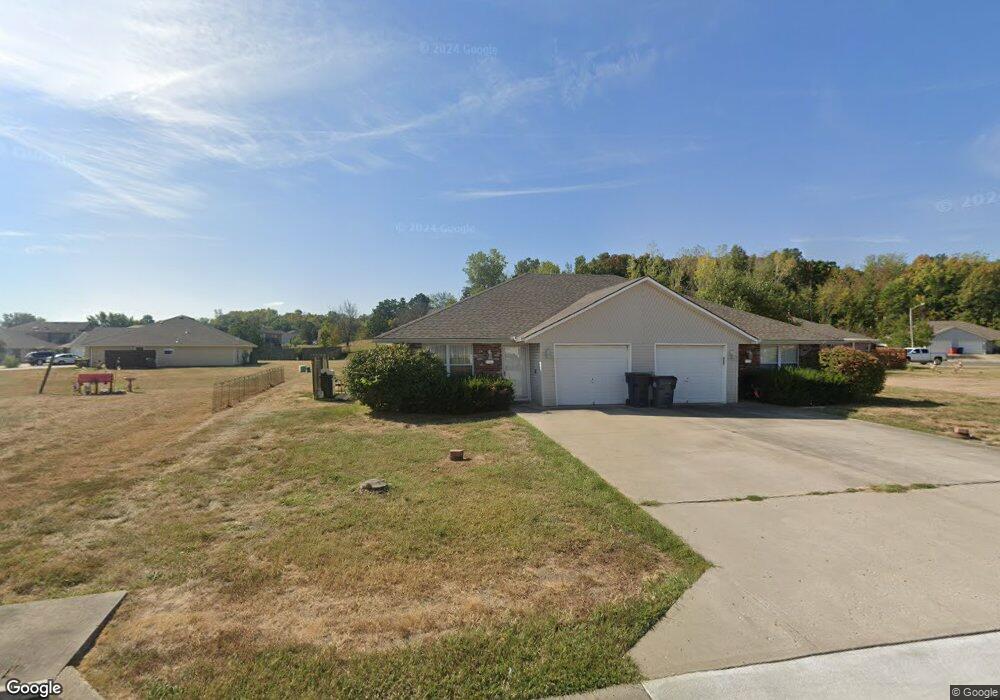
1405 SW Blue Branch Dr Grain Valley, MO 64029
Estimated Value: $277,000 - $357,000
4
Beds
2
Baths
1,936
Sq Ft
$162/Sq Ft
Est. Value
About This Home
This home is located at 1405 SW Blue Branch Dr, Grain Valley, MO 64029 and is currently estimated at $312,732, approximately $161 per square foot. 1405 SW Blue Branch Dr is a home located in Jackson County with nearby schools including Grain Valley High School.
Ownership History
Date
Name
Owned For
Owner Type
Purchase Details
Closed on
Aug 13, 2018
Sold by
Brancalo Rosalind
Bought by
Martin Andrew J
Current Estimated Value
Home Financials for this Owner
Home Financials are based on the most recent Mortgage that was taken out on this home.
Original Mortgage
$147,000
Outstanding Balance
$127,664
Interest Rate
4.5%
Mortgage Type
Credit Line Revolving
Estimated Equity
$185,068
Purchase Details
Closed on
Oct 26, 2010
Sold by
Brancato Rosalind R
Bought by
Brancato Rosalind R
Home Financials for this Owner
Home Financials are based on the most recent Mortgage that was taken out on this home.
Original Mortgage
$360,000
Interest Rate
4.38%
Mortgage Type
Future Advance Clause Open End Mortgage
Create a Home Valuation Report for This Property
The Home Valuation Report is an in-depth analysis detailing your home's value as well as a comparison with similar homes in the area
Home Values in the Area
Average Home Value in this Area
Purchase History
| Date | Buyer | Sale Price | Title Company |
|---|---|---|---|
| Martin Andrew J | -- | Stewart Title Co | |
| Brancato Rosalind R | -- | Stewart Title Company |
Source: Public Records
Mortgage History
| Date | Status | Borrower | Loan Amount |
|---|---|---|---|
| Open | Martin Andrew J | $147,000 | |
| Previous Owner | Brancato Rosalind R | $360,000 |
Source: Public Records
Tax History Compared to Growth
Tax History
| Year | Tax Paid | Tax Assessment Tax Assessment Total Assessment is a certain percentage of the fair market value that is determined by local assessors to be the total taxable value of land and additions on the property. | Land | Improvement |
|---|---|---|---|---|
| 2025 | $2,954 | $41,242 | $7,224 | $34,018 |
| 2024 | $2,843 | $35,863 | $6,365 | $29,498 |
| 2023 | $2,843 | $35,863 | $5,041 | $30,822 |
| 2022 | $3,135 | $34,580 | $4,114 | $30,466 |
| 2021 | $3,061 | $34,580 | $4,114 | $30,466 |
| 2020 | $2,720 | $30,310 | $4,114 | $26,196 |
| 2019 | $2,665 | $30,310 | $4,114 | $26,196 |
| 2018 | $2,443 | $25,958 | $3,290 | $22,668 |
| 2017 | $2,443 | $25,958 | $3,290 | $22,668 |
| 2016 | $2,380 | $25,308 | $3,990 | $21,318 |
| 2014 | $2,137 | $22,553 | $4,072 | $18,481 |
Source: Public Records
Map
Nearby Homes
- 1418 SW Blue Branch Dr
- 401 S Minter Rd
- 509 SW Joseph Ct
- 1024 Christie Ln
- 1402 NW Broadway Throughway
- 719 S Minter Rd
- 1215 SW Lone Star Ct
- 29605 SW Eagles Pkwy
- 200 Cross Creek Ln
- 1235 NW Ashley Ln
- 1214 SW Windcrest Ct
- 636 SW Lakeview Dr
- 6205 Chiles Rd
- 1219 SW Windcrest Ct
- 1309 SW Graystone Cir
- 1229 NW Ashley Dr
- 209 SW Cross Creek Dr
- 29800 E 65th St
- 207 Pebblebrook St
- 1203 SW Lakeview Dr
- 1341 SW Stoneybrooke Dr
- 313 SW Blue Branch Ct
- 1409 SW Blue Branch Dr
- 1337 SW Stoneybrooke Dr
- 1333 SW Stoneybrooke Dr
- 315 SW Blue Branch Ct
- 1404 SW Blue Branch Dr
- 1411 SW Blue Branch Dr
- 1408 SW Blue Branch Dr
- 1402 SW Blue Branch Dr
- 1410 SW Blue Branch Dr
- 1400 SW Blue Branch Dr
- 1400 SW Blue Branch Dr
- 317 SW Blue Branch Dr
- 317 SW Blue Branch Ct
- 1318 SW Blue Branch Dr
- 1329 SW Stoneybrooke Dr
- 1412 SW Blue Branch Dr
- 1313 SW Blue Branch Dr
- 1322 SW Stoneybrooke Dr