Estimated Value: $40,000 - $53,000
3
Beds
1
Bath
1,485
Sq Ft
$31/Sq Ft
Est. Value
About This Home
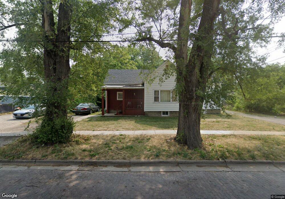
This home is located at 1406 S 19th St, Springfield, IL 62703 and is currently estimated at $46,122, approximately $31 per square foot. 1406 S 19th St is a home located in Sangamon County with nearby schools including Butler Elementary School, Benjamin Franklin Middle School, and Springfield Southeast High School.
Ownership History
Date
Name
Owned For
Owner Type
Purchase Details
Closed on
Nov 24, 2025
Sold by
Walton Glenn H
Bought by
Malaak Estates Inc
Current Estimated Value
Purchase Details
Closed on
Aug 2, 2006
Purchase Details
Closed on
Nov 30, 2005
Purchase Details
Closed on
May 8, 2002
Purchase Details
Closed on
Mar 28, 2001
Purchase Details
Closed on
Mar 29, 1999
Purchase Details
Closed on
Aug 14, 1998
Purchase Details
Closed on
Nov 26, 1997
Purchase Details
Closed on
Mar 28, 1996
Create a Home Valuation Report for This Property
The Home Valuation Report is an in-depth analysis detailing your home's value as well as a comparison with similar homes in the area
Home Values in the Area
Average Home Value in this Area
Purchase History
| Date | Buyer | Sale Price | Title Company |
|---|---|---|---|
| Malaak Estates Inc | $40,000 | None Listed On Document | |
| -- | -- | -- | |
| -- | -- | -- | |
| -- | $42,900 | -- | |
| -- | $7,000 | -- | |
| -- | -- | -- | |
| -- | -- | -- | |
| -- | -- | -- | |
| -- | $26,500 | -- | |
| -- | $13,000 | -- |
Source: Public Records
Tax History
| Year | Tax Paid | Tax Assessment Tax Assessment Total Assessment is a certain percentage of the fair market value that is determined by local assessors to be the total taxable value of land and additions on the property. | Land | Improvement |
|---|---|---|---|---|
| 2024 | $1,193 | $14,204 | $1,977 | $12,227 |
| 2023 | $1,147 | $12,974 | $1,806 | $11,168 |
| 2022 | $1,075 | $11,992 | $1,713 | $10,279 |
| 2021 | $1,039 | $11,543 | $1,649 | $9,894 |
| 2020 | $1,018 | $11,560 | $1,651 | $9,909 |
| 2019 | $999 | $11,519 | $1,645 | $9,874 |
| 2018 | $1,078 | $12,753 | $1,637 | $11,116 |
| 2017 | $1,055 | $12,588 | $1,616 | $10,972 |
| 2016 | $1,034 | $12,404 | $1,592 | $10,812 |
| 2015 | $1,024 | $12,256 | $1,573 | $10,683 |
| 2014 | $1,086 | $12,177 | $1,563 | $10,614 |
| 2013 | $1,062 | $13,109 | $1,564 | $11,545 |
Source: Public Records
Map
Nearby Homes
- 1909 E Cedar St
- 1838 S 19th St
- 2238 E Stuart St
- 1914 S 16th St
- 2051 Randall Ct
- 1529 E Edwards St
- 1848 Honeysuckle Ct
- 1622 E Cornell Ave
- 1713 E Glenn Ave
- 1546 E Cornell Ave
- 1405 E Edwards St
- 2160 S 14th St
- 1105 Knoll Pointe Place
- 2154 S 13th St
- 2128 E Capitol Ave
- 2212 S 14th St
- 2216 S 13th St
- 725 E Spruce St
- 2313 S 13th St
- 2236 E Adams St
- 1910 South Grand Ave E
- 1901 E Pine St
- 1912 S Grand Ave E
- 1912 South Grand Ave E
- 1905 E Pine St
- 1918 South Grand Ave E
- 1918 S Grand Ave E
- 1909 E Pine St
- 1913 E Pine St
- 1829 E Pine St
- 1922 South Grand Ave E
- 1924 South Grand Ave E
- 1827 E Pine St
- 1917 E Pine St
- 1901 S Grand Ave E
- 1901 South Grand Ave E
- 1901 South Grand Ave E
- 1905 South Grand Ave E
- 1921 E Pine St
- 1913 S Grand Ave E
Your Personal Tour Guide
Ask me questions while you tour the home.