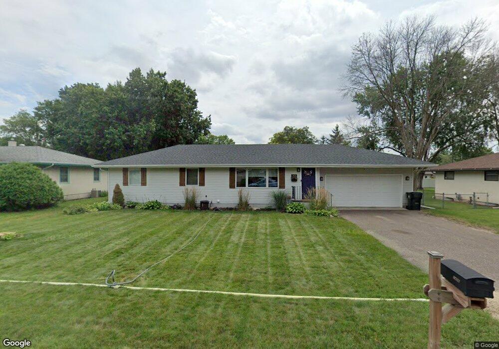
1406 Sophia Ave Saint Paul, MN 55109
Gladstone NeighborhoodEstimated Value: $337,000 - $369,000
4
Beds
2
Baths
1,504
Sq Ft
$235/Sq Ft
Est. Value
About This Home
This home is located at 1406 Sophia Ave, Saint Paul, MN 55109 and is currently estimated at $354,024, approximately $235 per square foot. 1406 Sophia Ave is a home located in Ramsey County with nearby schools including Weaver Elementary School, John Glenn Middle School, and Mounds Park Academy.
Ownership History
Date
Name
Owned For
Owner Type
Purchase Details
Closed on
Jun 5, 2018
Sold by
Semiak Sarah Kristen and Anderson Sarah K
Bought by
Semlak Patrick J
Current Estimated Value
Home Financials for this Owner
Home Financials are based on the most recent Mortgage that was taken out on this home.
Original Mortgage
$189,000
Outstanding Balance
$163,819
Interest Rate
4.6%
Estimated Equity
$190,205
Purchase Details
Closed on
Sep 15, 2010
Sold by
Schrankler Reed L and Schrankler Bridgett K
Bought by
Semlak Patrick J and Anderson Sarah K
Create a Home Valuation Report for This Property
The Home Valuation Report is an in-depth analysis detailing your home's value as well as a comparison with similar homes in the area
Home Values in the Area
Average Home Value in this Area
Purchase History
| Date | Buyer | Sale Price | Title Company |
|---|---|---|---|
| Semlak Patrick J | -- | None Available | |
| Semlak Patrick J | $190,000 | -- |
Source: Public Records
Mortgage History
| Date | Status | Borrower | Loan Amount |
|---|---|---|---|
| Open | Semlak Patrick J | $189,000 |
Source: Public Records
Tax History Compared to Growth
Tax History
| Year | Tax Paid | Tax Assessment Tax Assessment Total Assessment is a certain percentage of the fair market value that is determined by local assessors to be the total taxable value of land and additions on the property. | Land | Improvement |
|---|---|---|---|---|
| 2025 | $4,670 | $351,300 | $62,800 | $288,500 |
| 2023 | $4,670 | $333,500 | $62,800 | $270,700 |
| 2022 | $3,520 | $312,600 | $62,800 | $249,800 |
| 2021 | $3,524 | $247,300 | $62,800 | $184,500 |
| 2020 | $3,334 | $252,200 | $62,800 | $189,400 |
| 2019 | $2,954 | $225,600 | $62,800 | $162,800 |
| 2018 | $3,002 | $206,000 | $62,800 | $143,200 |
| 2017 | $3,174 | $203,700 | $62,800 | $140,900 |
| 2016 | $3,090 | $0 | $0 | $0 |
| 2015 | $2,864 | $200,700 | $57,600 | $143,100 |
| 2014 | $2,212 | $0 | $0 | $0 |
Source: Public Records
Map
Nearby Homes
- 1435 Price Ave
- 1751 Clarence St
- 1672 Manton St
- 1740 English St
- 1639 Clarence St
- 1869 Birmingham St
- 1532 Larpenteur Ave E
- 1870 Clarence St
- 1854 Barclay St
- 1730 Atlantic St
- 1562 Chamber St
- 1940 Barclay St
- 1627 Christie Place
- 1567 Atlantic St
- 1607 Hoyt Ave E
- 1637 Iowa Ave E
- 1849 Kennard St
- 1201 Frost Ave
- 1450 Arlington Ave E
- 1583 Nevada Ave E
- 1414 Sophia Ave
- 1415 Price Ave
- 1399 Price Ave
- 1421 Price Ave
- 1390 Sophia Ave
- 1401 Sophia Ave
- 1745 Birmingham St
- 1391 Price Ave
- 1752 Ide St
- 1384 Sophia Ave
- 1753 Birmingham St
- 1716 Birmingham St
- 1383 Price Ave
- 1738 Birmingham St
- 1732 Birmingham St
- 1381 Sophia Ave
- 1746 Birmingham St
- 1406 Price Ave
- 1400 Price Ave
- 1760 Ide St