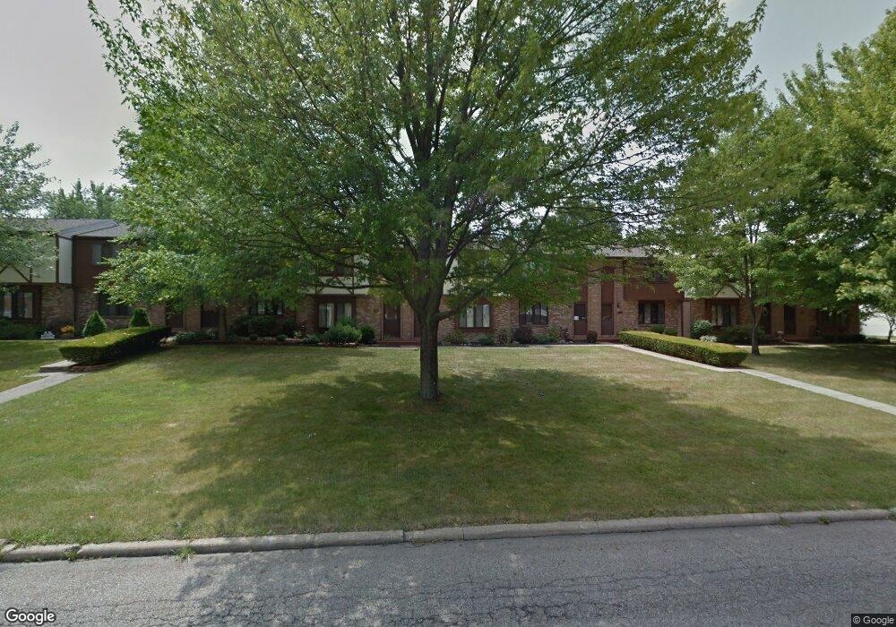
1408 Maplecrest Dr Unit 1E Youngstown, OH 44515
Austintown NeighborhoodEstimated Value: $110,000 - $157,000
2
Beds
2
Baths
1,188
Sq Ft
$103/Sq Ft
Est. Value
About This Home
This home is located at 1408 Maplecrest Dr Unit 1E, Youngstown, OH 44515 and is currently estimated at $122,742, approximately $103 per square foot. 1408 Maplecrest Dr Unit 1E is a home located in Mahoning County with nearby schools including Austintown Elementary School, Austintown Intermediate School, and Austintown Middle School.
Ownership History
Date
Name
Owned For
Owner Type
Purchase Details
Closed on
Feb 25, 2022
Bought by
William A Murrell
Current Estimated Value
Home Financials for this Owner
Home Financials are based on the most recent Mortgage that was taken out on this home.
Interest Rate
3.89%
Purchase Details
Closed on
May 22, 2007
Sold by
Rowland Michael P and Rowland Amy B
Bought by
Taylor Laura J
Home Financials for this Owner
Home Financials are based on the most recent Mortgage that was taken out on this home.
Original Mortgage
$78,870
Interest Rate
6.22%
Mortgage Type
Purchase Money Mortgage
Purchase Details
Closed on
Aug 9, 1994
Bought by
Fabek Terri A
Purchase Details
Closed on
Oct 16, 1987
Bought by
Baca Kathleen P
Create a Home Valuation Report for This Property
The Home Valuation Report is an in-depth analysis detailing your home's value as well as a comparison with similar homes in the area
Home Values in the Area
Average Home Value in this Area
Purchase History
| Date | Buyer | Sale Price | Title Company |
|---|---|---|---|
| William A Murrell | $59,000 | -- | |
| Taylor Laura J | $78,700 | Attorney | |
| Fabek Terri A | $57,500 | -- | |
| Baca Kathleen P | $42,000 | -- |
Source: Public Records
Mortgage History
| Date | Status | Borrower | Loan Amount |
|---|---|---|---|
| Closed | William A Murrell | -- | |
| Previous Owner | Taylor Laura J | $78,870 |
Source: Public Records
Tax History
| Year | Tax Paid | Tax Assessment Tax Assessment Total Assessment is a certain percentage of the fair market value that is determined by local assessors to be the total taxable value of land and additions on the property. | Land | Improvement |
|---|---|---|---|---|
| 2025 | $1,621 | $33,030 | $2,370 | $30,660 |
| 2024 | $1,549 | $33,030 | $2,370 | $30,660 |
| 2023 | $1,525 | $33,030 | $2,370 | $30,660 |
| 2022 | $1,187 | $21,090 | $2,370 | $18,720 |
| 2021 | $1,187 | $21,090 | $2,370 | $18,720 |
| 2020 | $1,192 | $21,090 | $2,370 | $18,720 |
| 2019 | $1,160 | $18,670 | $2,100 | $16,570 |
| 2018 | $1,116 | $18,670 | $2,100 | $16,570 |
| 2017 | $1,112 | $18,670 | $2,100 | $16,570 |
| 2016 | $1,111 | $18,440 | $2,100 | $16,340 |
| 2015 | $1,077 | $18,440 | $2,100 | $16,340 |
| 2014 | $1,082 | $18,440 | $2,100 | $16,340 |
| 2013 | $1,070 | $18,440 | $2,100 | $16,340 |
Source: Public Records
Map
Nearby Homes
- 1707 Westhampton Dr
- 4829 New Rd
- 325 S Inglewood Ave
- 2063 Woodland Trace
- 4656 Pinegrove Ave
- 285 Aldrich Rd
- 5365 Oakcrest Ave
- 5109 W Elmwood Ave
- 238 Aldrich Rd
- 148 Marcia Dr
- 2351 Birch Trace Dr
- 158 Dehoff Dr
- 2612 Frostwood Dr
- 603 S Raccoon Rd Unit 9
- 603 S Raccoon Rd Unit 14
- 603 S Raccoon Rd Unit 61
- 406 S Raccoon Rd
- 5630 Stanford Ave
- 4314 Kerrybrook Dr
- 4614 Deopham Green Dr
- 1406 Maplecrest Dr
- 1404 Maplecrest Dr
- 1404 Maplecrest Dr Unit C
- 1402 Maplecrest Dr
- 1410 Maplecrest Dr
- 1400 Maplecrest Dr
- 1412 Maplecrest Dr
- 1414 Maplecrest Dr
- 1416 Maplecrest Dr
- 1418 Maplecrest Dr
- 1350 Maplecrest Dr
- 1420 Maplecrest Dr
- 5159 Winthrop Dr Unit 5159
- 0 Winthrop Dr
- 1616 Westhampton Dr
- 1384 Cavalcade Dr
- 1430 Maplecrest Dr
- 1392 Cavalcade Dr
- 1614 Westhampton Dr
- 5151 Winthrop Dr
Your Personal Tour Guide
Ask me questions while you tour the home.