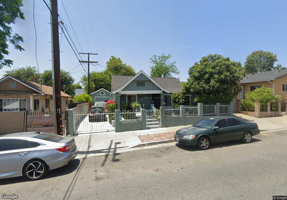
1415 North Avenue 51 Los Angeles, CA 90042
Estimated Value: $826,522 - $995,000
2
Beds
1
Bath
748
Sq Ft
$1,249/Sq Ft
Est. Value
About This Home
This home is located at 1415 North Avenue 51, Los Angeles, CA 90042 and is currently estimated at $934,131, approximately $1,248 per square foot. 1415 North Avenue 51 is a home located in Los Angeles County with nearby schools including Buchanan Street Elementary, Benjamin Franklin High School, and Luther Burbank Middle School.
Ownership History
Date
Name
Owned For
Owner Type
Purchase Details
Closed on
May 26, 2000
Sold by
Rossi Noreen Co Tr
Bought by
Ramos George and Ramos Antonia
Current Estimated Value
Home Financials for this Owner
Home Financials are based on the most recent Mortgage that was taken out on this home.
Original Mortgage
$82,450
Interest Rate
8.18%
Purchase Details
Closed on
Jul 21, 1993
Sold by
Rossi James
Bought by
Rossi James and Rossi Noreen
Create a Home Valuation Report for This Property
The Home Valuation Report is an in-depth analysis detailing your home's value as well as a comparison with similar homes in the area
Home Values in the Area
Average Home Value in this Area
Purchase History
| Date | Buyer | Sale Price | Title Company |
|---|---|---|---|
| Ramos George | $85,000 | American Coast Title | |
| Rossi James | -- | -- |
Source: Public Records
Mortgage History
| Date | Status | Borrower | Loan Amount |
|---|---|---|---|
| Previous Owner | Ramos George | $82,450 |
Source: Public Records
Tax History Compared to Growth
Tax History
| Year | Tax Paid | Tax Assessment Tax Assessment Total Assessment is a certain percentage of the fair market value that is determined by local assessors to be the total taxable value of land and additions on the property. | Land | Improvement |
|---|---|---|---|---|
| 2025 | $1,747 | $130,618 | $92,205 | $38,413 |
| 2024 | $1,718 | $128,058 | $90,398 | $37,660 |
| 2023 | $1,688 | $125,548 | $88,626 | $36,922 |
| 2022 | $1,612 | $123,088 | $86,889 | $36,199 |
| 2021 | $1,590 | $120,676 | $85,186 | $35,490 |
| 2019 | $1,544 | $117,099 | $82,660 | $34,439 |
| 2018 | $1,479 | $114,804 | $81,040 | $33,764 |
| 2016 | $1,406 | $110,347 | $77,894 | $32,453 |
| 2015 | $1,387 | $108,690 | $76,724 | $31,966 |
| 2014 | $1,400 | $106,562 | $75,222 | $31,340 |
Source: Public Records
Map
Nearby Homes
- 5117 Stratford Rd
- 5125 Buchanan St
- 5252 Range View Ave
- 4925 Buchanan St
- 1113 N Avenue 50
- 1813 N Avenue 53
- 1048 Dexter St
- 1037 N Avenue 50
- 4854 Buchanan St
- 5055 Hub St
- 5240 Barker Dr
- 1902 N Avenue 51
- 1932 Phillips Way
- 1813 N Avenue 55
- 1942 Phillips Way
- 1915 N Avenue 52
- 917 N Avenue 51
- 829 N Avenue 53
- 1938 Phillips Way
- 1336 Armadale Ave
- 5052 Stratford Rd
- 5056 Stratford Rd
- 5048 Stratford Rd
- 5055 Meridian St
- 1411 North Avenue 51
- 5049 Meridian St
- 5044 Stratford Rd
- 1420 N Avenue 51
- 1420 North Avenue 51
- 5045 Meridian St
- 5040 Stratford Rd
- 5053 Meridian St
- 5101 Meridian St
- 5106 Stratford Rd
- 5043 Meridian St
- 5105 Meridian St
- 5036 Stratford Rd
- 5111 Meridian St
- 5039 Meridian St
- 5057 Stratford Rd