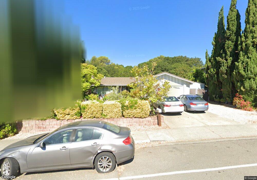
1417 Oakwood Ave Vallejo, CA 94591
Woodridge NeighborhoodEstimated Value: $527,642 - $587,000
4
Beds
2
Baths
1,480
Sq Ft
$381/Sq Ft
Est. Value
About This Home
This home is located at 1417 Oakwood Ave, Vallejo, CA 94591 and is currently estimated at $564,161, approximately $381 per square foot. 1417 Oakwood Ave is a home located in Solano County with nearby schools including Joseph H. Wardlaw Elementary School, Hogan Middle School, and Jesse M. Bethel High School.
Ownership History
Date
Name
Owned For
Owner Type
Purchase Details
Closed on
Apr 16, 2015
Sold by
Arreola Abraham
Bought by
Arreola Abraham and Arreola Maria
Current Estimated Value
Home Financials for this Owner
Home Financials are based on the most recent Mortgage that was taken out on this home.
Original Mortgage
$180,000
Outstanding Balance
$63,861
Interest Rate
3.02%
Mortgage Type
New Conventional
Estimated Equity
$500,300
Purchase Details
Closed on
Nov 29, 2011
Sold by
Arreola Maria Garcia
Bought by
Arreola Abraham
Home Financials for this Owner
Home Financials are based on the most recent Mortgage that was taken out on this home.
Original Mortgage
$188,107
Interest Rate
4.12%
Mortgage Type
FHA
Purchase Details
Closed on
Oct 26, 2011
Sold by
Wells Fargo Bank Na
Bought by
Arreola Abraham
Home Financials for this Owner
Home Financials are based on the most recent Mortgage that was taken out on this home.
Original Mortgage
$188,107
Interest Rate
4.12%
Mortgage Type
FHA
Purchase Details
Closed on
Jul 15, 2011
Sold by
Shook Renee Marie and Shook Kenneth Edward
Bought by
Wells Fargo Bank Na
Purchase Details
Closed on
Aug 25, 2005
Sold by
Gilbreath Ronald E and Gilbreath Linda L
Bought by
Shook Kenneth Edward and Shook Renee Marie
Home Financials for this Owner
Home Financials are based on the most recent Mortgage that was taken out on this home.
Original Mortgage
$25,250
Interest Rate
5.64%
Mortgage Type
Credit Line Revolving
Purchase Details
Closed on
Nov 20, 1994
Sold by
Gilbreath Ronald E and Gilbreath Linda L
Bought by
Gilbreath Ronald E and Gilbreath Linda L
Purchase Details
Closed on
Aug 9, 1993
Sold by
Saiki David and Saiki Toshiko
Bought by
Gilbreath Ronald E and Gilbreath Linda L
Home Financials for this Owner
Home Financials are based on the most recent Mortgage that was taken out on this home.
Original Mortgage
$167,062
Interest Rate
7.25%
Mortgage Type
Assumption
Create a Home Valuation Report for This Property
The Home Valuation Report is an in-depth analysis detailing your home's value as well as a comparison with similar homes in the area
Home Values in the Area
Average Home Value in this Area
Purchase History
| Date | Buyer | Sale Price | Title Company |
|---|---|---|---|
| Arreola Abraham | $707,272 | Orange Coast Title Company | |
| Arreola Abraham | -- | Fidelity National Title Co | |
| Arreola Abraham | $193,000 | Fidelity National Title Co | |
| Wells Fargo Bank Na | $121,655 | Accommodation | |
| Shook Kenneth Edward | $505,000 | North American Title Co | |
| Gilbreath Ronald E | -- | -- | |
| Gilbreath Ronald E | $165,000 | Frontier Title Company |
Source: Public Records
Mortgage History
| Date | Status | Borrower | Loan Amount |
|---|---|---|---|
| Open | Arreola Abraham | $180,000 | |
| Closed | Arreola Abraham | $188,107 | |
| Closed | Arreola Abraham | $188,107 | |
| Previous Owner | Shook Kenneth Edward | $25,250 | |
| Previous Owner | Shook Kenneth Edward | $404,000 | |
| Previous Owner | Gilbreath Ronald E | $167,062 |
Source: Public Records
Tax History Compared to Growth
Tax History
| Year | Tax Paid | Tax Assessment Tax Assessment Total Assessment is a certain percentage of the fair market value that is determined by local assessors to be the total taxable value of land and additions on the property. | Land | Improvement |
|---|---|---|---|---|
| 2025 | $4,001 | $242,409 | $45,213 | $197,196 |
| 2024 | $4,001 | $237,657 | $44,327 | $193,330 |
| 2023 | $3,762 | $232,998 | $43,458 | $189,540 |
| 2022 | $3,661 | $228,430 | $42,606 | $185,824 |
| 2021 | $3,580 | $223,952 | $41,771 | $182,181 |
| 2020 | $3,587 | $221,656 | $41,343 | $180,313 |
| 2019 | $3,473 | $217,311 | $40,533 | $176,778 |
| 2018 | $3,255 | $213,051 | $39,739 | $173,312 |
| 2017 | $3,107 | $208,874 | $38,960 | $169,914 |
| 2016 | $2,522 | $204,780 | $38,197 | $166,583 |
| 2015 | $2,489 | $201,705 | $37,624 | $164,081 |
| 2014 | -- | $197,754 | $36,887 | $160,867 |
Source: Public Records
Map
Nearby Homes
- 272 Woodridge Dr
- 121 Kim Ct
- 670 Henry St
- 1213 Hale St
- 136 Evergreen Way
- 367 Darley Dr
- 351 Springbrook Dr
- 2512 Tennessee St
- 1168 Sherman St
- 373 Clydesdale Dr
- 125 Skyline Ct
- 225 Skyline Dr
- 100 Percheron Ct
- 602 Fleming Ave E
- 312 Skyline Dr
- 400 Foothill Dr
- 129 Foster St
- 108 Hilltop Dr
- 101 University Ave
- 134 Nashville Ln