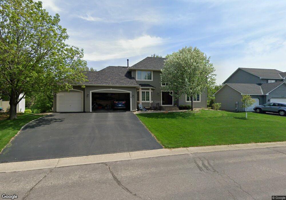
14170 Foxtail Ln Saint Paul, MN 55124
Cedar Isle NeighborhoodEstimated Value: $652,000 - $726,000
5
Beds
4
Baths
2,878
Sq Ft
$235/Sq Ft
Est. Value
About This Home
This home is located at 14170 Foxtail Ln, Saint Paul, MN 55124 and is currently estimated at $677,766, approximately $235 per square foot. 14170 Foxtail Ln is a home located in Dakota County with nearby schools including Greenleaf Elementary School, Falcon Ridge Middle School, and Eastview Senior High School.
Ownership History
Date
Name
Owned For
Owner Type
Purchase Details
Closed on
Feb 12, 1999
Sold by
Muehlheuser Kurt J and Muehlheuser Shawn E
Bought by
Hedberg Ronald J and Hedberg Denise M Johnson
Current Estimated Value
Purchase Details
Closed on
Feb 20, 1996
Sold by
Constru Mcdonald
Bought by
Muehlheuser Kurt J and Muehlheuser Shawn E
Purchase Details
Closed on
Feb 15, 1996
Sold by
Developmen Arcon
Bought by
Mcdonald Construction Inc
Create a Home Valuation Report for This Property
The Home Valuation Report is an in-depth analysis detailing your home's value as well as a comparison with similar homes in the area
Home Values in the Area
Average Home Value in this Area
Purchase History
| Date | Buyer | Sale Price | Title Company |
|---|---|---|---|
| Hedberg Ronald J | $289,800 | -- | |
| Muehlheuser Kurt J | $265,375 | -- | |
| Mcdonald Construction Inc | $47,500 | -- |
Source: Public Records
Tax History Compared to Growth
Tax History
| Year | Tax Paid | Tax Assessment Tax Assessment Total Assessment is a certain percentage of the fair market value that is determined by local assessors to be the total taxable value of land and additions on the property. | Land | Improvement |
|---|---|---|---|---|
| 2024 | $7,460 | $631,700 | $165,800 | $465,900 |
| 2023 | $7,460 | $633,300 | $166,200 | $467,100 |
| 2022 | $6,054 | $603,400 | $165,600 | $437,800 |
| 2021 | $6,042 | $516,900 | $144,000 | $372,900 |
| 2020 | $6,008 | $506,200 | $137,200 | $369,000 |
| 2019 | $5,457 | $489,200 | $130,600 | $358,600 |
| 2018 | $5,484 | $463,600 | $124,400 | $339,200 |
| 2017 | $5,484 | $445,000 | $118,500 | $326,500 |
| 2016 | $5,721 | $421,600 | $112,800 | $308,800 |
| 2015 | $5,537 | $434,500 | $110,600 | $323,900 |
| 2014 | -- | $423,500 | $106,600 | $316,900 |
| 2013 | -- | $378,268 | $97,842 | $280,426 |
Source: Public Records
Map
Nearby Homes
- 14217 Footbridge Way
- 13954 Flagstaff Ct
- 13947 Fleetwood Ave
- 14057 Flintwood Ct
- 14461 Freesia Way
- 7342 Upper 139th St W
- 7291 Upper 136th St W
- 13720 Georgia Dr
- 13868 Glendale Ct
- 13358 Foliage Ave
- 14620 Garrett Ave Unit 310
- 13715 Grafton Ct
- 13973 Falcon Ave
- 7577 138th St W
- 7662 142nd St W
- 14242 Glencove Trail
- 13912 Farmington Way
- 6790 132nd St W
- 6567 133rd St W
- 13135 Gamma Way
- 14180 Foxtail Ln
- 14129 Friday Ln
- 14143 Friday Ln
- 14115 Friday Ln
- 14175 Foxtail Ln
- 14190 Foxtail Ln
- 14180 Freeport Trail
- 14165 Foxtail Ln
- 14140 Foxtail Ln
- 14101 Friday Ln
- 14157 Friday Ln
- 14086 Freeport Ct
- 14120 Foxtail Ln
- 14155 Foxtail Ln
- 14087 Friday Ln
- 14072 Freeport Ct
- 14054 Freeport Ct
- 14136 Friday Ln
- 14122 Friday Ln
- 14038 Freeport Ct