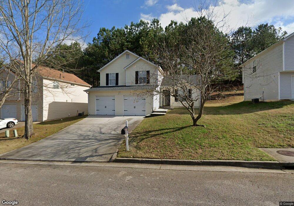
142 Brandon Ridge Cir Stockbridge, GA 30281
Estimated Value: $238,010 - $249,000
3
Beds
2
Baths
1,380
Sq Ft
$177/Sq Ft
Est. Value
About This Home
This home is located at 142 Brandon Ridge Cir, Stockbridge, GA 30281 and is currently estimated at $244,503, approximately $177 per square foot. 142 Brandon Ridge Cir is a home located in Henry County with nearby schools including Stockbridge Elementary School, Smith-Barnes Elementary School, and Stockbridge Middle School.
Ownership History
Date
Name
Owned For
Owner Type
Purchase Details
Closed on
Aug 10, 1998
Sold by
Gt Architecture Con Corp
Bought by
Jennings Sandra E
Current Estimated Value
Home Financials for this Owner
Home Financials are based on the most recent Mortgage that was taken out on this home.
Original Mortgage
$94,200
Outstanding Balance
$19,261
Interest Rate
6.99%
Mortgage Type
FHA
Estimated Equity
$225,242
Create a Home Valuation Report for This Property
The Home Valuation Report is an in-depth analysis detailing your home's value as well as a comparison with similar homes in the area
Home Values in the Area
Average Home Value in this Area
Purchase History
| Date | Buyer | Sale Price | Title Company |
|---|---|---|---|
| Jennings Sandra E | $95,800 | -- |
Source: Public Records
Mortgage History
| Date | Status | Borrower | Loan Amount |
|---|---|---|---|
| Open | Jennings Sandra E | $94,200 |
Source: Public Records
Tax History Compared to Growth
Tax History
| Year | Tax Paid | Tax Assessment Tax Assessment Total Assessment is a certain percentage of the fair market value that is determined by local assessors to be the total taxable value of land and additions on the property. | Land | Improvement |
|---|---|---|---|---|
| 2025 | $4,014 | $95,440 | $14,000 | $81,440 |
| 2024 | $4,014 | $96,640 | $14,000 | $82,640 |
| 2023 | $4,063 | $94,080 | $10,000 | $84,080 |
| 2022 | $2,631 | $66,840 | $10,000 | $56,840 |
| 2021 | $2,215 | $56,000 | $10,000 | $46,000 |
| 2020 | $2,077 | $52,400 | $8,000 | $44,400 |
| 2019 | $1,561 | $45,400 | $8,000 | $37,400 |
| 2018 | $0 | $42,000 | $8,000 | $34,000 |
| 2016 | $1,561 | $38,960 | $6,000 | $32,960 |
| 2015 | -- | $30,640 | $6,000 | $24,640 |
| 2014 | $1,042 | $24,360 | $4,800 | $19,560 |
Source: Public Records
Map
Nearby Homes
- 9 Cheyenne Dr
- 32 Bay Cove Dr
- 816 Lorraine Ln Unit 4
- 44 Bay Cove Dr
- 318 Eagle Ct
- 213 Baron Ct
- 184 Eagle Way
- 564 Goldfinch Way
- 537 Goldfinch Way
- 235 Alexis Ave
- 396 Avian Forest Dr
- 0 Tye St Unit 10634748
- 0 Tye St Unit 20124844
- 377 Avian Forest Dr
- 172 Garden Walk
- 144 Garden Walk
- 137 Dustin Dr
- 503 Goldfinch Way
- 100 Garden Walk
- 843 Tramore Dr
- 136 Brandon Ridge Cir
- 148 Brandon Ridge Cir
- 40 Bridlewood Ct
- 130 Brandon Ridge Cir
- 154 Brandon Ridge Cir
- 154 Brandon Ridge Cir
- 48 Bridlewood Ct
- 0 Bridlewood Ct Unit 8699366
- 0 Bridlewood Ct Unit 8641602
- 0 Bridlewood Ct Unit 7033659
- 143 Brandon Ridge Cir
- 124 Brandon Ridge Cir
- 137 Brandon Ridge Cir
- 149 Brandon Ridge Cir
- 54 Bridlewood Ct Unit 23
- 54 Bridlewood Ct
- 133 Brandon Ridge Cir
- 155 Brandon Ridge Cir
- 116 Brandon Ridge Cir
- 37 Bridlewood Ct