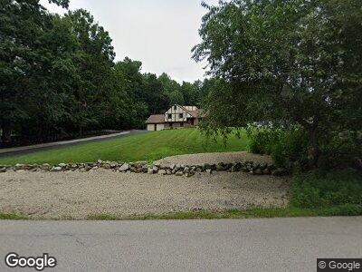
142 Londonderry Rd Windham, NH 03087
Estimated Value: $597,595 - $788,000
4
Beds
2
Baths
1,671
Sq Ft
$400/Sq Ft
Est. Value
About This Home
This home is located at 142 Londonderry Rd, Windham, NH 03087 and is currently estimated at $667,649, approximately $399 per square foot. 142 Londonderry Rd is a home located in Rockingham County with nearby schools including Golden Brook Elementary School, Windham Middle School, and Windham High School.
Ownership History
Date
Name
Owned For
Owner Type
Purchase Details
Closed on
Sep 16, 1999
Sold by
Mergenthaler Gustav and Mergenthaler Ingrid
Bought by
Kostro James E
Current Estimated Value
Home Financials for this Owner
Home Financials are based on the most recent Mortgage that was taken out on this home.
Original Mortgage
$170,850
Outstanding Balance
$55,116
Interest Rate
7.83%
Estimated Equity
$587,093
Create a Home Valuation Report for This Property
The Home Valuation Report is an in-depth analysis detailing your home's value as well as a comparison with similar homes in the area
Home Values in the Area
Average Home Value in this Area
Purchase History
| Date | Buyer | Sale Price | Title Company |
|---|---|---|---|
| Kostro James E | $201,000 | -- |
Source: Public Records
Mortgage History
| Date | Status | Borrower | Loan Amount |
|---|---|---|---|
| Open | Kostro James E | $75,000 | |
| Open | Kostro James E | $170,850 |
Source: Public Records
Tax History Compared to Growth
Tax History
| Year | Tax Paid | Tax Assessment Tax Assessment Total Assessment is a certain percentage of the fair market value that is determined by local assessors to be the total taxable value of land and additions on the property. | Land | Improvement |
|---|---|---|---|---|
| 2024 | $8,343 | $368,500 | $153,800 | $214,700 |
| 2023 | $7,882 | $368,300 | $153,800 | $214,500 |
| 2022 | $7,278 | $368,300 | $153,800 | $214,500 |
| 2021 | $6,858 | $368,300 | $153,800 | $214,500 |
| 2020 | $7,046 | $368,300 | $153,800 | $214,500 |
| 2019 | $6,535 | $289,800 | $141,000 | $148,800 |
| 2018 | $6,749 | $289,800 | $141,000 | $148,800 |
| 2017 | $5,854 | $289,800 | $141,000 | $148,800 |
| 2016 | $6,323 | $289,800 | $141,000 | $148,800 |
| 2015 | $5,988 | $275,700 | $173,000 | $102,700 |
| 2014 | $6,850 | $285,400 | $173,000 | $112,400 |
| 2013 | $6,502 | $275,500 | $173,000 | $102,500 |
Source: Public Records
Map
Nearby Homes
- 11 Spruce St
- 37 Forest St
- 194 Fordway Extension
- 14 Settlers Ln
- 3 Thomas St
- 34 Pleasant Dr
- 4 Mulberry St
- 35 Chapparel Dr
- 9 Hope Hill Rd Unit 3-14
- 9 Rocco Dr Unit R
- 5 Highclere Rd
- 5 Rocco Dr Unit L
- 74 Boulder Dr Unit 74
- 26-28 South Rd
- 15 Highclere Rd
- 47 Blossom Rd
- 11 Ross Dr
- 2 Chesterfield Ln Unit 11B
- 44 Sheffield Way Unit 6B
- 42 Sheffield Way Unit 6A
- 142 Londonderry Rd
- 140 Londonderry Rd
- 146 Londonderry Rd
- 145 Londonderry Rd
- 143 Londonderry Rd
- 1 New Rd
- 147 Londonderry Rd
- 138 Londonderry Rd
- 136 Londonderry Rd
- 6 Carr Hill Rd
- 4 Carr Hill Rd
- 17 Coventry Rd
- 139 Londonderry Rd
- 149 Londonderry Rd
- 8 Carr Hill Rd
- 134 Londonderry Rd
- 141 Londonderry Rd
- 1 Grandview Rd
- 10 Carr Hill Rd
- 5 Carr Hill Rd