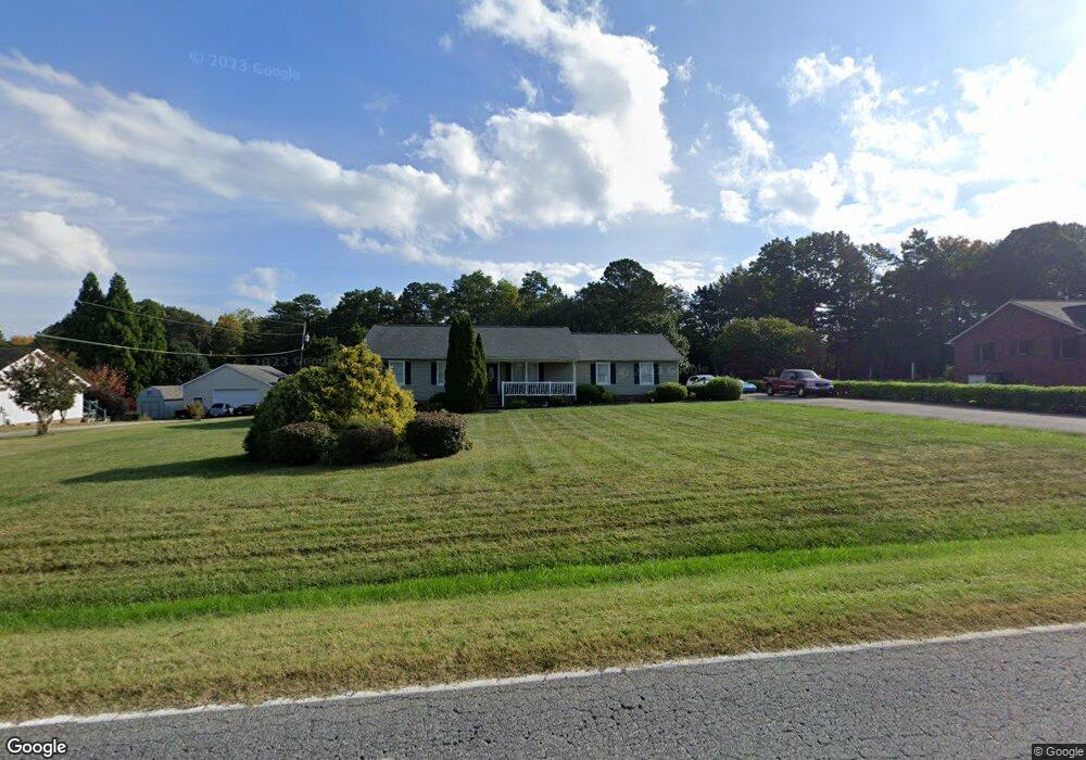
142 Pear Tree Rd Troutman, NC 28166
Estimated Value: $260,000 - $342,000
3
Beds
2
Baths
1,584
Sq Ft
$200/Sq Ft
Est. Value
About This Home
This home is located at 142 Pear Tree Rd, Troutman, NC 28166 and is currently estimated at $316,873, approximately $200 per square foot. 142 Pear Tree Rd is a home located in Iredell County with nearby schools including Troutman Elementary School, Troutman Middle School, and South Iredell High School.
Ownership History
Date
Name
Owned For
Owner Type
Purchase Details
Closed on
Jul 31, 2003
Sold by
Walker Dean M and Walker Angela S
Bought by
Kennedy Kenneth S
Current Estimated Value
Home Financials for this Owner
Home Financials are based on the most recent Mortgage that was taken out on this home.
Original Mortgage
$122,970
Outstanding Balance
$51,026
Interest Rate
5.17%
Mortgage Type
FHA
Estimated Equity
$265,847
Purchase Details
Closed on
Jan 1, 1996
Purchase Details
Closed on
Aug 1, 1995
Purchase Details
Closed on
Dec 1, 1986
Create a Home Valuation Report for This Property
The Home Valuation Report is an in-depth analysis detailing your home's value as well as a comparison with similar homes in the area
Home Values in the Area
Average Home Value in this Area
Purchase History
| Date | Buyer | Sale Price | Title Company |
|---|---|---|---|
| Kennedy Kenneth S | $125,000 | -- | |
| -- | $105,500 | -- | |
| -- | -- | -- | |
| -- | -- | -- |
Source: Public Records
Mortgage History
| Date | Status | Borrower | Loan Amount |
|---|---|---|---|
| Open | Kennedy Kenneth S | $122,970 |
Source: Public Records
Tax History
| Year | Tax Paid | Tax Assessment Tax Assessment Total Assessment is a certain percentage of the fair market value that is determined by local assessors to be the total taxable value of land and additions on the property. | Land | Improvement |
|---|---|---|---|---|
| 2025 | $1,301 | $206,810 | $50,000 | $156,810 |
| 2024 | $1,301 | $206,810 | $50,000 | $156,810 |
| 2023 | $1,301 | $206,810 | $50,000 | $156,810 |
| 2022 | $1,082 | $160,350 | $36,500 | $123,850 |
| 2021 | $1,262 | $192,260 | $36,500 | $155,760 |
| 2020 | $1,262 | $192,260 | $36,500 | $155,760 |
| 2019 | $1,214 | $192,260 | $36,500 | $155,760 |
| 2018 | $1,121 | $178,960 | $36,500 | $142,460 |
| 2017 | $1,121 | $178,960 | $36,500 | $142,460 |
| 2016 | $1,121 | $178,960 | $36,500 | $142,460 |
| 2015 | $1,121 | $178,960 | $36,500 | $142,460 |
| 2014 | $1,051 | $181,610 | $35,000 | $146,610 |
Source: Public Records
Map
Nearby Homes
- 116 Holly Springs Loop
- 173 Painted Bunting Dr
- 118 Horton Dr
- 125 Apple Tree Ln Unit 15-16
- 105 Apple Tree Ln Unit 12
- 551 Perry Rd
- 0 Hoover Rd
- 129-131 Shermill Ln
- 505 Cedar St
- 340 Field Dr
- 214 Astor St
- 213 Cassius Dr
- 111 Overcash Rd
- 236 Cassius Dr
- 131 Autumn Leaf Rd
- Elijah Plan at Norman Creek - Townhomes
- Wilmington Plan at Norman Creek
- Raleigh Plan at Norman Creek
- Southampton Plan at Norman Creek - Townhomes
- Newberry Plan at Norman Creek
- 148 Pear Tree Rd
- 136 Pear Tree Rd
- 121 Windstone Dr Unit 5
- 108 Gray Barn Dr
- 125 Windstone Dr Unit 6
- 117 Windstone Dr Unit 4
- 117 Windstone Dr
- 145 Pear Tree Rd
- 137 Pear Tree Rd
- 129 Windstone Dr Unit Lot 7
- 129 Windstone Dr Unit 9
- 129 Windstone Dr
- 113 Windstone Dr Unit LOT 3
- 149 Pear Tree Rd
- 131 Pear Tree Rd
- 158 Pear Tree Rd
- 114 Gray Barn Dr
- lot 7 Windstone Dr
- lot 7 Windstone Dr Unit lot 7
- 133 Windstone Dr Unit 8