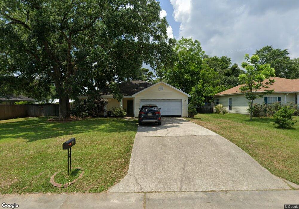
142 Valarie Dr Long Beach, MS 39560
Estimated Value: $176,667 - $203,000
Studio
--
Bath
1,615
Sq Ft
$121/Sq Ft
Est. Value
About This Home
This home is located at 142 Valarie Dr, Long Beach, MS 39560 and is currently estimated at $195,917, approximately $121 per square foot. 142 Valarie Dr is a home located in Harrison County with nearby schools including W.J. Quarles Elementary School, Harper McCaughan Elementary School, and Long Beach Middle School.
Ownership History
Date
Name
Owned For
Owner Type
Purchase Details
Closed on
Jul 31, 2019
Sold by
Hilton Kristen E and Irby Kristen
Bought by
Morris Mitchell Lee and Morris Darcee
Current Estimated Value
Home Financials for this Owner
Home Financials are based on the most recent Mortgage that was taken out on this home.
Original Mortgage
$122,735
Outstanding Balance
$107,958
Interest Rate
4.12%
Mortgage Type
FHA
Estimated Equity
$87,959
Purchase Details
Closed on
Jul 25, 2001
Sold by
Martine Martine
Bought by
Hilton Harrell J
Create a Home Valuation Report for This Property
The Home Valuation Report is an in-depth analysis detailing your home's value as well as a comparison with similar homes in the area
Home Values in the Area
Average Home Value in this Area
Purchase History
| Date | Buyer | Sale Price | Title Company |
|---|---|---|---|
| Morris Mitchell Lee | -- | Esplanade Land & Title | |
| Hilton Harrell J | -- | -- |
Source: Public Records
Mortgage History
| Date | Status | Borrower | Loan Amount |
|---|---|---|---|
| Open | Morris Mitchell Lee | $122,735 |
Source: Public Records
Tax History
| Year | Tax Paid | Tax Assessment Tax Assessment Total Assessment is a certain percentage of the fair market value that is determined by local assessors to be the total taxable value of land and additions on the property. | Land | Improvement |
|---|---|---|---|---|
| 2025 | $1,436 | $10,785 | $0 | $0 |
| 2024 | $1,352 | $10,341 | $0 | $0 |
| 2023 | $1,352 | $10,341 | $0 | $0 |
| 2022 | $1,304 | $10,341 | $0 | $0 |
| 2021 | $1,380 | $10,341 | $0 | $0 |
| 2020 | $2,247 | $13,939 | $0 | $0 |
| 2019 | $1,223 | $9,292 | $0 | $0 |
| 2018 | $1,096 | $9,292 | $0 | $0 |
| 2017 | $1,122 | $9,474 | $0 | $0 |
| 2015 | $1,066 | $9,479 | $0 | $0 |
| 2014 | -- | $7,754 | $0 | $0 |
| 2013 | -- | $9,479 | $1,725 | $7,754 |
Source: Public Records
Map
Nearby Homes
- 1998 Pettits Ln
- 0 Valarie Dr
- 1114 Leigh St
- 110 Jamaica St
- 105 Suffolk Dr
- 20017 Sunshine Dr
- 20021 Sunshine Dr Unit A & B
- 20042 Townsend Flurry Rd
- 103 Reeves St
- 211 Palmyra St
- 205 Shalimar Dr
- 20091 Lovers Ln
- 6019 Red Gate Dr
- 0 Cliff Allen Ln
- 6022 Seagull Dr
- 501 Old Savannah Dr
- 6010 Seagull Dr
- 20260 28th St
- 1089 Enclave Cir
- 1091 Enclave Cir
- 140 Valarie Dr
- 1100 Alverado Dr
- 4 Warwick Cir
- 5 Warwick Cir
- 138 Valarie Dr
- 98 Valarie Dr
- 1004 Alverado Dr
- 3 Warwick Cir
- 100 Valarie Dr
- 102 Valarie Dr
- 1103 Alverado Dr
- 1002 Alverado Dr
- 1101 Alverado Dr
- 1105 Alverado Dr
- 136 Valarie Dr
- 1007 Alverado Dr
- 2 Warwick Cir
- 1107 Alverado Dr
- 106 Valarie Dr
- 303 Suffolk Dr
Your Personal Tour Guide
Ask me questions while you tour the home.