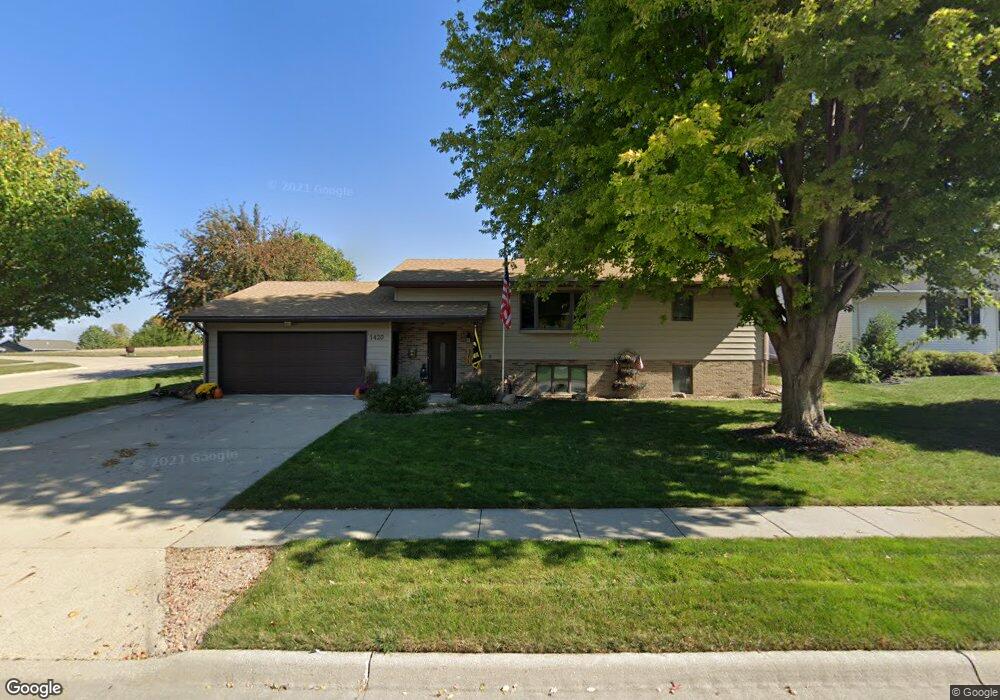
1420 Amy Ave Carroll, IA 51401
Estimated Value: $302,000 - $368,000
2
Beds
2
Baths
1,564
Sq Ft
$216/Sq Ft
Est. Value
About This Home
This home is located at 1420 Amy Ave, Carroll, IA 51401 and is currently estimated at $338,407, approximately $216 per square foot. 1420 Amy Ave is a home with nearby schools including Fairview Elementary School, Adams Elementary School, and Carroll Middle School.
Ownership History
Date
Name
Owned For
Owner Type
Purchase Details
Closed on
Jul 2, 2019
Sold by
Espenhover Julie A
Bought by
Espenhover Thomas D
Current Estimated Value
Create a Home Valuation Report for This Property
The Home Valuation Report is an in-depth analysis detailing your home's value as well as a comparison with similar homes in the area
Home Values in the Area
Average Home Value in this Area
Purchase History
| Date | Buyer | Sale Price | Title Company |
|---|---|---|---|
| Espenhover Thomas D | -- | -- |
Source: Public Records
Tax History Compared to Growth
Tax History
| Year | Tax Paid | Tax Assessment Tax Assessment Total Assessment is a certain percentage of the fair market value that is determined by local assessors to be the total taxable value of land and additions on the property. | Land | Improvement |
|---|---|---|---|---|
| 2025 | $3,486 | $313,760 | $38,490 | $275,270 |
| 2024 | $3,486 | $281,660 | $38,490 | $243,170 |
| 2023 | $3,869 | $281,660 | $38,490 | $243,170 |
| 2022 | $3,670 | $262,120 | $42,300 | $219,820 |
| 2021 | $3,670 | $262,120 | $42,300 | $219,820 |
| 2020 | $3,756 | $262,120 | $42,300 | $219,820 |
| 2019 | $3,848 | $262,120 | $42,300 | $219,820 |
| 2018 | $3,620 | $262,120 | $42,300 | $219,820 |
| 2017 | $3,612 | $261,455 | $45,261 | $216,194 |
| 2016 | $3,374 | $244,350 | $0 | $0 |
| 2015 | $3,374 | $229,830 | $0 | $0 |
| 2014 | $3,128 | $229,830 | $0 | $0 |
Source: Public Records
Map
Nearby Homes
- 1550 Edgewood Dr
- 1620 Edgewood Dr
- 638 Capistrano Ave
- 1137 High Ridge Rd
- 746 Granada Rd
- 621 Alta Vista Dr
- 1068 Amy Ave
- 1102 Skyline Dr
- 1022 Skyline Dr
- 1399 E 11th St
- 1401 E 11th St
- 1037 Bella Vista Dr
- 1407 E 10th St
- 1409 E 10th St
- 260 Bass St
- 1206 Woodland Dr
- 1505 E 10th St
- 265 Perch St
- 903 Amy Cir
- 0 Monterey Dr Unit 6307161
- 1412 Amy Ave
- 1001 Capistrano Ave
- 1402 Amy Ave
- 1011 Capistrano Ave
- 1419 Amy Ave
- 1411 Amy Ave
- 921 Capistrano Ave
- 1405 Amy Ave
- 1326 Amy Ave
- 915 Capistrano Ave
- 1327 Amy Ave
- 1420 High Ridge Rd
- 905 Capistrano Ave
- 1010 Mockingbird Dr
- 922 Mockingbird Dr
- 1004 Mockingbird Dr
- 1014 Mockingbird Dr
- 1318 Amy Ave
- 1404 High Ridge Rd
- 1018 Mockingbird Dr