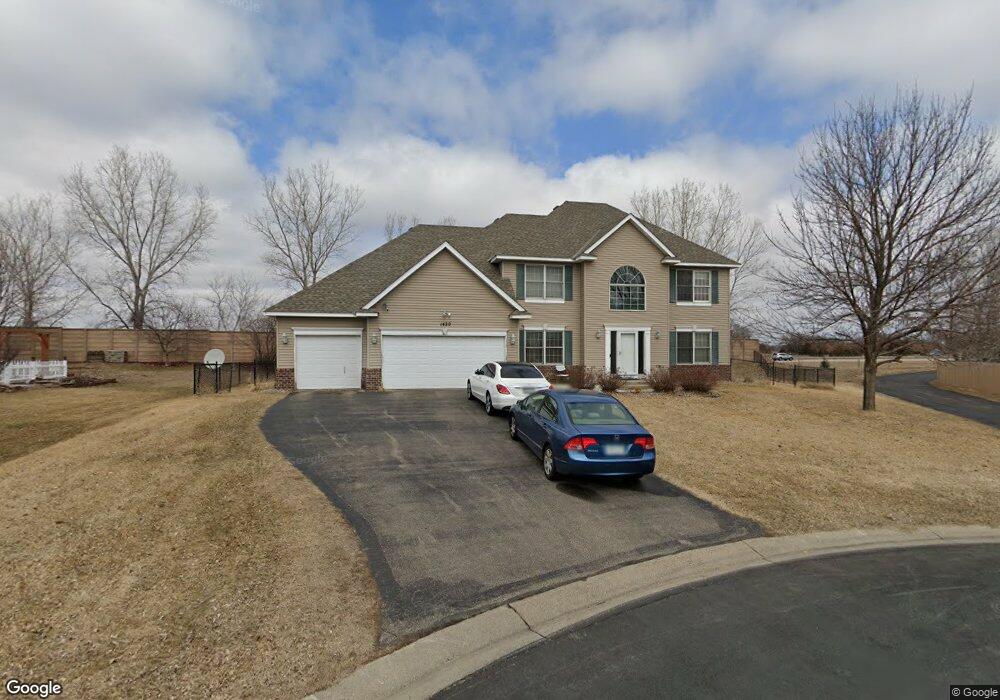
1420 Wakefield Cir Shakopee, MN 55379
Estimated Value: $538,000 - $587,000
4
Beds
3
Baths
2,784
Sq Ft
$200/Sq Ft
Est. Value
About This Home
This home is located at 1420 Wakefield Cir, Shakopee, MN 55379 and is currently estimated at $557,799, approximately $200 per square foot. 1420 Wakefield Cir is a home located in Scott County with nearby schools including Red Oak Elementary School, Shakopee West Middle School, and Shakopee Senior High School.
Ownership History
Date
Name
Owned For
Owner Type
Purchase Details
Closed on
Nov 5, 2010
Sold by
Federal National Mortgage Association
Bought by
Ahmed Nur
Current Estimated Value
Home Financials for this Owner
Home Financials are based on the most recent Mortgage that was taken out on this home.
Original Mortgage
$189,600
Outstanding Balance
$125,095
Interest Rate
4.27%
Mortgage Type
New Conventional
Estimated Equity
$432,704
Purchase Details
Closed on
May 30, 2003
Sold by
Dr Horton Inc - Minnesota
Bought by
Ojo Oladayo and Ojo Wuraola
Create a Home Valuation Report for This Property
The Home Valuation Report is an in-depth analysis detailing your home's value as well as a comparison with similar homes in the area
Home Values in the Area
Average Home Value in this Area
Purchase History
| Date | Buyer | Sale Price | Title Company |
|---|---|---|---|
| Ahmed Nur | $237,000 | -- | |
| Ojo Oladayo | $340,828 | -- |
Source: Public Records
Mortgage History
| Date | Status | Borrower | Loan Amount |
|---|---|---|---|
| Open | Ahmed Nur | $189,600 |
Source: Public Records
Tax History Compared to Growth
Tax History
| Year | Tax Paid | Tax Assessment Tax Assessment Total Assessment is a certain percentage of the fair market value that is determined by local assessors to be the total taxable value of land and additions on the property. | Land | Improvement |
|---|---|---|---|---|
| 2025 | $5,742 | $522,900 | $177,000 | $345,900 |
| 2024 | $5,312 | $515,000 | $173,600 | $341,400 |
| 2023 | $5,332 | $497,300 | $163,700 | $333,600 |
| 2022 | $5,096 | $491,000 | $157,400 | $333,600 |
| 2021 | $4,424 | $402,200 | $131,700 | $270,500 |
| 2020 | $4,926 | $381,800 | $109,800 | $272,000 |
| 2019 | $4,750 | $373,800 | $101,800 | $272,000 |
| 2018 | $4,974 | $0 | $0 | $0 |
| 2016 | $5,410 | $0 | $0 | $0 |
| 2014 | -- | $0 | $0 | $0 |
Source: Public Records
Map
Nearby Homes
- 6869 Falmouth Curve
- 1463 Ashbourne Cir
- 7287 Falmouth Curve
- 7263 Falmouth Curve
- 1789 Windsor Dr S
- 7379 Devin Ln
- 7584 Derby Ln
- 1515 Yorkshire Ln
- 1411 Yorkshire Ln
- 7432 Whitehall Rd
- 1551 Coneflower Ln
- 1782 Switchgrass Cir
- 4432 Bulrush Blvd
- 4360 Blakewood Dr
- 2015 Brookview St
- Sheridan & Sheridan C Plan at Whispering Waters
- Preston I & II Plan at Whispering Waters
- Newport Plan at Whispering Waters
- Morgan Plan at Whispering Waters
- Mackenzie Plan at Whispering Waters
- 1430 Wakefield Cir
- 1410 Wakefield Cir
- 1440 Wakefield Cir
- 1415 Wakefield Cir
- 1425 Wakefield Cir
- 1435 Wakefield Cir
- 1450 Wakefield Cir
- 1445 Wakefield Cir
- 1452 Wakefield Cir
- 1455 Wakefield Cir
- 1465 Wakefield Cir
- 1475 Wakefield Cir
- 1456 Wakefield Cir
- 6508 Berwick Cir
- 6498 Berwick Cir
- 1485 Wakefield Cir
- 6518 Berwick Cir
- 1460 Wakefield Cir
- 6528 Carlisle Curve
- 6538 Carlisle Curve