
Seller's Agent in 2025
KIMBERLY CUMBO
Key Realty
(740) 808-0263
37 in this area
83 Total Sales
Estimated Value: $189,000 - $203,000
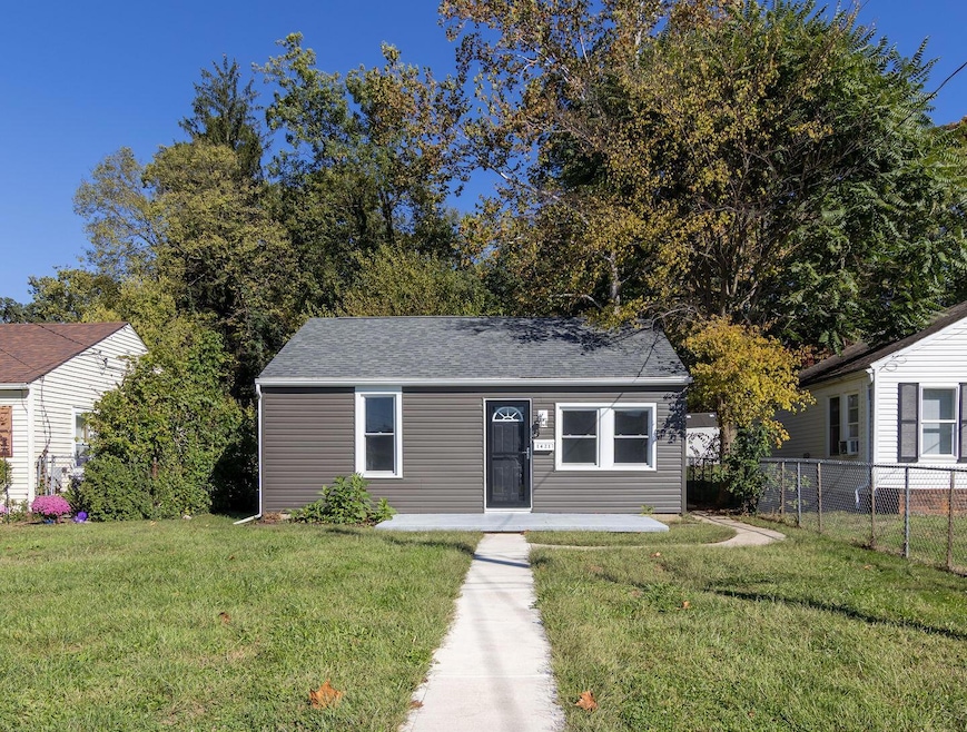
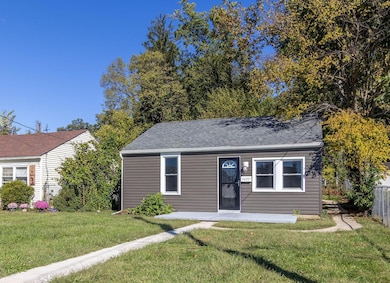
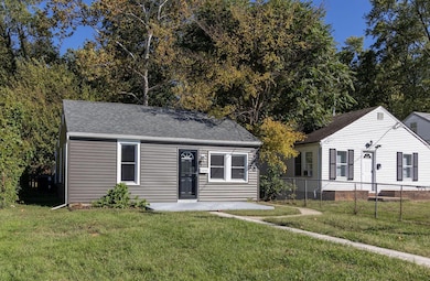
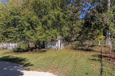
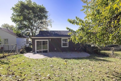
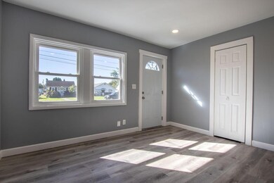
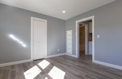
Completely renovated! 3 bedroom 2 full bath ranch home! Everything is new! The roof was completed in 2024, everything else, plumbing, electric, windows, siding, flooring, and fixtures were all done in 2025! Home also has a tankless water heater. There is a shed in the fenced in back yard. This is such a cute home, nothing to do but move in!! Income reqirements apply. See ATA remarks.
| Date | Buyer | Sale Price | Title Company |
|---|---|---|---|
| Withem Zachary | -- | Valmer Land Title | |
| Lancaster Fairfield Cmnty Action Agcy | -- | None Available | |
| The Fairfield County Land Reutilization | -- | None Available | |
| Johnson Robert E | $87,500 | Real Living Title | |
| Mcmahan Raymond D | $70,000 | -- | |
| Barnard Margie L | $42,000 | -- | |
| -- | $32,000 | -- |
| Date | Status | Borrower | Loan Amount |
|---|---|---|---|
| Open | Withem Zachary | $7,000 | |
| Open | Withem Zachary | $196,377 | |
| Previous Owner | Johnson Robert E | $83,125 | |
| Closed | Mcmahan Raymond D | -- |
| Date | Event | Price | List to Sale | Price per Sq Ft |
|---|---|---|---|---|
| 11/24/2025 11/24/25 | Sold | $200,000 | +0.1% | $202 / Sq Ft |
| 10/23/2025 10/23/25 | For Sale | $199,900 | -0.1% | $202 / Sq Ft |
| 10/14/2025 10/14/25 | Off Market | $200,000 | -- | -- |
| 10/14/2025 10/14/25 | For Sale | $199,900 | -- | $202 / Sq Ft |
| Year | Tax Paid | Tax Assessment Tax Assessment Total Assessment is a certain percentage of the fair market value that is determined by local assessors to be the total taxable value of land and additions on the property. | Land | Improvement |
|---|---|---|---|---|
| 2025 | $3,162 | $49,250 | $15,730 | $33,520 |
| 2024 | $3,162 | $35,170 | $9,140 | $26,030 |
| 2023 | $1,331 | $35,810 | $9,140 | $26,670 |
| 2022 | $1,338 | $35,810 | $9,140 | $26,670 |
| 2021 | $1,093 | $27,400 | $7,640 | $19,760 |
| 2020 | $1,099 | $27,400 | $7,640 | $19,760 |
| 2019 | $1,463 | $27,400 | $7,640 | $19,760 |
| 2018 | $2,212 | $21,650 | $7,640 | $14,010 |
| 2017 | $1,816 | $21,460 | $7,640 | $13,820 |
| 2016 | $1,749 | $21,460 | $7,640 | $13,820 |
| 2015 | $783 | $20,850 | $7,640 | $13,210 |
| 2014 | $745 | $20,850 | $7,640 | $13,210 |
| 2013 | $745 | $20,850 | $7,640 | $13,210 |
Seller's Agent in 2025
KIMBERLY CUMBO
Key Realty
(740) 808-0263
37 in this area
83 Total Sales
Buyer's Agent in 2025
Carla Schorr
Keller Williams Greater Cols
(740) 407-4684
27 in this area
71 Total Sales
Source: Columbus and Central Ohio Regional MLS
MLS Number: 225038937
APN: 05-35211-300
Disclaimer: Certain information contained herein is derived from information provided by parties other than Homes.com. All information provided is deemed reliable, but is not guaranteed to be accurate and should be independently verified.
![]() IDX information is provided exclusively for personal, non-commercial use, and may not be used for any purpose other than to identify prospective properties consumers may be interested in purchasing.
IDX information is provided exclusively for personal, non-commercial use, and may not be used for any purpose other than to identify prospective properties consumers may be interested in purchasing.
Information is deemed reliable but not guaranteed.
Ask me questions while you tour the home.