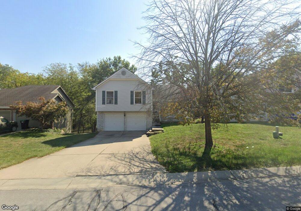
1421 NE Tawny Dr Lees Summit, MO 64086
Estimated Value: $311,000 - $332,000
3
Beds
3
Baths
1,291
Sq Ft
$248/Sq Ft
Est. Value
About This Home
This home is located at 1421 NE Tawny Dr, Lees Summit, MO 64086 and is currently estimated at $320,061, approximately $247 per square foot. 1421 NE Tawny Dr is a home located in Jackson County with nearby schools including Underwood Elementary School, Bernard C. Campbell Middle School, and Lee's Summit North High School.
Ownership History
Date
Name
Owned For
Owner Type
Purchase Details
Closed on
Jun 19, 2010
Sold by
Donlan Timothy J and Donlan Wendy J
Bought by
Buhler Brandon K and Buhler Julie M
Current Estimated Value
Home Financials for this Owner
Home Financials are based on the most recent Mortgage that was taken out on this home.
Original Mortgage
$127,300
Interest Rate
4.41%
Mortgage Type
New Conventional
Purchase Details
Closed on
Jun 27, 2000
Sold by
Sattman Todd and Sattman Tina
Bought by
Donlan Timothy J and Donlan Wendy J
Home Financials for this Owner
Home Financials are based on the most recent Mortgage that was taken out on this home.
Original Mortgage
$129,650
Interest Rate
8.66%
Mortgage Type
FHA
Create a Home Valuation Report for This Property
The Home Valuation Report is an in-depth analysis detailing your home's value as well as a comparison with similar homes in the area
Home Values in the Area
Average Home Value in this Area
Purchase History
| Date | Buyer | Sale Price | Title Company |
|---|---|---|---|
| Buhler Brandon K | -- | Stewart Title Of Kansas City | |
| Donlan Timothy J | -- | Security Land Title Co |
Source: Public Records
Mortgage History
| Date | Status | Borrower | Loan Amount |
|---|---|---|---|
| Previous Owner | Buhler Brandon K | $127,300 | |
| Previous Owner | Donlan Timothy J | $129,650 |
Source: Public Records
Tax History Compared to Growth
Tax History
| Year | Tax Paid | Tax Assessment Tax Assessment Total Assessment is a certain percentage of the fair market value that is determined by local assessors to be the total taxable value of land and additions on the property. | Land | Improvement |
|---|---|---|---|---|
| 2025 | $3,224 | $50,255 | $7,492 | $42,763 |
| 2024 | $3,789 | $44,650 | $6,650 | $38,000 |
| 2023 | $3,789 | $52,854 | $7,119 | $45,735 |
| 2022 | $3,068 | $38,000 | $5,928 | $32,072 |
| 2021 | $3,131 | $38,000 | $5,928 | $32,072 |
| 2020 | $2,870 | $34,491 | $5,928 | $28,563 |
| 2019 | $2,791 | $34,491 | $5,928 | $28,563 |
| 2018 | $2,932 | $33,617 | $4,916 | $28,701 |
| 2017 | $2,932 | $33,617 | $4,916 | $28,701 |
| 2016 | $2,888 | $32,775 | $4,541 | $28,234 |
| 2014 | $2,753 | $30,629 | $4,238 | $26,391 |
Source: Public Records
Map
Nearby Homes
- 1505 NE Deer Ct
- 27104 E Cedar Grove Dr
- 1138 NE Mulberry St
- 1637 NE Westwind Dr
- 1400 NE Colbern Rd
- 1717 NE Luther Rd
- 1108 NE Ridgeview Dr
- 811 NE Mulberry St
- 810 NE Cedar St
- 809 NE Mulberry St
- 1020 NE Lindsay Ave
- 1345 NE Foxwood Dr
- 1708 NE Balboa St
- 1325 NE Foxwood Dr
- 1317 NE Foxwood Dr
- 717 NE Mulberry St
- 715 NE Cambridge Dr
- 713 NE Aaron Dr
- 1676 NE Ozark Dr
- 1300 NE Browning Ln
- 1425 NE Tawny Dr
- 1417 NE Tawny Dr
- 1429 NE Tawny Dr
- 1413 NE Tawny Dr
- 1426 NE Tawny Dr
- 1501 NE Auburn Dr
- 1433 NE Tawny Dr
- 1430 NE Tawny Dr
- 1409 NE Tawny Dr
- 1505 NE Auburn Dr
- 1411 NE Ivory Ln
- 1501 NE Tawny Dr
- 1413 NE Ivory Ln
- 1500 NE Auburn Dr
- 1504 NE Jade St
- 1405 NE Tawny Dr
- 1504 NE Auburn Dr
- 1409 NE Ivory Ln
- 1509 NE Auburn Dr
- 1505 NE Tawny Dr