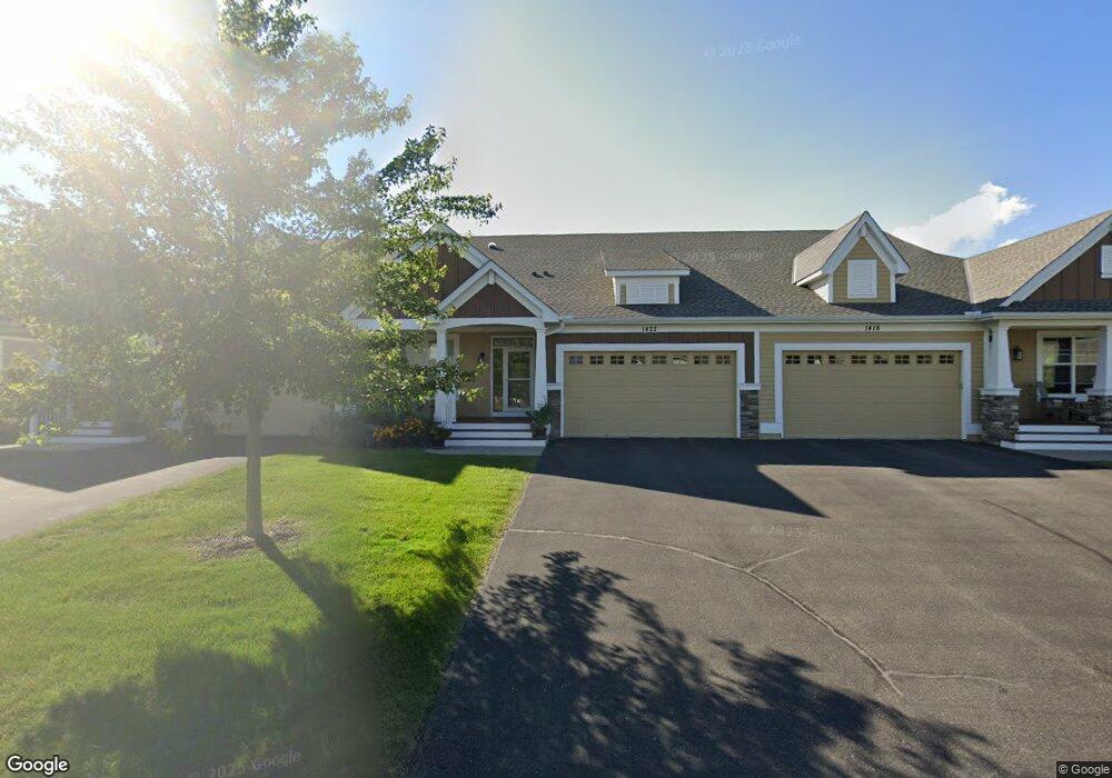
1422 Palisade Path Saint Paul, MN 55129
Estimated Value: $538,000 - $694,000
3
Beds
3
Baths
1,800
Sq Ft
$349/Sq Ft
Est. Value
About This Home
This home is located at 1422 Palisade Path, Saint Paul, MN 55129 and is currently estimated at $627,333, approximately $348 per square foot. 1422 Palisade Path is a home located in Washington County with nearby schools including Brookview Elementary, Oak-Land Middle School, and Stillwater Area High School.
Ownership History
Date
Name
Owned For
Owner Type
Purchase Details
Closed on
May 12, 2017
Sold by
Pratt Construction Inc
Bought by
Clowes Jefferson J and Buss Sherri A
Current Estimated Value
Home Financials for this Owner
Home Financials are based on the most recent Mortgage that was taken out on this home.
Original Mortgage
$100,000
Outstanding Balance
$81,443
Interest Rate
3.37%
Mortgage Type
Adjustable Rate Mortgage/ARM
Estimated Equity
$545,890
Purchase Details
Closed on
Oct 3, 2012
Sold by
Woodbury Residential Land Llc
Bought by
Pratt Construction Incorporated
Home Financials for this Owner
Home Financials are based on the most recent Mortgage that was taken out on this home.
Original Mortgage
$450,000
Interest Rate
3.55%
Mortgage Type
Purchase Money Mortgage
Purchase Details
Closed on
Jun 28, 2012
Sold by
Bmo Harris Bank National Association
Bought by
Woodbury Residential Land Llc
Create a Home Valuation Report for This Property
The Home Valuation Report is an in-depth analysis detailing your home's value as well as a comparison with similar homes in the area
Home Values in the Area
Average Home Value in this Area
Purchase History
| Date | Buyer | Sale Price | Title Company |
|---|---|---|---|
| Clowes Jefferson J | $46,706 | None Available | |
| Pratt Construction Incorporated | $450,000 | Title Recording Svcs | |
| Woodbury Residential Land Llc | $3,040,000 | None Available |
Source: Public Records
Mortgage History
| Date | Status | Borrower | Loan Amount |
|---|---|---|---|
| Open | Clowes Jefferson J | $100,000 | |
| Previous Owner | Pratt Construction Incorporated | $450,000 |
Source: Public Records
Tax History Compared to Growth
Tax History
| Year | Tax Paid | Tax Assessment Tax Assessment Total Assessment is a certain percentage of the fair market value that is determined by local assessors to be the total taxable value of land and additions on the property. | Land | Improvement |
|---|---|---|---|---|
| 2024 | $5,836 | $597,700 | $145,000 | $452,700 |
| 2023 | $5,836 | $608,300 | $152,000 | $456,300 |
| 2022 | $4,762 | $548,700 | $141,400 | $407,300 |
| 2021 | $4,604 | $485,100 | $125,000 | $360,100 |
| 2020 | $4,508 | $486,500 | $135,000 | $351,500 |
| 2019 | $4,654 | $472,400 | $115,000 | $357,400 |
| 2018 | $3,178 | $457,600 | $115,000 | $342,600 |
| 2017 | $7,034 | $320,000 | $115,000 | $205,000 |
| 2016 | $6,790 | $115,000 | $115,000 | $0 |
| 2015 | $7,254 | $85,000 | $85,000 | $0 |
| 2013 | -- | $85,600 | $85,600 | $0 |
Source: Public Records
Map
Nearby Homes
- 11325 Sandcastle Dr Unit A
- 11300 Sandcastle Dr Unit G
- 1050 Wyncrest Ct
- 11279 Crestbury Dr
- 1658 Headwaters Ln
- 1631 Deephaven Dr
- 11365 Crestbury Cir
- 10830 Falling Water Ln Unit C
- 10601 Watersedge Ln
- 10814 Falling Water Ln Unit D
- 1109 Siesta Dr
- 10776 Falling Water Ln Unit B
- 10695 Brookview Rd
- 10685 Brookview Rd
- 11581 Riverstone Ct
- 880 Drew Dr
- 1442 Pebble Beach Dr
- 10395 Lancaster Cove
- 10374 Lancaster Ln
- 11006 James Curve
- 1426 Palisade Path
- 1418 Palisade Path
- 13XXX 15th St S
- 1430 Palisade Path
- 1434 Palisade Path
- 1438 Palisade Path
- 1423 Palisade Path
- 1419 Palisade Path
- 1415 Palisade Path
- 1281 Palisade Cir
- 1431 Palisade Path
- 1279 Palisade Cir
- 1411 Palisade Path
- 1435 Palisade Path
- 1407 Palisade Path
- 1400 Palisade Path
- 1439 Palisade Path
- 1283 Palisade Cir
- 1443 Palisade Path
- 1396 Palisade Path