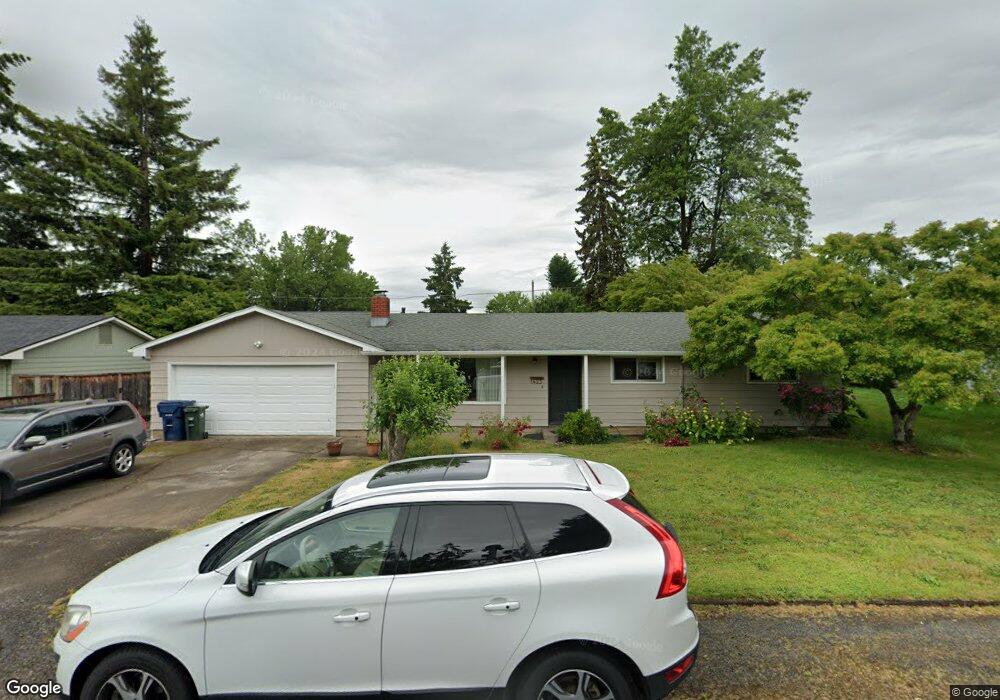
1423 Corum Ave Eugene, OR 97401
Cal Young NeighborhoodEstimated Value: $433,000 - $481,000
3
Beds
2
Baths
1,200
Sq Ft
$376/Sq Ft
Est. Value
About This Home
This home is located at 1423 Corum Ave, Eugene, OR 97401 and is currently estimated at $450,908, approximately $375 per square foot. 1423 Corum Ave is a home located in Lane County with nearby schools including Willagillespie Elementary School, Cal Young Middle School, and Sheldon High School.
Ownership History
Date
Name
Owned For
Owner Type
Purchase Details
Closed on
Oct 20, 2015
Sold by
Brooks Patricia Ann
Bought by
Robidou John E and Robidou Kathleen J
Current Estimated Value
Home Financials for this Owner
Home Financials are based on the most recent Mortgage that was taken out on this home.
Original Mortgage
$265,000
Interest Rate
3.86%
Mortgage Type
Purchase Money Mortgage
Purchase Details
Closed on
Aug 25, 2008
Sold by
Mcneal Wendy Y
Bought by
Brooks Patricia Ann
Purchase Details
Closed on
Nov 27, 2007
Sold by
Mcneal Wendy Y
Bought by
Mcneal Wendy Y
Create a Home Valuation Report for This Property
The Home Valuation Report is an in-depth analysis detailing your home's value as well as a comparison with similar homes in the area
Home Values in the Area
Average Home Value in this Area
Purchase History
| Date | Buyer | Sale Price | Title Company |
|---|---|---|---|
| Robidou John E | $263,000 | Cascade Title Company | |
| Brooks Patricia Ann | $260,500 | First American Title Ins Co | |
| Mcneal Wendy Y | -- | None Available |
Source: Public Records
Mortgage History
| Date | Status | Borrower | Loan Amount |
|---|---|---|---|
| Closed | Robidou John E | $265,000 |
Source: Public Records
Tax History Compared to Growth
Tax History
| Year | Tax Paid | Tax Assessment Tax Assessment Total Assessment is a certain percentage of the fair market value that is determined by local assessors to be the total taxable value of land and additions on the property. | Land | Improvement |
|---|---|---|---|---|
| 2025 | $4,675 | $239,926 | -- | -- |
| 2024 | $4,617 | $232,938 | -- | -- |
| 2023 | $4,617 | $226,154 | $0 | $0 |
| 2022 | $4,325 | $219,567 | $0 | $0 |
| 2021 | $4,062 | $213,172 | $0 | $0 |
| 2020 | $4,076 | $206,964 | $0 | $0 |
| 2019 | $3,937 | $200,936 | $0 | $0 |
| 2018 | $3,706 | $189,402 | $0 | $0 |
| 2017 | $3,532 | $189,402 | $0 | $0 |
| 2016 | $3,389 | $183,885 | $0 | $0 |
| 2015 | $3,274 | $178,529 | $0 | $0 |
| 2014 | $3,201 | $173,329 | $0 | $0 |
Source: Public Records
Map
Nearby Homes
- 1332 Jeppesen Ave
- 2280 Tabor St
- 1215 Cedar Ridge Dr
- 1750 Tabor St
- 1861 Happy Ln
- 1641 Chasa St
- 2415 Norkenzie Rd
- 1982 Shiloh St
- 1632 Larkspur Loop
- 1637 Larkspur Loop
- 1500 Norkenzie Rd Unit 43
- 1798 Carmel Ave
- 1585 Farm House Dr
- 1455 Holly Ave
- 2133 Jeppesen Acres Rd
- 2132 Willona Dr
- 2134 Willona Dr
- 1328 Spyglass Dr
- 2055 Monterey Ln
- 1170 Cal Young Rd
- 1449 Corum Ave
- 1405 Corum Ave
- 2035 Tabor St
- 1440 Flintridge Ave
- 1450 Flintridge Ave
- 1463 Corum Ave
- 1428 Corum Ave
- 2055 Tabor St
- 1450 Corum Ave
- 1985 Tabor St
- 2016 Tabor St
- 1464 Corum Ave
- 1491 Corum Ave
- 2075 Tabor St
- 1398 Corum Ave
- 2030 Tabor St
- 1430 Flintridge Ave
- 1460 Flintridge Ave
- 1390 Corum Ave
- 1385 Corum Ave